YO61 3RN maps, stats, and open data
YO61 3RN is located in the Easingwold electoral ward, within the unitary authority of North Yorkshire and the English Parliamentary constituency of Thirsk and Malton. The Sub Integrated Care Board (ICB) Location is NHS Humber and North Yorkshire ICB - 03Q and the police force is North Yorkshire. This postcode has been in use since July 2019.
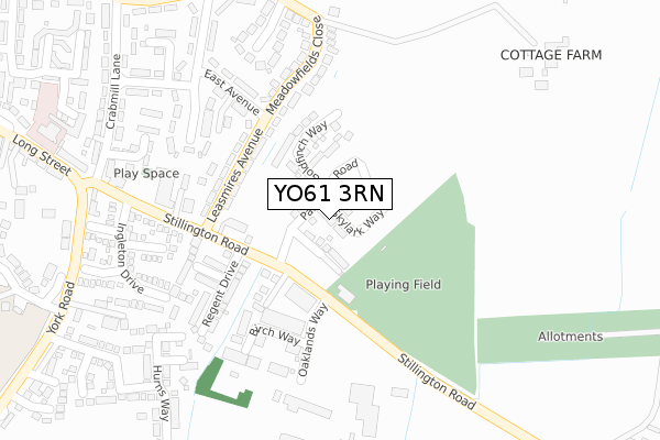
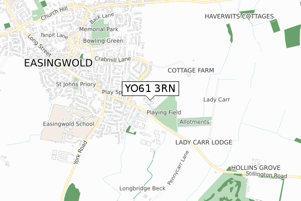
YO61 3RN maps


Licence: Open Government Licence (requires attribution)
Attribution: Contains OS data © Crown copyright and database right 2025
Source: Open Postcode Geo
Licence: Open Government Licence (requires attribution)
Attribution: Contains OS data © Crown copyright and database right 2025; Contains Royal Mail data © Royal Mail copyright and database right 2025; Source: Office for National Statistics licensed under the Open Government Licence v.3.0
YO61 3RN geodata
| Easting | 453556 |
| Northing | 469337 |
| Latitude | 54.117137 |
| Longitude | -1.182187 |
Where is YO61 3RN?
| Country | England |
| Postcode District | YO61 |
Politics
| Ward | Easingwold |
|---|---|
| Constituency | Thirsk And Malton |
House Prices
Sales of detached houses in YO61 3RN
3, SKYLARK WAY, EASINGWOLD, YORK, YO61 3RN 2021 17 DEC £387,000 |
36, SKYLARK WAY, EASINGWOLD, YORK, YO61 3RN 2021 26 NOV £449,995 |
34, SKYLARK WAY, EASINGWOLD, YORK, YO61 3RN 2021 19 NOV £439,995 |
32, SKYLARK WAY, EASINGWOLD, YORK, YO61 3RN 2021 24 SEP £384,995 |
7, SKYLARK WAY, EASINGWOLD, YORK, YO61 3RN 2021 10 SEP £384,995 |
5, SKYLARK WAY, EASINGWOLD, YORK, YO61 3RN 2020 18 DEC £434,995 |
3, SKYLARK WAY, EASINGWOLD, YORK, YO61 3RN 2020 7 FEB £385,000 |
Licence: Contains HM Land Registry data © Crown copyright and database right 2025. This data is licensed under the Open Government Licence v3.0.
Transport
Nearest bus stops to YO61 3RN
| Oaklands Way (Stillington Road) | Easingwold | 116m |
| Oaklands Way (Stillington Road) | Easingwold | 126m |
| Leasmires Avenue (Stillington Road) | Easingwold | 219m |
| Leasmires Avenue (Stillington Road) | Easingwold | 236m |
| Crab Mill Lane (Stillington Road) | Easingwold | 381m |
Broadband
Broadband access in YO61 3RN (2020 data)
| Percentage of properties with Next Generation Access | 100.0% |
| Percentage of properties with Superfast Broadband | 100.0% |
| Percentage of properties with Ultrafast Broadband | 72.7% |
| Percentage of properties with Full Fibre Broadband | 72.7% |
Superfast Broadband is between 30Mbps and 300Mbps
Ultrafast Broadband is > 300Mbps
Broadband limitations in YO61 3RN (2020 data)
| Percentage of properties unable to receive 2Mbps | 0.0% |
| Percentage of properties unable to receive 5Mbps | 0.0% |
| Percentage of properties unable to receive 10Mbps | 0.0% |
| Percentage of properties unable to receive 30Mbps | 0.0% |
Deprivation
8.4% of English postcodes are less deprived than YO61 3RN:Food Standards Agency
Three nearest food hygiene ratings to YO61 3RN (metres)


➜ Get more ratings from the Food Standards Agency
Nearest post box to YO61 3RN
| Last Collection | |||
|---|---|---|---|
| Location | Mon-Fri | Sat | Distance |
| Galtres Drive Easingwold | 17:45 | 09:45 | 413m |
| Long Street Easingwold | 17:50 | 09:45 | 416m |
| Cross Roads Uppleby | 17:40 | 09:45 | 845m |
YO61 3RN ITL and YO61 3RN LAU
The below table lists the International Territorial Level (ITL) codes (formerly Nomenclature of Territorial Units for Statistics (NUTS) codes) and Local Administrative Units (LAU) codes for YO61 3RN:
| ITL 1 Code | Name |
|---|---|
| TLE | Yorkshire and The Humber |
| ITL 2 Code | Name |
| TLE2 | North Yorkshire |
| ITL 3 Code | Name |
| TLE22 | North Yorkshire CC |
| LAU 1 Code | Name |
| E07000164 | Hambleton |
YO61 3RN census areas
The below table lists the Census Output Area (OA), Lower Layer Super Output Area (LSOA), and Middle Layer Super Output Area (MSOA) for YO61 3RN:
| Code | Name | |
|---|---|---|
| OA | E00140489 | |
| LSOA | E01027595 | Hambleton 010B |
| MSOA | E02005759 | Hambleton 010 |
Nearest postcodes to YO61 3RN
| YO61 3DU | Leasmires Avenue | 184m |
| YO61 3DX | Stillington Road | 200m |
| YO61 3DT | Leasmires Avenue | 212m |
| YO61 3PL | Galtres Mews | 255m |
| YO61 3FB | Birch Way | 261m |
| YO61 3DR | Meadowfields Close | 266m |
| YO61 3DJ | Galtres Drive | 273m |
| YO61 3DW | East Avenue | 278m |
| YO61 3JG | Stillington Road | 308m |
| YO61 3JJ | Sandholme Close | 309m |