YO61 3GR maps, stats, and open data
YO61 3GR is located in the Easingwold electoral ward, within the unitary authority of North Yorkshire and the English Parliamentary constituency of Thirsk and Malton. The Sub Integrated Care Board (ICB) Location is NHS Humber and North Yorkshire ICB - 03Q and the police force is North Yorkshire. This postcode has been in use since May 2018.
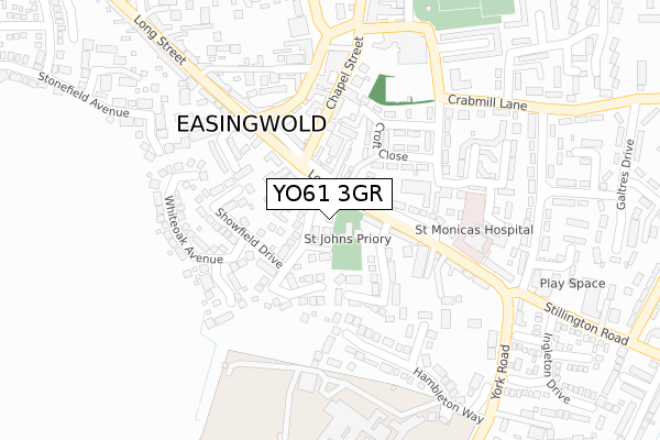
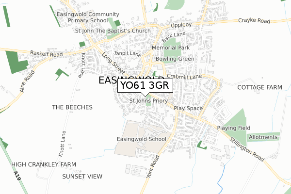
YO61 3GR maps


Licence: Open Government Licence (requires attribution)
Attribution: Contains OS data © Crown copyright and database right 2025
Source: Open Postcode Geo
Licence: Open Government Licence (requires attribution)
Attribution: Contains OS data © Crown copyright and database right 2025; Contains Royal Mail data © Royal Mail copyright and database right 2025; Source: Office for National Statistics licensed under the Open Government Licence v.3.0
YO61 3GR geodata
| Easting | 452871 |
| Northing | 469508 |
| Latitude | 54.118745 |
| Longitude | -1.192636 |
Where is YO61 3GR?
| Country | England |
| Postcode District | YO61 |
Politics
| Ward | Easingwold |
|---|---|
| Constituency | Thirsk And Malton |
Transport
Nearest bus stops to YO61 3GR
| The Horse Shoe (Long Street) | Easingwold | 113m |
| The Horse Shoe (Long Street) | Easingwold | 117m |
| Secondary School (Hambleton Way) | Easingwold | 244m |
| The New Inn (Long Street) | Easingwold | 279m |
| The George Hotel (Market Place) | Easingwold | 324m |
Broadband
Broadband access in YO61 3GR (2020 data)
| Percentage of properties with Next Generation Access | 100.0% |
| Percentage of properties with Superfast Broadband | 100.0% |
| Percentage of properties with Ultrafast Broadband | 0.0% |
| Percentage of properties with Full Fibre Broadband | 0.0% |
Superfast Broadband is between 30Mbps and 300Mbps
Ultrafast Broadband is > 300Mbps
Broadband limitations in YO61 3GR (2020 data)
| Percentage of properties unable to receive 2Mbps | 0.0% |
| Percentage of properties unable to receive 5Mbps | 0.0% |
| Percentage of properties unable to receive 10Mbps | 0.0% |
| Percentage of properties unable to receive 30Mbps | 0.0% |
Deprivation
54.6% of English postcodes are less deprived than YO61 3GR:Food Standards Agency
Three nearest food hygiene ratings to YO61 3GR (metres)


➜ Get more ratings from the Food Standards Agency
Nearest post box to YO61 3GR
| Last Collection | |||
|---|---|---|---|
| Location | Mon-Fri | Sat | Distance |
| Long Street Easingwold | 17:50 | 09:45 | 292m |
| Long Street Easingwold | 17:15 | 09:45 | 292m |
| Easingwold Post Office | 18:45 | 12:30 | 365m |
YO61 3GR ITL and YO61 3GR LAU
The below table lists the International Territorial Level (ITL) codes (formerly Nomenclature of Territorial Units for Statistics (NUTS) codes) and Local Administrative Units (LAU) codes for YO61 3GR:
| ITL 1 Code | Name |
|---|---|
| TLE | Yorkshire and The Humber |
| ITL 2 Code | Name |
| TLE2 | North Yorkshire |
| ITL 3 Code | Name |
| TLE22 | North Yorkshire CC |
| LAU 1 Code | Name |
| E07000164 | Hambleton |
YO61 3GR census areas
The below table lists the Census Output Area (OA), Lower Layer Super Output Area (LSOA), and Middle Layer Super Output Area (MSOA) for YO61 3GR:
| Code | Name | |
|---|---|---|
| OA | E00140499 | |
| LSOA | E01027594 | Hambleton 010A |
| MSOA | E02005759 | Hambleton 010 |
Nearest postcodes to YO61 3GR
| YO61 3JA | Long Street | 61m |
| YO61 3JB | Long Street | 63m |
| YO61 3QH | Dove Court | 78m |
| YO61 3GG | Chase Garth Road | 80m |
| YO61 3LP | Hebdon Court | 84m |
| YO61 3EZ | Rosemary Court | 125m |
| YO61 3GD | Showfield Drive | 130m |
| YO61 3GQ | Hunters Close | 132m |
| YO61 3FY | 136m | |
| YO61 3DB | Croft Close | 141m |