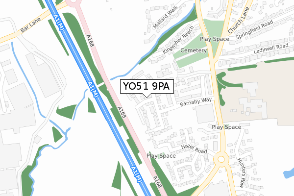
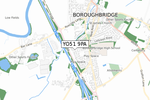
YO51 9PA maps, stats, and open data
YO51 9PA is located in the Boroughbridge & Claro electoral ward, within the unitary authority of North Yorkshire and the English Parliamentary constituency of Harrogate and Knaresborough. The Sub Integrated Care Board (ICB) Location is NHS Humber and North Yorkshire ICB - 42D and the police force is North Yorkshire. This postcode has been in use since December 2017.
YO51 9PA maps


Licence: Open Government Licence (requires attribution)
Attribution: Contains OS data © Crown copyright and database right 2025
Source: Open Postcode Geo
Licence: Open Government Licence (requires attribution)
Attribution: Contains OS data © Crown copyright and database right 2025; Contains Royal Mail data © Royal Mail copyright and database right 2025; Source: Office for National Statistics licensed under the Open Government Licence v.3.0
YO51 9PA geodata
| Easting | 439299 |
| Northing | 466039 |
| Latitude | 54.088782 |
| Longitude | -1.400704 |
Where is YO51 9PA?
| Country | England |
| Postcode District | YO51 |
Politics
| Ward | Boroughbridge & Claro |
|---|---|
| Constituency | Harrogate And Knaresborough |
House Prices
Sales of detached houses in YO51 9PA
42, HEREFORD WAY, BOROUGHBRIDGE, YORK, YO51 9PA 2025 21 MAR £428,500 |
35, HEREFORD WAY, BOROUGHBRIDGE, YORK, YO51 9PA 2025 31 JAN £375,000 |
14, HEREFORD WAY, BOROUGHBRIDGE, YORK, YO51 9PA 2024 31 MAY £338,000 |
34, HEREFORD WAY, BOROUGHBRIDGE, YORK, YO51 9PA 2024 24 MAY £425,000 |
63, HEREFORD WAY, BOROUGHBRIDGE, YORK, YO51 9PA 2023 5 DEC £415,000 |
83, HEREFORD WAY, BOROUGHBRIDGE, YORK, YO51 9PA 2023 7 NOV £410,000 |
88, HEREFORD WAY, BOROUGHBRIDGE, YORK, YO51 9PA 2022 12 AUG £425,000 |
39, HEREFORD WAY, BOROUGHBRIDGE, YORK, YO51 9PA 2022 11 AUG £430,000 |
52, HEREFORD WAY, BOROUGHBRIDGE, YORK, YO51 9PA 2022 1 JUL £355,000 |
87, HEREFORD WAY, BOROUGHBRIDGE, YORK, YO51 9PA 2021 17 JUN £335,000 |
Licence: Contains HM Land Registry data © Crown copyright and database right 2025. This data is licensed under the Open Government Licence v3.0.
Transport
Nearest bus stops to YO51 9PA
| High School (Unclassified) | Boroughbridge | 228m |
| High School (N/A) | Boroughbridge | 244m |
| Morrisons Car Park (N/A) | Minskip | 350m |
| Morrisons Car Park (N/A) | Minskip | 363m |
| Morrisons Car Park (N/A) | Minskip | 399m |
Broadband
Broadband access in YO51 9PA (2020 data)
| Percentage of properties with Next Generation Access | 100.0% |
| Percentage of properties with Superfast Broadband | 100.0% |
| Percentage of properties with Ultrafast Broadband | 100.0% |
| Percentage of properties with Full Fibre Broadband | 100.0% |
Superfast Broadband is between 30Mbps and 300Mbps
Ultrafast Broadband is > 300Mbps
Broadband limitations in YO51 9PA (2020 data)
| Percentage of properties unable to receive 2Mbps | 0.0% |
| Percentage of properties unable to receive 5Mbps | 0.0% |
| Percentage of properties unable to receive 10Mbps | 0.0% |
| Percentage of properties unable to receive 30Mbps | 0.0% |
Deprivation
24.4% of English postcodes are less deprived than YO51 9PA:Food Standards Agency
Three nearest food hygiene ratings to YO51 9PA (metres)


➜ Get more ratings from the Food Standards Agency
Nearest post box to YO51 9PA
| Last Collection | |||
|---|---|---|---|
| Location | Mon-Fri | Sat | Distance |
| Morrisons Supermarket | 17:30 | 12:35 | 377m |
| High Street Boroughbridge | 17:30 | 12:10 | 725m |
| Boroughbridge Post Office | 17:30 | 12:15 | 890m |
YO51 9PA ITL and YO51 9PA LAU
The below table lists the International Territorial Level (ITL) codes (formerly Nomenclature of Territorial Units for Statistics (NUTS) codes) and Local Administrative Units (LAU) codes for YO51 9PA:
| ITL 1 Code | Name |
|---|---|
| TLE | Yorkshire and The Humber |
| ITL 2 Code | Name |
| TLE2 | North Yorkshire |
| ITL 3 Code | Name |
| TLE22 | North Yorkshire CC |
| LAU 1 Code | Name |
| E07000165 | Harrogate |
YO51 9PA census areas
The below table lists the Census Output Area (OA), Lower Layer Super Output Area (LSOA), and Middle Layer Super Output Area (MSOA) for YO51 9PA:
| Code | Name | |
|---|---|---|
| OA | E00140781 | |
| LSOA | E01027645 | Harrogate 005B |
| MSOA | E02005765 | Harrogate 005 |
Nearest postcodes to YO51 9PA
| YO51 9GN | Battle Close | 105m |
| YO51 9UU | Lawson Avenue | 142m |
| YO51 9GJ | Barnaby Way | 145m |
| YO51 9UX | Fothergill Way | 174m |
| YO51 9GL | Harclay Garth | 182m |
| YO51 9UT | Hazel Road | 198m |
| YO51 9GH | Victory Row | 215m |
| YO51 9JS | Kingfisher Reach | 225m |
| YO51 9HS | Wetherby Road | 231m |
| YO51 9UZ | Smithsons Grove | 245m |