YO51 9FW maps, stats, and open data
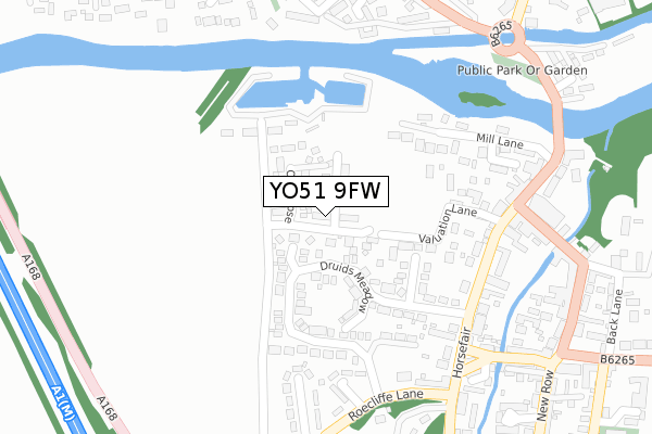
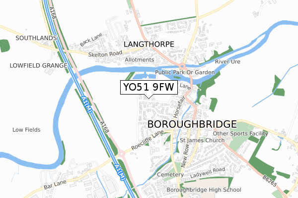
YO51 9FW is located in the Boroughbridge & Claro electoral ward, within the unitary authority of North Yorkshire and the English Parliamentary constituency of Harrogate and Knaresborough. The Sub Integrated Care Board (ICB) Location is NHS Humber and North Yorkshire ICB - 42D and the police force is North Yorkshire. This postcode has been in use since September 2018.
YO51 9FW maps


Licence: Open Government Licence (requires attribution)
Attribution: Contains OS data © Crown copyright and database right 2025
Source: Open Postcode Geo
Licence: Open Government Licence (requires attribution)
Attribution: Contains OS data © Crown copyright and database right 2025; Contains Royal Mail data © Royal Mail copyright and database right 2025; Source: Office for National Statistics licensed under the Open Government Licence v.3.0
YO51 9FW geodata
| Easting | 439374 |
| Northing | 466884 |
| Latitude | 54.096370 |
| Longitude | -1.399448 |
Where is YO51 9FW?
| Country | England |
| Postcode District | YO51 |
Politics
| Ward | Boroughbridge & Claro |
|---|---|
| Constituency | Harrogate And Knaresborough |
House Prices
Sales of detached houses in YO51 9FW
54, CHESTNUT DRIVE, BOROUGHBRIDGE, YORK, YO51 9FW 2022 21 FEB £329,950 |
60, CHESTNUT DRIVE, BOROUGHBRIDGE, YORK, YO51 9FW 2021 10 DEC £305,000 |
62, CHESTNUT DRIVE, BOROUGHBRIDGE, YORK, YO51 9FW 2021 26 NOV £329,950 |
3, CHESTNUT DRIVE, BOROUGHBRIDGE, YORK, YO51 9FW 2020 27 MAR £365,000 |
5, CHESTNUT DRIVE, BOROUGHBRIDGE, YORK, YO51 9FW 2019 26 APR £299,950 |
1, CHESTNUT DRIVE, BOROUGHBRIDGE, YORK, YO51 9FW 2018 28 SEP £324,995 |
Licence: Contains HM Land Registry data © Crown copyright and database right 2025. This data is licensed under the Open Government Licence v3.0.
Transport
Nearest bus stops to YO51 9FW
| Crown Hotel (Fishergate) | Boroughbridge | 245m |
| Crown Hotel (Fishergate) | Boroughbridge | 249m |
| Druids Meadow (Roecliffe Lane) | Boroughbridge | 295m |
| Anchor Inn (Leeming Lane) | Boroughbridge | 299m |
| Anchor Inn (Leeming Lane) | Boroughbridge | 309m |
Broadband
Broadband access in YO51 9FW (2020 data)
| Percentage of properties with Next Generation Access | 100.0% |
| Percentage of properties with Superfast Broadband | 100.0% |
| Percentage of properties with Ultrafast Broadband | 100.0% |
| Percentage of properties with Full Fibre Broadband | 100.0% |
Superfast Broadband is between 30Mbps and 300Mbps
Ultrafast Broadband is > 300Mbps
Broadband limitations in YO51 9FW (2020 data)
| Percentage of properties unable to receive 2Mbps | 0.0% |
| Percentage of properties unable to receive 5Mbps | 0.0% |
| Percentage of properties unable to receive 10Mbps | 0.0% |
| Percentage of properties unable to receive 30Mbps | 0.0% |
Deprivation
24.4% of English postcodes are less deprived than YO51 9FW:Food Standards Agency
Three nearest food hygiene ratings to YO51 9FW (metres)


➜ Get more ratings from the Food Standards Agency
Nearest post box to YO51 9FW
| Last Collection | |||
|---|---|---|---|
| Location | Mon-Fri | Sat | Distance |
| Boroughbridge Post Office | 17:30 | 12:15 | 196m |
| High Street Boroughbridge | 17:30 | 12:10 | 336m |
| Skelton Road Langthorpe | 16:15 | 12:15 | 452m |
YO51 9FW ITL and YO51 9FW LAU
The below table lists the International Territorial Level (ITL) codes (formerly Nomenclature of Territorial Units for Statistics (NUTS) codes) and Local Administrative Units (LAU) codes for YO51 9FW:
| ITL 1 Code | Name |
|---|---|
| TLE | Yorkshire and The Humber |
| ITL 2 Code | Name |
| TLE2 | North Yorkshire |
| ITL 3 Code | Name |
| TLE22 | North Yorkshire CC |
| LAU 1 Code | Name |
| E07000165 | Harrogate |
YO51 9FW census areas
The below table lists the Census Output Area (OA), Lower Layer Super Output Area (LSOA), and Middle Layer Super Output Area (MSOA) for YO51 9FW:
| Code | Name | |
|---|---|---|
| OA | E00140782 | |
| LSOA | E01027645 | Harrogate 005B |
| MSOA | E02005765 | Harrogate 005 |
Nearest postcodes to YO51 9FW
| YO51 9LJ | Valuation Lane | 110m |
| YO51 9BB | Chatsworth Grove | 144m |
| YO51 9AB | Vine Terrace | 154m |
| YO51 9LH | Mill Lane | 159m |
| YO51 9NP | Druids Meadow | 163m |
| YO51 9AA | Horsefair | 167m |
| YO51 9NJ | Lancaster Court | 174m |
| YO51 9AD | Horsefair | 190m |
| YO51 9NF | Druids Meadow | 201m |
| YO51 9AQ | Horsefair | 201m |