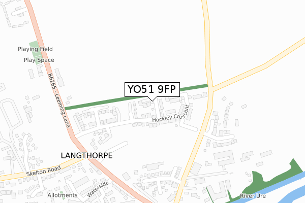
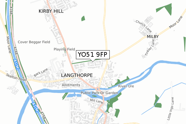
YO51 9FP is located in the Wathvale & Bishop Monkton electoral ward, within the unitary authority of North Yorkshire and the English Parliamentary constituency of Skipton and Ripon. The Sub Integrated Care Board (ICB) Location is NHS Humber and North Yorkshire ICB - 42D and the police force is North Yorkshire. This postcode has been in use since January 2019.


GetTheData
Source: OS Open Zoomstack (Ordnance Survey)
Licence: Open Government Licence (requires attribution)
Attribution: Contains OS data © Crown copyright and database right 2025
Source: Open Postcode Geo
Licence: Open Government Licence (requires attribution)
Attribution: Contains OS data © Crown copyright and database right 2025; Contains Royal Mail data © Royal Mail copyright and database right 2025; Source: Office for National Statistics licensed under the Open Government Licence v.3.0
| Easting | 439491 |
| Northing | 467497 |
| Latitude | 54.101870 |
| Longitude | -1.397579 |
GetTheData
Source: Open Postcode Geo
Licence: Open Government Licence
| Country | England |
| Postcode District | YO51 |
➜ See where YO51 is on a map ➜ Where is Langthorpe? | |
GetTheData
Source: Land Registry Price Paid Data
Licence: Open Government Licence
| Ward | Wathvale & Bishop Monkton |
| Constituency | Skipton And Ripon |
GetTheData
Source: ONS Postcode Database
Licence: Open Government Licence
5, PASTURE CLOSE, LANGTHORPE, YORK, YO51 9FP 2024 23 SEP £499,950 |
5, PASTURE CLOSE, LANGTHORPE, YORK, YO51 9FP 2024 23 SEP £499,950 |
2022 4 APR £449,995 |
2, PASTURE CLOSE, LANGTHORPE, YORK, YO51 9FP 2019 29 NOV £439,995 |
2019 31 OCT £414,995 |
5, PASTURE CLOSE, LANGTHORPE, YORK, YO51 9FP 2019 10 OCT £408,495 |
4, PASTURE CLOSE, LANGTHORPE, YORK, YO51 9FP 2019 9 OCT £343,550 |
3, PASTURE CLOSE, LANGTHORPE, YORK, YO51 9FP 2019 21 AUG £410,995 |
7, PASTURE CLOSE, LANGTHORPE, YORK, YO51 9FP 2019 5 JUL £465,495 |
GetTheData
Source: HM Land Registry Price Paid Data
Licence: Contains HM Land Registry data © Crown copyright and database right 2025. This data is licensed under the Open Government Licence v3.0.
| Langthorpe Corner (Skelton Road) | Langthorpe | 272m |
| Langthorpe Corner (Skelton Road) | Langthorpe | 283m |
| Langthorpe Corner (Skelton Road) | Langthorpe | 315m |
| Anchor Inn (Leeming Lane) | Boroughbridge | 317m |
| Anchor Inn (Leeming Lane) | Boroughbridge | 326m |
GetTheData
Source: NaPTAN
Licence: Open Government Licence
| Percentage of properties with Next Generation Access | 100.0% |
| Percentage of properties with Superfast Broadband | 100.0% |
| Percentage of properties with Ultrafast Broadband | 100.0% |
| Percentage of properties with Full Fibre Broadband | 100.0% |
Superfast Broadband is between 30Mbps and 300Mbps
Ultrafast Broadband is > 300Mbps
| Percentage of properties unable to receive 2Mbps | 0.0% |
| Percentage of properties unable to receive 5Mbps | 0.0% |
| Percentage of properties unable to receive 10Mbps | 0.0% |
| Percentage of properties unable to receive 30Mbps | 0.0% |
GetTheData
Source: Ofcom
Licence: Ofcom Terms of Use (requires attribution)
GetTheData
Source: ONS Postcode Database
Licence: Open Government Licence


➜ Get more ratings from the Food Standards Agency
GetTheData
Source: Food Standards Agency
Licence: FSA terms & conditions
| Last Collection | |||
|---|---|---|---|
| Location | Mon-Fri | Sat | Distance |
| Skelton Road Langthorpe | 16:15 | 12:15 | 301m |
| Boroughbridge Post Office | 17:30 | 12:15 | 615m |
| High Street Boroughbridge | 17:30 | 12:10 | 831m |
GetTheData
Source: Dracos
Licence: Creative Commons Attribution-ShareAlike
The below table lists the International Territorial Level (ITL) codes (formerly Nomenclature of Territorial Units for Statistics (NUTS) codes) and Local Administrative Units (LAU) codes for YO51 9FP:
| ITL 1 Code | Name |
|---|---|
| TLE | Yorkshire and The Humber |
| ITL 2 Code | Name |
| TLE2 | North Yorkshire |
| ITL 3 Code | Name |
| TLE22 | North Yorkshire CC |
| LAU 1 Code | Name |
| E07000165 | Harrogate |
GetTheData
Source: ONS Postcode Directory
Licence: Open Government Licence
The below table lists the Census Output Area (OA), Lower Layer Super Output Area (LSOA), and Middle Layer Super Output Area (MSOA) for YO51 9FP:
| Code | Name | |
|---|---|---|
| OA | E00141013 | |
| LSOA | E01027687 | Harrogate 005D |
| MSOA | E02005765 | Harrogate 005 |
GetTheData
Source: ONS Postcode Directory
Licence: Open Government Licence
| YO51 9BW | 215m | |
| YO51 9JU | Market Hill | 268m |
| YO51 9BX | Station View | 291m |
| YO51 9BL | 302m | |
| YO51 9JR | Station Court | 305m |
| YO51 9BU | Station Terrace | 309m |
| YO51 9DE | 316m | |
| YO51 9BP | 337m | |
| YO51 9BT | Anchor Terrace | 347m |
| YO51 9GY | Waterside | 356m |
GetTheData
Source: Open Postcode Geo; Land Registry Price Paid Data
Licence: Open Government Licence