YO43 3RU maps, stats, and open data
YO43 3RU is located in the Wolds Weighton electoral ward, within the unitary authority of East Riding of Yorkshire and the English Parliamentary constituency of East Yorkshire. The Sub Integrated Care Board (ICB) Location is NHS Humber and North Yorkshire ICB - 02Y and the police force is Humberside. This postcode has been in use since April 2020.
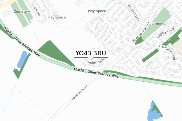
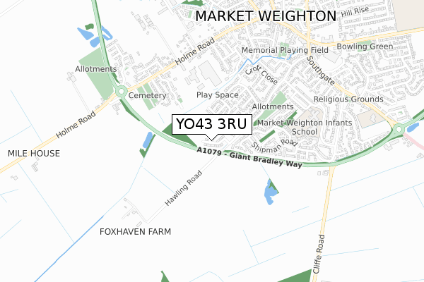
YO43 3RU maps


Licence: Open Government Licence (requires attribution)
Attribution: Contains OS data © Crown copyright and database right 2025
Source: Open Postcode Geo
Licence: Open Government Licence (requires attribution)
Attribution: Contains OS data © Crown copyright and database right 2025; Contains Royal Mail data © Royal Mail copyright and database right 2025; Source: Office for National Statistics licensed under the Open Government Licence v.3.0
YO43 3RU geodata
| Easting | 487384 |
| Northing | 441090 |
| Latitude | 53.858709 |
| Longitude | -0.672891 |
Where is YO43 3RU?
| Country | England |
| Postcode District | YO43 |
Politics
| Ward | Wolds Weighton |
|---|---|
| Constituency | East Yorkshire |
House Prices
Sales of detached houses in YO43 3RU
11, BEALES CLOSE, MARKET WEIGHTON, YORK, YO43 3RU 2021 26 NOV £274,995 |
16, BEALES CLOSE, MARKET WEIGHTON, YORK, YO43 3RU 2020 18 DEC £284,995 |
12, BEALES CLOSE, MARKET WEIGHTON, YORK, YO43 3RU 2020 14 DEC £288,995 |
18, BEALES CLOSE, MARKET WEIGHTON, YORK, YO43 3RU 2020 8 DEC £299,995 |
17, BEALES CLOSE, MARKET WEIGHTON, YORK, YO43 3RU 2020 2 NOV £289,995 |
27, BEALES CLOSE, MARKET WEIGHTON, YORK, YO43 3RU 2020 3 SEP £284,995 |
➜ Market Weighton house prices
Licence: Contains HM Land Registry data © Crown copyright and database right 2025. This data is licensed under the Open Government Licence v3.0.
Transport
Nearest bus stops to YO43 3RU
| Market Weighton Holme Rd (Holme Road) | Market Weighton | 513m |
| Market Weighton Holme Rd (Holme Road) | Market Weighton | 527m |
| Market Weighton Southgate (Southgate) | Market Weighton | 703m |
| Market Weighton Southgate (Southgate) | Market Weighton | 722m |
| Market Weighton High St (High Street) | Market Weighton | 762m |
Deprivation
18% of English postcodes are less deprived than YO43 3RU:Food Standards Agency
Three nearest food hygiene ratings to YO43 3RU (metres)


➜ Get more ratings from the Food Standards Agency
Nearest post box to YO43 3RU
| Last Collection | |||
|---|---|---|---|
| Location | Mon-Fri | Sat | Distance |
| 26 Hawling Road Market Weighton | 17:45 | 12:00 | 482m |
| 74 Holme Road Market Weighton | 17:45 | 11:00 | 509m |
| 33 Princess Road Market Weighton | 17:45 | 12:00 | 587m |
YO43 3RU ITL and YO43 3RU LAU
The below table lists the International Territorial Level (ITL) codes (formerly Nomenclature of Territorial Units for Statistics (NUTS) codes) and Local Administrative Units (LAU) codes for YO43 3RU:
| ITL 1 Code | Name |
|---|---|
| TLE | Yorkshire and The Humber |
| ITL 2 Code | Name |
| TLE1 | East Yorkshire and Northern Lincolnshire |
| ITL 3 Code | Name |
| TLE12 | East Riding of Yorkshire |
| LAU 1 Code | Name |
| E06000011 | East Riding of Yorkshire |
YO43 3RU census areas
The below table lists the Census Output Area (OA), Lower Layer Super Output Area (LSOA), and Middle Layer Super Output Area (MSOA) for YO43 3RU:
| Code | Name | |
|---|---|---|
| OA | E00066216 | |
| LSOA | E01013121 | East Riding of Yorkshire 015B |
| MSOA | E02002698 | East Riding of Yorkshire 015 |
Nearest postcodes to YO43 3RU
| YO43 3FR | Cooper Street | 124m |
| YO43 3FS | Cooper Street | 144m |
| YO43 3FA | Wicstun Way | 155m |
| YO43 3NH | Sweep Close | 155m |
| YO43 3RF | Potter Close | 164m |
| YO43 3FQ | Birch Close | 181m |
| YO43 3NP | Stephenson Close | 244m |
| YO43 3NW | Wilson Close | 258m |
| YO43 3NJ | Hanson Close | 259m |
| YO43 3RA | Shipman Road | 301m |