YO43 3GP maps, stats, and open data
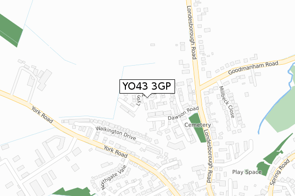
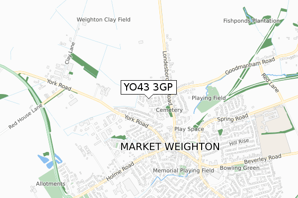
YO43 3GP is located in the Wolds Weighton electoral ward, within the unitary authority of East Riding of Yorkshire and the English Parliamentary constituency of East Yorkshire. The Sub Integrated Care Board (ICB) Location is NHS Humber and North Yorkshire ICB - 02Y and the police force is Humberside. This postcode has been in use since April 2018.
YO43 3GP maps


Licence: Open Government Licence (requires attribution)
Attribution: Contains OS data © Crown copyright and database right 2025
Source: Open Postcode Geo
Licence: Open Government Licence (requires attribution)
Attribution: Contains OS data © Crown copyright and database right 2025; Contains Royal Mail data © Royal Mail copyright and database right 2025; Source: Office for National Statistics licensed under the Open Government Licence v.3.0
YO43 3GP geodata
| Easting | 487496 |
| Northing | 442194 |
| Latitude | 53.868610 |
| Longitude | -0.670875 |
Where is YO43 3GP?
| Country | England |
| Postcode District | YO43 |
Politics
| Ward | Wolds Weighton |
|---|---|
| Constituency | East Yorkshire |
House Prices
Sales of detached houses in YO43 3GP
42, LYON AVENUE, MARKET WEIGHTON, YORK, YO43 3GP 2025 11 JUL £415,000 |
23, LYON AVENUE, MARKET WEIGHTON, YORK, YO43 3GP 2024 30 OCT £410,000 |
36, LYON AVENUE, MARKET WEIGHTON, YORK, YO43 3GP 2023 24 AUG £335,000 |
4, LYON AVENUE, MARKET WEIGHTON, YORK, YO43 3GP 2023 23 JUN £307,500 |
4, LYON AVENUE, MARKET WEIGHTON, YORK, YO43 3GP 2023 16 JUN £315,000 |
36, LYON AVENUE, MARKET WEIGHTON, YORK, YO43 3GP 2023 28 APR £338,000 |
6, LYON AVENUE, MARKET WEIGHTON, YORK, YO43 3GP 2022 7 OCT £244,000 |
2022 8 JUN £357,000 |
35, LYON AVENUE, MARKET WEIGHTON, YORK, YO43 3GP 2021 1 SEP £305,000 |
26, LYON AVENUE, MARKET WEIGHTON, YORK, YO43 3GP 2021 31 MAR £260,000 |
➜ Market Weighton house prices
Licence: Contains HM Land Registry data © Crown copyright and database right 2025. This data is licensed under the Open Government Licence v3.0.
Transport
Nearest bus stops to YO43 3GP
| Market Weighton York Rd (York Road) | Market Weighton | 204m |
| Market Weighton York Road (York Road) | Market Weighton | 239m |
| Market Weighton York Rd (York Road) | Market Weighton | 390m |
| Market Weighton Market Pl (Market Place) | Market Weighton | 433m |
| Market Weighton High St (High Street) | Market Weighton | 662m |
Broadband
Broadband access in YO43 3GP (2020 data)
| Percentage of properties with Next Generation Access | 100.0% |
| Percentage of properties with Superfast Broadband | 100.0% |
| Percentage of properties with Ultrafast Broadband | 100.0% |
| Percentage of properties with Full Fibre Broadband | 100.0% |
Superfast Broadband is between 30Mbps and 300Mbps
Ultrafast Broadband is > 300Mbps
Broadband limitations in YO43 3GP (2020 data)
| Percentage of properties unable to receive 2Mbps | 0.0% |
| Percentage of properties unable to receive 5Mbps | 0.0% |
| Percentage of properties unable to receive 10Mbps | 0.0% |
| Percentage of properties unable to receive 30Mbps | 0.0% |
Deprivation
14.3% of English postcodes are less deprived than YO43 3GP:Food Standards Agency
Three nearest food hygiene ratings to YO43 3GP (metres)


➜ Get more ratings from the Food Standards Agency
Nearest post box to YO43 3GP
| Last Collection | |||
|---|---|---|---|
| Location | Mon-Fri | Sat | Distance |
| 34 Londesborough Road Mar/Weton | 17:45 | 11:30 | 194m |
| Becklands Park, York Road | 16:30 | 11:00 | 342m |
| Market Weighton Post Office | 17:45 | 12:30 | 585m |
YO43 3GP ITL and YO43 3GP LAU
The below table lists the International Territorial Level (ITL) codes (formerly Nomenclature of Territorial Units for Statistics (NUTS) codes) and Local Administrative Units (LAU) codes for YO43 3GP:
| ITL 1 Code | Name |
|---|---|
| TLE | Yorkshire and The Humber |
| ITL 2 Code | Name |
| TLE1 | East Yorkshire and Northern Lincolnshire |
| ITL 3 Code | Name |
| TLE12 | East Riding of Yorkshire |
| LAU 1 Code | Name |
| E06000011 | East Riding of Yorkshire |
YO43 3GP census areas
The below table lists the Census Output Area (OA), Lower Layer Super Output Area (LSOA), and Middle Layer Super Output Area (MSOA) for YO43 3GP:
| Code | Name | |
|---|---|---|
| OA | E00066222 | |
| LSOA | E01013120 | East Riding of Yorkshire 015A |
| MSOA | E02002698 | East Riding of Yorkshire 015 |
Nearest postcodes to YO43 3GP
| YO43 3GE | Dawson Road | 90m |
| YO43 3GG | Thornton Close | 92m |
| YO43 3GH | Gill Close | 97m |
| YO43 3GJ | Plume Close | 131m |
| YO43 3HW | Londesborough Road | 146m |
| YO43 3NR | Walkington Drive | 160m |
| YO43 3HR | Londesborough Road | 173m |
| YO43 3GF | Rees Close | 174m |
| YO43 3EF | York Road | 221m |
| YO43 3EG | York Close | 227m |