YO42 4QT maps, stats, and open data
YO42 4QT is located in the Wolds Weighton electoral ward, within the unitary authority of East Riding of Yorkshire and the English Parliamentary constituency of East Yorkshire. The Sub Integrated Care Board (ICB) Location is NHS Humber and North Yorkshire ICB - 03Q and the police force is Humberside. This postcode has been in use since November 2018.
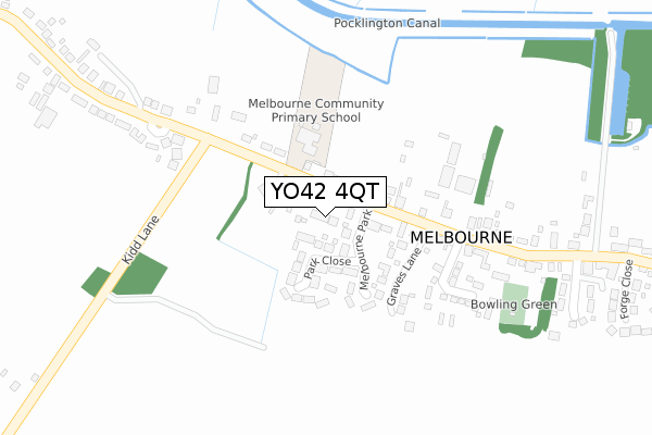
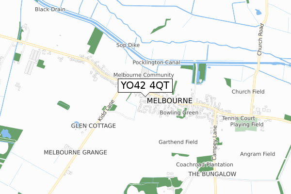
YO42 4QT maps


Licence: Open Government Licence (requires attribution)
Attribution: Contains OS data © Crown copyright and database right 2025
Source: Open Postcode Geo
Licence: Open Government Licence (requires attribution)
Attribution: Contains OS data © Crown copyright and database right 2025; Contains Royal Mail data © Royal Mail copyright and database right 2025; Source: Office for National Statistics licensed under the Open Government Licence v.3.0
YO42 4QT geodata
| Easting | 474883 |
| Northing | 444117 |
| Latitude | 53.887860 |
| Longitude | -0.862175 |
Where is YO42 4QT?
| Country | England |
| Postcode District | YO42 |
Politics
| Ward | Wolds Weighton |
|---|---|
| Constituency | East Yorkshire |
House Prices
Sales of detached houses in YO42 4QT
3, THORNLEIGH CROFT, MELBOURNE, YORK, YO42 4QT 2023 28 JUL £590,000 |
3, THORNLEIGH CROFT, MELBOURNE, YORK, YO42 4QT 2021 1 FEB £570,000 |
1, THORNLEIGH CROFT, MELBOURNE, YORK, YO42 4QT 2019 22 NOV £490,000 |
3, THORNLEIGH CROFT, MELBOURNE, YORK, YO42 4QT 2019 25 OCT £480,000 |
2, THORNLEIGH CROFT, MELBOURNE, YORK, YO42 4QT 2018 30 OCT £465,000 |
Licence: Contains HM Land Registry data © Crown copyright and database right 2025. This data is licensed under the Open Government Licence v3.0.
Transport
Nearest bus stops to YO42 4QT
| Melbourne Main Street (Main Street) | Melbourne | 264m |
| Melbourne Main Street (Main Street) | Melbourne | 348m |
| Melbourne Main Street (Campey Lane) | Melbourne | 601m |
| Thornton Main Street (Main Street) | Melbourne | 1,583m |
Broadband
Broadband access in YO42 4QT (2020 data)
| Percentage of properties with Next Generation Access | 100.0% |
| Percentage of properties with Superfast Broadband | 100.0% |
| Percentage of properties with Ultrafast Broadband | 0.0% |
| Percentage of properties with Full Fibre Broadband | 0.0% |
Superfast Broadband is between 30Mbps and 300Mbps
Ultrafast Broadband is > 300Mbps
Broadband limitations in YO42 4QT (2020 data)
| Percentage of properties unable to receive 2Mbps | 0.0% |
| Percentage of properties unable to receive 5Mbps | 0.0% |
| Percentage of properties unable to receive 10Mbps | 0.0% |
| Percentage of properties unable to receive 30Mbps | 0.0% |
Deprivation
28.3% of English postcodes are less deprived than YO42 4QT:Food Standards Agency
Three nearest food hygiene ratings to YO42 4QT (metres)


➜ Get more ratings from the Food Standards Agency
Nearest post box to YO42 4QT
| Last Collection | |||
|---|---|---|---|
| Location | Mon-Fri | Sat | Distance |
| Melbourne East | 16:30 | 09:55 | 545m |
| Village Hall Sutton On Derwent | 18:40 | 10:50 | 5,184m |
| Halifax Way Pocklinton Ind Est | 18:30 | 12:00 | 5,676m |
YO42 4QT ITL and YO42 4QT LAU
The below table lists the International Territorial Level (ITL) codes (formerly Nomenclature of Territorial Units for Statistics (NUTS) codes) and Local Administrative Units (LAU) codes for YO42 4QT:
| ITL 1 Code | Name |
|---|---|
| TLE | Yorkshire and The Humber |
| ITL 2 Code | Name |
| TLE1 | East Yorkshire and Northern Lincolnshire |
| ITL 3 Code | Name |
| TLE12 | East Riding of Yorkshire |
| LAU 1 Code | Name |
| E06000011 | East Riding of Yorkshire |
YO42 4QT census areas
The below table lists the Census Output Area (OA), Lower Layer Super Output Area (LSOA), and Middle Layer Super Output Area (MSOA) for YO42 4QT:
| Code | Name | |
|---|---|---|
| OA | E00066231 | |
| LSOA | E01013127 | East Riding of Yorkshire 018E |
| MSOA | E02002701 | East Riding of Yorkshire 018 |
Nearest postcodes to YO42 4QT
| YO42 4QP | Melbourne Park | 95m |
| YO42 4QR | Park Close | 97m |
| YO42 4QE | 116m | |
| YO42 4SL | Orchard Park | 218m |
| YO42 4QG | Glen Crescent | 283m |
| YO42 4QW | St Monicas Close | 385m |
| YO42 4QJ | 438m | |
| YO42 4QQ | 483m | |
| YO42 4QS | Forge Close | 494m |
| YO42 4QH | Jubilee Terrace | 497m |