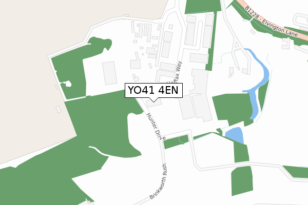
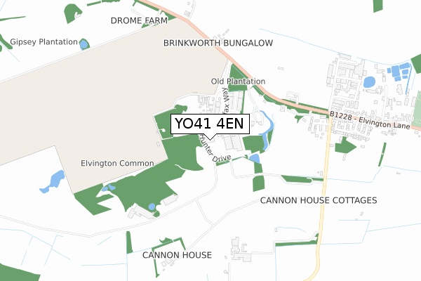
YO41 4EN is located in the Wheldrake electoral ward, within the unitary authority of York and the English Parliamentary constituency of York Outer. The Sub Integrated Care Board (ICB) Location is NHS Humber and North Yorkshire ICB - 03Q and the police force is North Yorkshire. This postcode has been in use since May 2018.


GetTheData
Source: OS Open Zoomstack (Ordnance Survey)
Licence: Open Government Licence (requires attribution)
Attribution: Contains OS data © Crown copyright and database right 2025
Source: Open Postcode Geo
Licence: Open Government Licence (requires attribution)
Attribution: Contains OS data © Crown copyright and database right 2025; Contains Royal Mail data © Royal Mail copyright and database right 2025; Source: Office for National Statistics licensed under the Open Government Licence v.3.0
| Easting | 468063 |
| Northing | 448052 |
| Latitude | 53.924160 |
| Longitude | -0.965046 |
GetTheData
Source: Open Postcode Geo
Licence: Open Government Licence
| Country | England |
| Postcode District | YO41 |
➜ See where YO41 is on a map ➜ Where is Elvington? | |
GetTheData
Source: Land Registry Price Paid Data
Licence: Open Government Licence
| Ward | Wheldrake |
| Constituency | York Outer |
GetTheData
Source: ONS Postcode Database
Licence: Open Government Licence
| Air Museum Entrance (Whitley Road) | Yorkshire Air Museum | 256m |
| Yorkshire Air Museum (Elvington Lane) | Elvington | 445m |
| Yorkshire Air Museum (Elvington Lane) | Elvington | 450m |
| Elvington Park (Elvington Lane) | Elvington | 827m |
| Elvington Park (Elvington Lane) | Elvington | 829m |
GetTheData
Source: NaPTAN
Licence: Open Government Licence
GetTheData
Source: ONS Postcode Database
Licence: Open Government Licence


➜ Get more ratings from the Food Standards Agency
GetTheData
Source: Food Standards Agency
Licence: FSA terms & conditions
| Last Collection | |||
|---|---|---|---|
| Location | Mon-Fri | Sat | Distance |
| Elvington Post Office | 18:50 | 10:55 | 1,992m |
| Village Hall Sutton On Derwent | 18:40 | 10:50 | 2,812m |
| Lay-by Common Road Dunnington | 18:00 | 13:00 | 3,507m |
GetTheData
Source: Dracos
Licence: Creative Commons Attribution-ShareAlike
The below table lists the International Territorial Level (ITL) codes (formerly Nomenclature of Territorial Units for Statistics (NUTS) codes) and Local Administrative Units (LAU) codes for YO41 4EN:
| ITL 1 Code | Name |
|---|---|
| TLE | Yorkshire and The Humber |
| ITL 2 Code | Name |
| TLE2 | North Yorkshire |
| ITL 3 Code | Name |
| TLE21 | York |
| LAU 1 Code | Name |
| E06000014 | York |
GetTheData
Source: ONS Postcode Directory
Licence: Open Government Licence
The below table lists the Census Output Area (OA), Lower Layer Super Output Area (LSOA), and Middle Layer Super Output Area (MSOA) for YO41 4EN:
| Code | Name | |
|---|---|---|
| OA | E00067906 | |
| LSOA | E01013451 | York 020C |
| MSOA | E02002791 | York 020 |
GetTheData
Source: ONS Postcode Directory
Licence: Open Government Licence
| YO41 4AT | York Road | 281m |
| YO41 4DL | The Conifers | 644m |
| YO41 4AY | Wheldrake Lane | 662m |
| YO41 4BF | Wheldrake Lane | 668m |
| YO41 4AX | York Road | 756m |
| YO41 4DW | Elvington Park | 789m |
| YO41 4AR | Elvington Industrial Estate | 839m |
| YO41 4AS | Algarth Terrace | 912m |
| YO41 4DZ | York Road | 1030m |
| YO41 4DY | York Road | 1069m |
GetTheData
Source: Open Postcode Geo; Land Registry Price Paid Data
Licence: Open Government Licence