Property/Postcode Data Search:
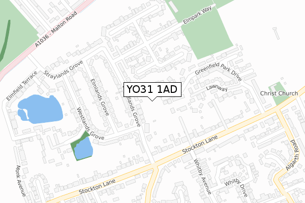
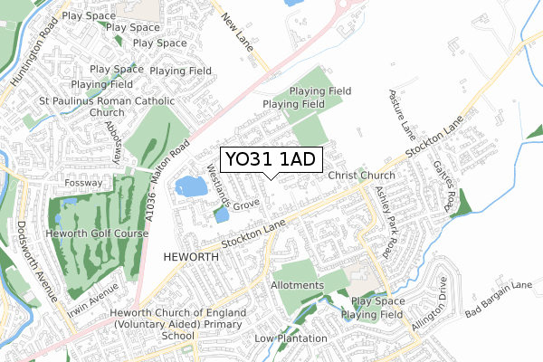
YO31 1AD maps, stats, and open data
YO31 1AD is located in the Heworth Without electoral ward, within the unitary authority of York and the English Parliamentary constituency of York Outer. The Sub Integrated Care Board (ICB) Location is NHS Humber and North Yorkshire ICB - 03Q and the police force is North Yorkshire. This postcode has been in use since September 2019.
YO31 1AD maps


Source: OS Open Zoomstack (Ordnance Survey)
Licence: Open Government Licence (requires attribution)
Attribution: Contains OS data © Crown copyright and database right 2025
Source: Open Postcode Geo
Licence: Open Government Licence (requires attribution)
Attribution: Contains OS data © Crown copyright and database right 2025; Contains Royal Mail data © Royal Mail copyright and database right 2025; Source: Office for National Statistics licensed under the Open Government Licence v.3.0
Licence: Open Government Licence (requires attribution)
Attribution: Contains OS data © Crown copyright and database right 2025
Source: Open Postcode Geo
Licence: Open Government Licence (requires attribution)
Attribution: Contains OS data © Crown copyright and database right 2025; Contains Royal Mail data © Royal Mail copyright and database right 2025; Source: Office for National Statistics licensed under the Open Government Licence v.3.0
YO31 1AD geodata
| Easting | 462165 |
| Northing | 453399 |
| Latitude | 53.972949 |
| Longitude | -1.053760 |
Where is YO31 1AD?
| Country | England |
| Postcode District | YO31 |
Politics
| Ward | Heworth Without |
|---|---|
| Constituency | York Outer |
House Prices
Sales of detached houses in YO31 1AD
2024 27 MAR £995,000 |
1, WOODVILLE COURT, GREENFIELD PARK DRIVE, YORK, YO31 1AD 2022 18 NOV £1,285,000 |
2021 27 JAN £925,000 |
5, WOODVILLE COURT, GREENFIELD PARK DRIVE, YORK, YO31 1AD 2020 25 SEP £925,000 |
9, WOODVILLE COURT, GREENFIELD PARK DRIVE, YORK, YO31 1AD 2020 15 JUL £200,000 |
7, WOODVILLE COURT, GREENFIELD PARK DRIVE, YORK, YO31 1AD 2020 28 FEB £625,000 |
6, WOODVILLE COURT, GREENFIELD PARK DRIVE, YORK, YO31 1AD 2020 31 JAN £850,000 |
2019 29 NOV £689,862 |
8, WOODVILLE COURT, GREENFIELD PARK DRIVE, YORK, YO31 1AD 2019 5 NOV £550,000 |
4, WOODVILLE COURT, GREENFIELD PARK DRIVE, YORK, YO31 1AD 2019 6 SEP £675,000 |
Source: HM Land Registry Price Paid Data
Licence: Contains HM Land Registry data © Crown copyright and database right 2025. This data is licensed under the Open Government Licence v3.0.
Licence: Contains HM Land Registry data © Crown copyright and database right 2025. This data is licensed under the Open Government Licence v3.0.
Transport
Nearest bus stops to YO31 1AD
| Elmpark Way (Woodlands Grove) | Heworth | 147m |
| Elmpark Way (Woodlands Grove) | Heworth | 153m |
| Woodlands Grove | Heworth | 182m |
| Woodlands Grove | Heworth | 184m |
| Whitby Avenue (Stockton Lane) | Heworth | 205m |
Nearest railway stations to YO31 1AD
| York Station | 3.1km |
Deprivation
3.1% of English postcodes are less deprived than YO31 1AD:Food Standards Agency
Three nearest food hygiene ratings to YO31 1AD (metres)
York City Hockey Club

Elmpark Way
217m
Heworth Amateur Rugby League Club

Elmpark Way
217m
Stockton Lane Playgroup

Christ Church
402m
➜ Get more ratings from the Food Standards Agency
Nearest post box to YO31 1AD
| Last Collection | |||
|---|---|---|---|
| Location | Mon-Fri | Sat | Distance |
| Corner Woodlands Grove | 17:30 | 12:15 | 202m |
| Straylands Grove | 17:30 | 12:15 | 295m |
| Brandon Pianos Whitby Avenue | 17:30 | 12:30 | 336m |
YO31 1AD ITL and YO31 1AD LAU
The below table lists the International Territorial Level (ITL) codes (formerly Nomenclature of Territorial Units for Statistics (NUTS) codes) and Local Administrative Units (LAU) codes for YO31 1AD:
| ITL 1 Code | Name |
|---|---|
| TLE | Yorkshire and The Humber |
| ITL 2 Code | Name |
| TLE2 | North Yorkshire |
| ITL 3 Code | Name |
| TLE21 | York |
| LAU 1 Code | Name |
| E06000014 | York |
YO31 1AD census areas
The below table lists the Census Output Area (OA), Lower Layer Super Output Area (LSOA), and Middle Layer Super Output Area (MSOA) for YO31 1AD:
| Code | Name | |
|---|---|---|
| OA | E00067584 | |
| LSOA | E01013387 | York 008D |
| MSOA | E02002779 | York 008 |
Nearest postcodes to YO31 1AD
| YO31 1DL | Woodlands Grove | 68m |
| YO31 1DS | Woodlands Grove | 119m |
| YO31 1DR | Westlands Grove | 134m |
| YO31 1DU | Elmpark Vale | 141m |
| YO31 1DP | Woodlands Grove | 151m |
| YO31 1EE | Elmlands Grove | 156m |
| YO31 1DT | Elmpark Way | 178m |
| YO31 1ED | Elmlands Grove | 187m |
| YO31 1JA | Stockton Lane | 195m |
| YO31 1JD | Lawnway | 201m |