YO30 6QQ maps, stats, and open data
YO30 6QQ is located in the Rawcliffe & Clifton Without electoral ward, within the unitary authority of York and the English Parliamentary constituency of York Outer. The Sub Integrated Care Board (ICB) Location is NHS Humber and North Yorkshire ICB - 03Q and the police force is North Yorkshire. This postcode has been in use since September 2017.
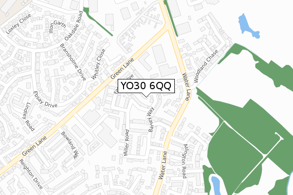
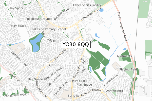
YO30 6QQ maps


Licence: Open Government Licence (requires attribution)
Attribution: Contains OS data © Crown copyright and database right 2025
Source: Open Postcode Geo
Licence: Open Government Licence (requires attribution)
Attribution: Contains OS data © Crown copyright and database right 2025; Contains Royal Mail data © Royal Mail copyright and database right 2025; Source: Office for National Statistics licensed under the Open Government Licence v.3.0
YO30 6QQ geodata
| Easting | 459367 |
| Northing | 454424 |
| Latitude | 53.982488 |
| Longitude | -1.096212 |
Where is YO30 6QQ?
| Country | England |
| Postcode District | YO30 |
Politics
| Ward | Rawcliffe & Clifton Without |
|---|---|
| Constituency | York Outer |
House Prices
Sales of detached houses in YO30 6QQ
2023 3 NOV £425,000 |
55, FARRO DRIVE, YORK, YO30 6QQ 2019 28 JUN £367,950 |
57, FARRO DRIVE, YORK, YO30 6QQ 2019 14 JUN £382,950 |
59, FARRO DRIVE, YORK, YO30 6QQ 2019 24 MAY £329,950 |
63, FARRO DRIVE, YORK, YO30 6QQ 2019 24 MAY £382,950 |
61, FARRO DRIVE, YORK, YO30 6QQ 2019 17 MAY £367,950 |
2019 14 MAR £373,000 |
49, FARRO DRIVE, YORK, YO30 6QQ 2019 1 FEB £379,950 |
37, FARRO DRIVE, YORK, YO30 6QQ 2018 14 DEC £339,950 |
47, FARRO DRIVE, YORK, YO30 6QQ 2018 26 OCT £363,950 |
Licence: Contains HM Land Registry data © Crown copyright and database right 2025. This data is licensed under the Open Government Licence v3.0.
Transport
Nearest bus stops to YO30 6QQ
| Victoria Farm (Water Lane) | Clifton Without | 124m |
| Victoria Farm (Water Lane) | Clifton Without | 136m |
| Woodland Chase (Water Lane) | Clifton Without | 168m |
| Green Lane | Clifton Without | 206m |
| Green Lane | Clifton Without | 288m |
Nearest railway stations to YO30 6QQ
| York Station | 2.7km |
| Poppleton Station | 3.5km |
Broadband
Broadband access in YO30 6QQ (2020 data)
| Percentage of properties with Next Generation Access | 100.0% |
| Percentage of properties with Superfast Broadband | 100.0% |
| Percentage of properties with Ultrafast Broadband | 0.0% |
| Percentage of properties with Full Fibre Broadband | 0.0% |
Superfast Broadband is between 30Mbps and 300Mbps
Ultrafast Broadband is > 300Mbps
Broadband speed in YO30 6QQ (2019 data)
Download
| Median download speed | 39.1Mbps |
| Average download speed | 36.6Mbps |
| Maximum download speed | 49.91Mbps |
Upload
| Median upload speed | 6.6Mbps |
| Average upload speed | 6.4Mbps |
| Maximum upload speed | 10.73Mbps |
Broadband limitations in YO30 6QQ (2020 data)
| Percentage of properties unable to receive 2Mbps | 0.0% |
| Percentage of properties unable to receive 5Mbps | 0.0% |
| Percentage of properties unable to receive 10Mbps | 0.0% |
| Percentage of properties unable to receive 30Mbps | 0.0% |
Deprivation
13.4% of English postcodes are less deprived than YO30 6QQ:Food Standards Agency
Three nearest food hygiene ratings to YO30 6QQ (metres)


➜ Get more ratings from the Food Standards Agency
Nearest post box to YO30 6QQ
| Last Collection | |||
|---|---|---|---|
| Location | Mon-Fri | Sat | Distance |
| Tower Court Oakdale Road | 18:00 | 12:45 | 403m |
| Tamworth Road Clifton Moor | 17:45 | 12:30 | 412m |
| Oakdale Road | 18:00 | 12:45 | 490m |
YO30 6QQ ITL and YO30 6QQ LAU
The below table lists the International Territorial Level (ITL) codes (formerly Nomenclature of Territorial Units for Statistics (NUTS) codes) and Local Administrative Units (LAU) codes for YO30 6QQ:
| ITL 1 Code | Name |
|---|---|
| TLE | Yorkshire and The Humber |
| ITL 2 Code | Name |
| TLE2 | North Yorkshire |
| ITL 3 Code | Name |
| TLE21 | York |
| LAU 1 Code | Name |
| E06000014 | York |
YO30 6QQ census areas
The below table lists the Census Output Area (OA), Lower Layer Super Output Area (LSOA), and Middle Layer Super Output Area (MSOA) for YO30 6QQ:
| Code | Name | |
|---|---|---|
| OA | E00067797 | |
| LSOA | E01013431 | York 006D |
| MSOA | E02002777 | York 006 |
Nearest postcodes to YO30 6QQ
| YO30 6PQ | Water Lane | 77m |
| YO30 4YD | Handley Close | 151m |
| YO30 4YE | Hayforth Close | 164m |
| YO30 4YB | Whitley Close | 196m |
| YO30 6RF | Water Lane | 199m |
| YO30 5GB | Tatton Close | 208m |
| YO30 6RA | Hazelnut Grove | 211m |
| YO30 6PF | Water Lane | 216m |
| YO30 5GD | Pentire Close | 242m |
| YO30 4XN | Bransholme Drive | 255m |