Property/Postcode Data Search:
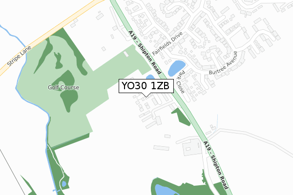
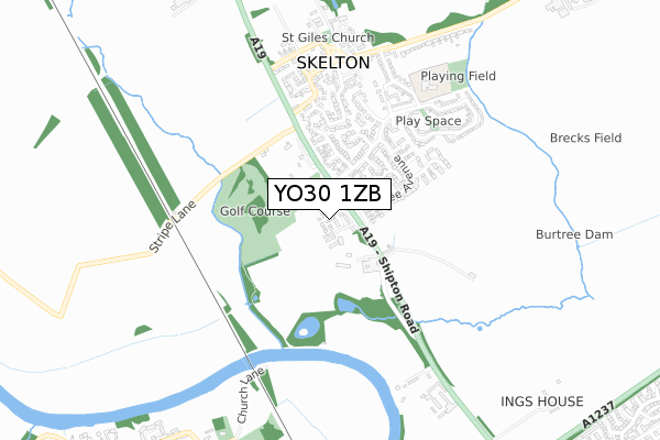
YO30 1ZB maps, stats, and open data
YO30 1ZB is located in the Rural West York electoral ward, within the unitary authority of York and the English Parliamentary constituency of York Outer. The Sub Integrated Care Board (ICB) Location is NHS Humber and North Yorkshire ICB - 03Q and the police force is North Yorkshire. This postcode has been in use since November 2019.
YO30 1ZB maps


Source: OS Open Zoomstack (Ordnance Survey)
Licence: Open Government Licence (requires attribution)
Attribution: Contains OS data © Crown copyright and database right 2025
Source: Open Postcode Geo
Licence: Open Government Licence (requires attribution)
Attribution: Contains OS data © Crown copyright and database right 2025; Contains Royal Mail data © Royal Mail copyright and database right 2025; Source: Office for National Statistics licensed under the Open Government Licence v.3.0
Licence: Open Government Licence (requires attribution)
Attribution: Contains OS data © Crown copyright and database right 2025
Source: Open Postcode Geo
Licence: Open Government Licence (requires attribution)
Attribution: Contains OS data © Crown copyright and database right 2025; Contains Royal Mail data © Royal Mail copyright and database right 2025; Source: Office for National Statistics licensed under the Open Government Licence v.3.0
YO30 1ZB geodata
| Easting | 456793 |
| Northing | 455846 |
| Latitude | 53.995556 |
| Longitude | -1.135193 |
Where is YO30 1ZB?
| Country | England |
| Postcode District | YO30 |
Politics
| Ward | Rural West York |
|---|---|
| Constituency | York Outer |
House Prices
Sales of detached houses in YO30 1ZB
2023 24 FEB £555,000 |
61, OUSEBANK DRIVE, SKELTON, YORK, YO30 1ZB 2021 27 AUG £474,900 |
63, OUSEBANK DRIVE, SKELTON, YORK, YO30 1ZB 2021 27 AUG £500,000 |
65, OUSEBANK DRIVE, SKELTON, YORK, YO30 1ZB 2021 27 AUG £519,995 |
52, OUSEBANK DRIVE, SKELTON, YORK, YO30 1ZB 2021 25 JUN £494,995 |
50, OUSEBANK DRIVE, SKELTON, YORK, YO30 1ZB 2021 25 JUN £500,000 |
54, OUSEBANK DRIVE, SKELTON, YORK, YO30 1ZB 2021 24 JUN £499,995 |
45, OUSEBANK DRIVE, SKELTON, YORK, YO30 1ZB 2021 9 APR £495,000 |
44, OUSEBANK DRIVE, SKELTON, YORK, YO30 1ZB 2021 1 APR £492,000 |
41, OUSEBANK DRIVE, SKELTON, YORK, YO30 1ZB 2021 26 MAR £488,995 |
Source: HM Land Registry Price Paid Data
Licence: Contains HM Land Registry data © Crown copyright and database right 2025. This data is licensed under the Open Government Licence v3.0.
Licence: Contains HM Land Registry data © Crown copyright and database right 2025. This data is licensed under the Open Government Licence v3.0.
Transport
Nearest bus stops to YO30 1ZB
| Fairfield Cottages (Shipton Road A19) | Skelton | 134m |
| Fairfield Cottages (Shipton Road A19) | Skelton | 160m |
| Fairfields Drive | Skelton | 221m |
| Fairfields Drive | Skelton | 253m |
| Fairfield Manor (Shipton Road) | Skelton | 277m |
Nearest railway stations to YO30 1ZB
| Poppleton Station | 2.4km |
| York Station | 5km |
Deprivation
10% of English postcodes are less deprived than YO30 1ZB:Food Standards Agency
Three nearest food hygiene ratings to YO30 1ZB (metres)
Maple Tree Cafe @ Skelton Garden Centre

Skelton Nurseries Ltd
123m
Mercure York Fairfield Manor Hotel

Shipton Road
123m
Blacksmiths Arms

Shipton Road
123m
➜ Get more ratings from the Food Standards Agency
Nearest post box to YO30 1ZB
| Last Collection | |||
|---|---|---|---|
| Location | Mon-Fri | Sat | Distance |
| Skelton Post Office | 16:15 | 12:00 | 481m |
| 12 The Village Skelton | 18:00 | 12:45 | 555m |
| Nether Poppleton Post Office | 16:30 | 11:15 | 1,222m |
YO30 1ZB ITL and YO30 1ZB LAU
The below table lists the International Territorial Level (ITL) codes (formerly Nomenclature of Territorial Units for Statistics (NUTS) codes) and Local Administrative Units (LAU) codes for YO30 1ZB:
| ITL 1 Code | Name |
|---|---|
| TLE | Yorkshire and The Humber |
| ITL 2 Code | Name |
| TLE2 | North Yorkshire |
| ITL 3 Code | Name |
| TLE21 | York |
| LAU 1 Code | Name |
| E06000014 | York |
YO30 1ZB census areas
The below table lists the Census Output Area (OA), Lower Layer Super Output Area (LSOA), and Middle Layer Super Output Area (MSOA) for YO30 1ZB:
| Code | Name | |
|---|---|---|
| OA | E00067828 | |
| LSOA | E01013430 | York 006C |
| MSOA | E02002777 | York 006 |
Nearest postcodes to YO30 1ZB
| YO30 1XW | Fairfield Cottages | 126m |
| YO30 1YY | Park Close | 208m |
| YO30 1YR | Grange Close | 282m |
| YO30 1YX | The Rowans | 283m |
| YO30 1YJ | Stripe Lane | 320m |
| YO30 1YZ | The Beeches | 347m |
| YO30 1YP | Fairfields Drive | 353m |
| YO30 1YS | Arthur Place | 356m |
| YO30 1YT | Burtree Avenue | 377m |
| YO30 1YH | The Vale | 432m |