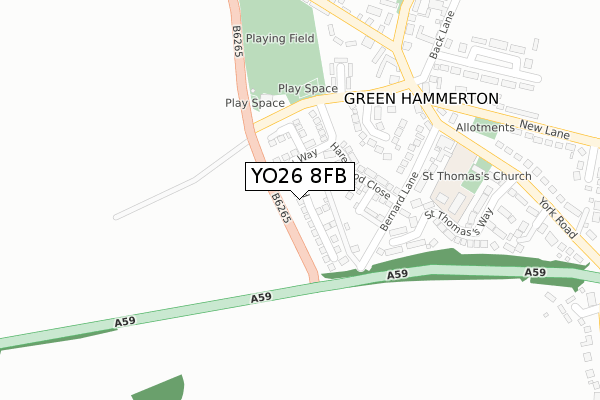
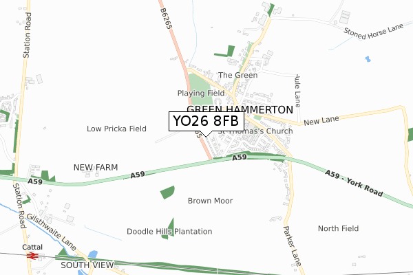
YO26 8FB maps, stats, and open data
YO26 8FB is located in the Ouseburn electoral ward, within the unitary authority of North Yorkshire and the English Parliamentary constituency of Selby and Ainsty. The Sub Integrated Care Board (ICB) Location is NHS Humber and North Yorkshire ICB - 42D and the police force is North Yorkshire. This postcode has been in use since December 2017.
YO26 8FB maps


Licence: Open Government Licence (requires attribution)
Attribution: Contains OS data © Crown copyright and database right 2025
Source: Open Postcode Geo
Licence: Open Government Licence (requires attribution)
Attribution: Contains OS data © Crown copyright and database right 2025; Contains Royal Mail data © Royal Mail copyright and database right 2025; Source: Office for National Statistics licensed under the Open Government Licence v.3.0
YO26 8FB geodata
| Easting | 445705 |
| Northing | 456638 |
| Latitude | 54.003770 |
| Longitude | -1.304190 |
Where is YO26 8FB?
| Country | England |
| Postcode District | YO26 |
Politics
| Ward | Ouseburn |
|---|---|
| Constituency | Selby And Ainsty |
House Prices
Sales of detached houses in YO26 8FB
2025 16 MAY £430,000 |
2022 4 APR £420,000 |
2021 24 JUN £422,000 |
6, PADDOCK WAY, GREEN HAMMERTON, YORK, YO26 8FB 2020 25 NOV £317,500 |
2020 21 AUG £379,950 |
36, PADDOCK WAY, GREEN HAMMERTON, YORK, YO26 8FB 2020 14 AUG £399,950 |
28, PADDOCK WAY, GREEN HAMMERTON, YORK, YO26 8FB 2020 7 AUG £324,950 |
2, PADDOCK WAY, GREEN HAMMERTON, YORK, YO26 8FB 2020 3 JUN £480,000 |
32, PADDOCK WAY, GREEN HAMMERTON, YORK, YO26 8FB 2020 29 APR £464,950 |
4, PADDOCK WAY, GREEN HAMMERTON, YORK, YO26 8FB 2020 28 APR £390,000 |
➜ Green Hammerton house prices
Licence: Contains HM Land Registry data © Crown copyright and database right 2025. This data is licensed under the Open Government Licence v3.0.
Transport
Nearest bus stops to YO26 8FB
| Bernard Lane (York Road) | Green Hammerton | 260m |
| The Bay Horse Inn (York Road) | Green Hammerton | 299m |
| Rosedale Cottage (Boroughbridge Road) | Green Hammerton | 326m |
| Rosedale Cottage (Boroughbridge Road) | Green Hammerton | 332m |
| Springbank Surgery (York Road) | Green Hammerton | 412m |
Nearest railway stations to YO26 8FB
| Cattal Station | 1.3km |
| Hammerton Station | 1.6km |
Broadband
Broadband access in YO26 8FB (2020 data)
| Percentage of properties with Next Generation Access | 100.0% |
| Percentage of properties with Superfast Broadband | 100.0% |
| Percentage of properties with Ultrafast Broadband | 100.0% |
| Percentage of properties with Full Fibre Broadband | 100.0% |
Superfast Broadband is between 30Mbps and 300Mbps
Ultrafast Broadband is > 300Mbps
Broadband limitations in YO26 8FB (2020 data)
| Percentage of properties unable to receive 2Mbps | 0.0% |
| Percentage of properties unable to receive 5Mbps | 0.0% |
| Percentage of properties unable to receive 10Mbps | 0.0% |
| Percentage of properties unable to receive 30Mbps | 0.0% |
Deprivation
29.8% of English postcodes are less deprived than YO26 8FB:Food Standards Agency
Three nearest food hygiene ratings to YO26 8FB (metres)


➜ Get more ratings from the Food Standards Agency
Nearest post box to YO26 8FB
| Last Collection | |||
|---|---|---|---|
| Location | Mon-Fri | Sat | Distance |
| Green Hammerton Post Office | 17:00 | 11:15 | 271m |
| Cattal Station | 16:30 | 11:40 | 1,279m |
| Kirk Hammerton Post Office | 16:15 | 11:00 | 1,434m |
YO26 8FB ITL and YO26 8FB LAU
The below table lists the International Territorial Level (ITL) codes (formerly Nomenclature of Territorial Units for Statistics (NUTS) codes) and Local Administrative Units (LAU) codes for YO26 8FB:
| ITL 1 Code | Name |
|---|---|
| TLE | Yorkshire and The Humber |
| ITL 2 Code | Name |
| TLE2 | North Yorkshire |
| ITL 3 Code | Name |
| TLE22 | North Yorkshire CC |
| LAU 1 Code | Name |
| E07000165 | Harrogate |
YO26 8FB census areas
The below table lists the Census Output Area (OA), Lower Layer Super Output Area (LSOA), and Middle Layer Super Output Area (MSOA) for YO26 8FB:
| Code | Name | |
|---|---|---|
| OA | E00141049 | |
| LSOA | E01027696 | Harrogate 016D |
| MSOA | E02005776 | Harrogate 016 |
Nearest postcodes to YO26 8FB
| YO26 8HG | Stoneleigh Gate | 183m |
| YO26 8BP | Bernard Lane | 184m |
| YO26 8AB | Harrogate Road | 221m |
| YO26 8BE | St Thomass Way | 244m |
| YO26 8AA | Harrogate Road | 256m |
| YO26 8HF | Cowley Mews | 269m |
| YO26 8AD | Boroughbridge Road | 292m |
| YO26 8BN | York Road | 331m |
| YO26 8AE | Boroughbridge Road | 337m |
| YO26 8BR | Ebor View | 369m |