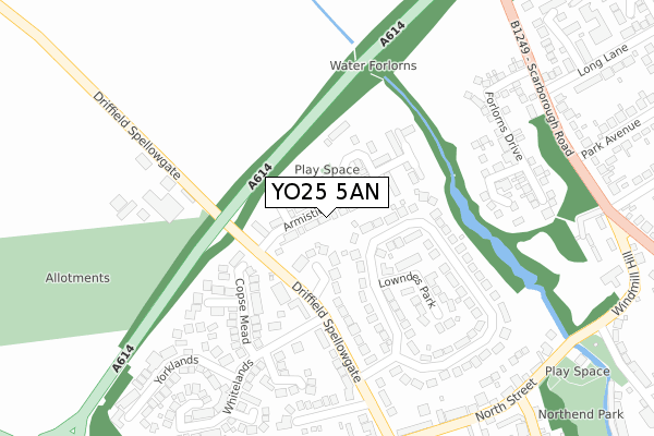
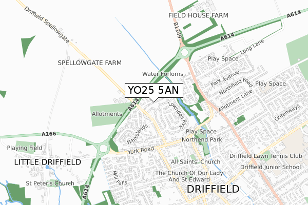
YO25 5AN maps, stats, and open data
YO25 5AN is located in the Driffield and Rural electoral ward, within the unitary authority of East Riding of Yorkshire and the English Parliamentary constituency of East Yorkshire. The Sub Integrated Care Board (ICB) Location is NHS Humber and North Yorkshire ICB - 02Y and the police force is Humberside. This postcode has been in use since March 2018.
YO25 5AN maps


Licence: Open Government Licence (requires attribution)
Attribution: Contains OS data © Crown copyright and database right 2025
Source: Open Postcode Geo
Licence: Open Government Licence (requires attribution)
Attribution: Contains OS data © Crown copyright and database right 2025; Contains Royal Mail data © Royal Mail copyright and database right 2025; Source: Office for National Statistics licensed under the Open Government Licence v.3.0
YO25 5AN geodata
| Easting | 501855 |
| Northing | 458457 |
| Latitude | 54.012108 |
| Longitude | -0.447175 |
Where is YO25 5AN?
| Country | England |
| Postcode District | YO25 |
Politics
| Ward | Driffield And Rural |
|---|---|
| Constituency | East Yorkshire |
House Prices
Sales of detached houses in YO25 5AN
2025 21 MAR £250,000 |
2022 12 AUG £283,000 |
2021 31 MAR £205,000 |
2, ARMISTICE PARK, DRIFFIELD, YO25 5AN 2020 18 DEC £279,950 |
48, ARMISTICE PARK, DRIFFIELD, YO25 5AN 2019 23 MAY £247,950 |
46, ARMISTICE PARK, DRIFFIELD, YO25 5AN 2019 28 FEB £259,950 |
21, ARMISTICE PARK, DRIFFIELD, YO25 5AN 2018 14 DEC £255,950 |
27, ARMISTICE PARK, DRIFFIELD, YO25 5AN 2018 7 DEC £259,950 |
17, ARMISTICE PARK, DRIFFIELD, YO25 5AN 2018 30 NOV £274,950 |
24, ARMISTICE PARK, DRIFFIELD, YO25 5AN 2018 30 NOV £274,950 |
Licence: Contains HM Land Registry data © Crown copyright and database right 2025. This data is licensed under the Open Government Licence v3.0.
Transport
Nearest bus stops to YO25 5AN
| Driffield York Road (York Road) | Driffield | 363m |
| Driffield York Road (York Road) | Driffield | 378m |
| Driffield York Road (York Road) | Driffield | 447m |
| Driffield Middle Street North (Middle Street North) | Driffield | 470m |
| Driffield Mill Falls (Mill Falls) | Driffield | 579m |
Nearest railway stations to YO25 5AN
| Driffield Station | 1.4km |
| Nafferton Station | 4km |
Broadband
Broadband access in YO25 5AN (2020 data)
| Percentage of properties with Next Generation Access | 100.0% |
| Percentage of properties with Superfast Broadband | 100.0% |
| Percentage of properties with Ultrafast Broadband | 100.0% |
| Percentage of properties with Full Fibre Broadband | 100.0% |
Superfast Broadband is between 30Mbps and 300Mbps
Ultrafast Broadband is > 300Mbps
Broadband limitations in YO25 5AN (2020 data)
| Percentage of properties unable to receive 2Mbps | 0.0% |
| Percentage of properties unable to receive 5Mbps | 0.0% |
| Percentage of properties unable to receive 10Mbps | 0.0% |
| Percentage of properties unable to receive 30Mbps | 0.0% |
Deprivation
3.8% of English postcodes are less deprived than YO25 5AN:Food Standards Agency
Three nearest food hygiene ratings to YO25 5AN (metres)


➜ Get more ratings from the Food Standards Agency
Nearest post box to YO25 5AN
| Last Collection | |||
|---|---|---|---|
| Location | Mon-Fri | Sat | Distance |
| Whitelands | 17:30 | 12:45 | 150m |
| 29 York Road Driffield | 17:45 | 12:45 | 360m |
| Park Avenue | 17:30 | 12:30 | 409m |
YO25 5AN ITL and YO25 5AN LAU
The below table lists the International Territorial Level (ITL) codes (formerly Nomenclature of Territorial Units for Statistics (NUTS) codes) and Local Administrative Units (LAU) codes for YO25 5AN:
| ITL 1 Code | Name |
|---|---|
| TLE | Yorkshire and The Humber |
| ITL 2 Code | Name |
| TLE1 | East Yorkshire and Northern Lincolnshire |
| ITL 3 Code | Name |
| TLE12 | East Riding of Yorkshire |
| LAU 1 Code | Name |
| E06000011 | East Riding of Yorkshire |
YO25 5AN census areas
The below table lists the Census Output Area (OA), Lower Layer Super Output Area (LSOA), and Middle Layer Super Output Area (MSOA) for YO25 5AN:
| Code | Name | |
|---|---|---|
| OA | E00065494 | |
| LSOA | E01012978 | East Riding of Yorkshire 008A |
| MSOA | E02002691 | East Riding of Yorkshire 008 |
Nearest postcodes to YO25 5AN
| YO25 5BN | Spellowgate Close | 66m |
| YO25 5BG | Lowndes Park | 188m |
| YO25 5FR | Copse Mead | 200m |
| YO25 5FS | Winterdale | 205m |
| YO25 5BB | Spellowgate | 205m |
| YO25 5BE | Lowndes Park | 237m |
| YO25 5YR | Spring Close | 248m |
| YO25 5YS | Summerfield Close | 257m |
| YO25 5BD | Orchard Close | 288m |
| YO25 5YJ | Autumn View | 321m |