YO21 2BA maps, stats, and open data
YO21 2BA is in Westerdale, Whitby. YO21 2BA is located in the Danby & Mulgrave electoral ward, within the unitary authority of North Yorkshire and the English Parliamentary constituency of Scarborough and Whitby. The Sub Integrated Care Board (ICB) Location is NHS Humber and North Yorkshire ICB - 42D and the police force is North Yorkshire. This postcode has been in use since February 2020.
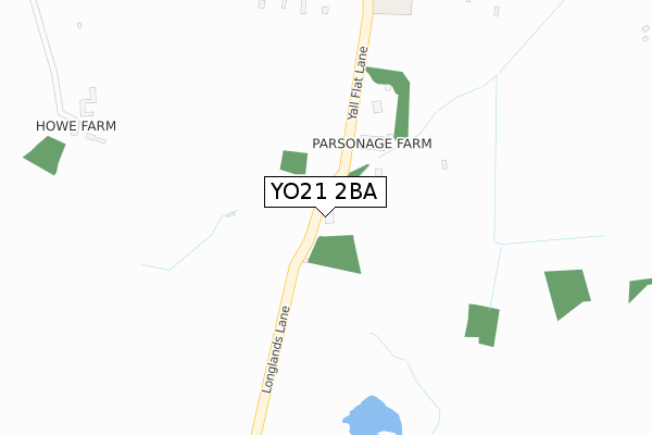
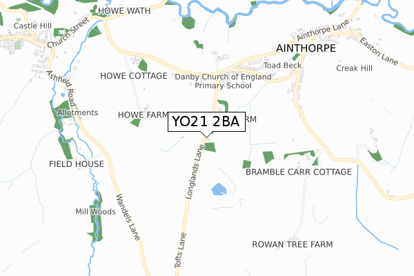
YO21 2BA maps


Licence: Open Government Licence (requires attribution)
Attribution: Contains OS data © Crown copyright and database right 2025
Source: Open Postcode Geo
Licence: Open Government Licence (requires attribution)
Attribution: Contains OS data © Crown copyright and database right 2025; Contains Royal Mail data © Royal Mail copyright and database right 2025; Source: Office for National Statistics licensed under the Open Government Licence v.3.0
YO21 2BA geodata
| Easting | 469881 |
| Northing | 507467 |
| Latitude | 54.457803 |
| Longitude | -0.923596 |
Where is YO21 2BA?
| Locality | Westerdale |
| Town/City | Whitby |
| Country | England |
| Postcode District | YO21 |
Politics
| Ward | Danby & Mulgrave |
|---|---|
| Constituency | Scarborough And Whitby |
Transport
Nearest bus stops to YO21 2BA
| Ainthorpe Lane | Ainthorpe | 677m |
| Ainthorpe Lane | Ainthorpe | 684m |
| Tea Rooms (Station Road) | Castleton | 1,210m |
| Downe Arms Ph (High Street) | Castleton | 1,232m |
| Post Office (High Street) | Castleton | 1,268m |
Nearest railway stations to YO21 2BA
| Danby Station | 1.2km |
| Castleton Moor Station | 1.8km |
| Commondale Station | 4.2km |
Deprivation
62.3% of English postcodes are less deprived than YO21 2BA:Food Standards Agency
Three nearest food hygiene ratings to YO21 2BA (metres)


➜ Get more ratings from the Food Standards Agency
Nearest post box to YO21 2BA
| Last Collection | |||
|---|---|---|---|
| Location | Mon-Fri | Sat | Distance |
| 34 Ainthorpe Lane Ainthorpe | 16:30 | 10:30 | 917m |
| Castleton Post Office | 16:15 | 09:30 | 1,274m |
| Danby Post Office | 16:40 | 09:45 | 1,523m |
YO21 2BA ITL and YO21 2BA LAU
The below table lists the International Territorial Level (ITL) codes (formerly Nomenclature of Territorial Units for Statistics (NUTS) codes) and Local Administrative Units (LAU) codes for YO21 2BA:
| ITL 1 Code | Name |
|---|---|
| TLE | Yorkshire and The Humber |
| ITL 2 Code | Name |
| TLE2 | North Yorkshire |
| ITL 3 Code | Name |
| TLE22 | North Yorkshire CC |
| LAU 1 Code | Name |
| E07000168 | Scarborough |
YO21 2BA census areas
The below table lists the Census Output Area (OA), Lower Layer Super Output Area (LSOA), and Middle Layer Super Output Area (MSOA) for YO21 2BA:
| Code | Name | |
|---|---|---|
| OA | E00141683 | |
| LSOA | E01027813 | Scarborough 002A |
| MSOA | E02005796 | Scarborough 002 |
Nearest postcodes to YO21 2BA
| YO21 2NQ | 134m | |
| YO21 2NG | Ainthorpe Lane | 356m |
| YO21 2JZ | Strait Lane | 456m |
| YO21 2JY | Strait Lane | 474m |
| YO21 2JX | Ainthorpe Lane | 524m |
| YO21 2JU | Valley View | 562m |
| YO21 2NF | The Howe | 626m |
| YO21 2LD | Brook Lane | 634m |
| YO21 2LA | Lilac Terrace | 666m |
| YO21 2LB | Brook Lane | 734m |