YO18 7BH maps, stats, and open data
YO18 7BH is located in the Thornton Dale & Wolds electoral ward, within the unitary authority of North Yorkshire and the English Parliamentary constituency of Thirsk and Malton. The Sub Integrated Care Board (ICB) Location is NHS Humber and North Yorkshire ICB - 03Q and the police force is North Yorkshire. This postcode has been in use since July 2018.
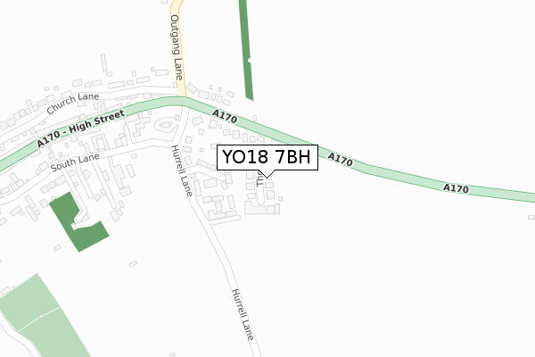
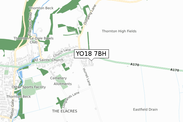
YO18 7BH maps


Licence: Open Government Licence (requires attribution)
Attribution: Contains OS data © Crown copyright and database right 2025
Source: Open Postcode Geo
Licence: Open Government Licence (requires attribution)
Attribution: Contains OS data © Crown copyright and database right 2025; Contains Royal Mail data © Royal Mail copyright and database right 2025; Source: Office for National Statistics licensed under the Open Government Licence v.3.0
YO18 7BH geodata
| Easting | 484441 |
| Northing | 483120 |
| Latitude | 54.236845 |
| Longitude | -0.705952 |
Where is YO18 7BH?
| Country | England |
| Postcode District | YO18 |
Politics
| Ward | Thornton Dale & Wolds |
|---|---|
| Constituency | Thirsk And Malton |
Transport
Nearest bus stops to YO18 7BH
| Hilltop (Hurrell Lane) | Thornton-le-dale | 118m |
| Hilltop (Hurrell Lane) | Thornton-le-dale | 140m |
| Nym Car Park (Malton Gate) | Thornton-le-dale | 903m |
| Thornton Cross (A170) | Thornton-le-dale | 1,010m |
| Thornton Cross (Chestnut Avenue) | Thornton-le-dale | 1,011m |
Broadband
Broadband access in YO18 7BH (2020 data)
| Percentage of properties with Next Generation Access | 100.0% |
| Percentage of properties with Superfast Broadband | 100.0% |
| Percentage of properties with Ultrafast Broadband | 100.0% |
| Percentage of properties with Full Fibre Broadband | 100.0% |
Superfast Broadband is between 30Mbps and 300Mbps
Ultrafast Broadband is > 300Mbps
Broadband limitations in YO18 7BH (2020 data)
| Percentage of properties unable to receive 2Mbps | 0.0% |
| Percentage of properties unable to receive 5Mbps | 0.0% |
| Percentage of properties unable to receive 10Mbps | 0.0% |
| Percentage of properties unable to receive 30Mbps | 0.0% |
Deprivation
22.7% of English postcodes are less deprived than YO18 7BH:Food Standards Agency
Three nearest food hygiene ratings to YO18 7BH (metres)


➜ Get more ratings from the Food Standards Agency
Nearest post box to YO18 7BH
| Last Collection | |||
|---|---|---|---|
| Location | Mon-Fri | Sat | Distance |
| Thornton Dale East End | 16:45 | 13:00 | 476m |
| Thornton Dale Post Office | 17:00 | 12:00 | 1,058m |
| Thornton Dale West End | 17:00 | 13:00 | 1,311m |
YO18 7BH ITL and YO18 7BH LAU
The below table lists the International Territorial Level (ITL) codes (formerly Nomenclature of Territorial Units for Statistics (NUTS) codes) and Local Administrative Units (LAU) codes for YO18 7BH:
| ITL 1 Code | Name |
|---|---|
| TLE | Yorkshire and The Humber |
| ITL 2 Code | Name |
| TLE2 | North Yorkshire |
| ITL 3 Code | Name |
| TLE22 | North Yorkshire CC |
| LAU 1 Code | Name |
| E07000167 | Ryedale |
YO18 7BH census areas
The below table lists the Census Output Area (OA), Lower Layer Super Output Area (LSOA), and Middle Layer Super Output Area (MSOA) for YO18 7BH:
| Code | Name | |
|---|---|---|
| OA | E00141619 | |
| LSOA | E01027801 | Ryedale 002E |
| MSOA | E02005789 | Ryedale 002 |
Nearest postcodes to YO18 7BH
| YO18 7QR | Hurrell Lane | 116m |
| YO18 7QP | Wilton Road | 141m |
| YO18 7QN | Wold View | 316m |
| YO18 7QU | South Lane | 367m |
| YO18 7QW | High Street | 411m |
| YO18 7QL | Church Lane | 437m |
| YO18 7QX | Peaslands Lane | 553m |
| YO18 7QG | Rectory Lane | 568m |
| YO18 7QH | Church Hill | 682m |
| YO18 7QJ | Dog Kennel Lane | 711m |