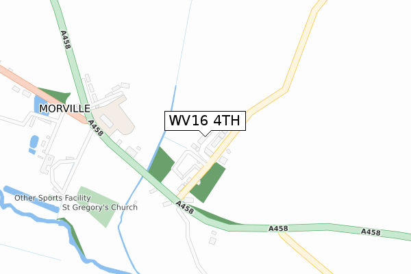
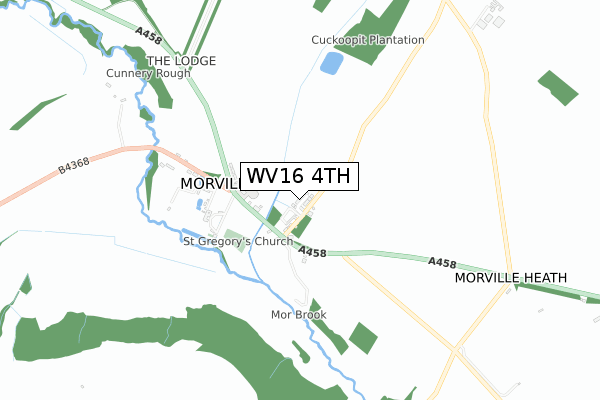
WV16 4TH is located in the Brown Clee electoral ward, within the unitary authority of Shropshire and the English Parliamentary constituency of Ludlow. The Sub Integrated Care Board (ICB) Location is NHS Shropshire, Telford and Wrekin ICB - M2L0M and the police force is West Mercia. This postcode has been in use since September 2018.


GetTheData
Source: OS Open Zoomstack (Ordnance Survey)
Licence: Open Government Licence (requires attribution)
Attribution: Contains OS data © Crown copyright and database right 2025
Source: Open Postcode Geo
Licence: Open Government Licence (requires attribution)
Attribution: Contains OS data © Crown copyright and database right 2025; Contains Royal Mail data © Royal Mail copyright and database right 2025; Source: Office for National Statistics licensed under the Open Government Licence v.3.0
| Easting | 367232 |
| Northing | 294063 |
| Latitude | 52.543442 |
| Longitude | -2.484605 |
GetTheData
Source: Open Postcode Geo
Licence: Open Government Licence
| Country | England |
| Postcode District | WV16 |
➜ See where WV16 is on a map ➜ Where is Morville? | |
GetTheData
Source: Land Registry Price Paid Data
Licence: Open Government Licence
| Ward | Brown Clee |
| Constituency | Ludlow |
GetTheData
Source: ONS Postcode Database
Licence: Open Government Licence
| Acton Arms (A458) | Morville | 190m |
| Acton Arms (A458) | Morville | 210m |
| School (A458) | Morville | 305m |
| School (A458) | Morville | 321m |
| Boars Head Farm (A458) | Morville | 1,347m |
GetTheData
Source: NaPTAN
Licence: Open Government Licence
| Percentage of properties with Next Generation Access | 100.0% |
| Percentage of properties with Superfast Broadband | 100.0% |
| Percentage of properties with Ultrafast Broadband | 0.0% |
| Percentage of properties with Full Fibre Broadband | 0.0% |
Superfast Broadband is between 30Mbps and 300Mbps
Ultrafast Broadband is > 300Mbps
| Median download speed | 47.5Mbps |
| Average download speed | 50.5Mbps |
| Maximum download speed | 75.28Mbps |
| Median upload speed | 10.0Mbps |
| Average upload speed | 11.6Mbps |
| Maximum upload speed | 19.53Mbps |
| Percentage of properties unable to receive 2Mbps | 0.0% |
| Percentage of properties unable to receive 5Mbps | 0.0% |
| Percentage of properties unable to receive 10Mbps | 0.0% |
| Percentage of properties unable to receive 30Mbps | 0.0% |
GetTheData
Source: Ofcom
Licence: Ofcom Terms of Use (requires attribution)
GetTheData
Source: ONS Postcode Database
Licence: Open Government Licence


➜ Get more ratings from the Food Standards Agency
GetTheData
Source: Food Standards Agency
Licence: FSA terms & conditions
| Last Collection | |||
|---|---|---|---|
| Location | Mon-Fri | Sat | Distance |
| Morville Wall Box | 17:15 | 10:00 | 284m |
| Morville Heath | 16:00 | 10:00 | 1,767m |
| Muckley Cross | 17:00 | 10:00 | 3,237m |
GetTheData
Source: Dracos
Licence: Creative Commons Attribution-ShareAlike
The below table lists the International Territorial Level (ITL) codes (formerly Nomenclature of Territorial Units for Statistics (NUTS) codes) and Local Administrative Units (LAU) codes for WV16 4TH:
| ITL 1 Code | Name |
|---|---|
| TLG | West Midlands (England) |
| ITL 2 Code | Name |
| TLG2 | Shropshire and Staffordshire |
| ITL 3 Code | Name |
| TLG22 | Shropshire |
| LAU 1 Code | Name |
| E06000051 | Shropshire |
GetTheData
Source: ONS Postcode Directory
Licence: Open Government Licence
The below table lists the Census Output Area (OA), Lower Layer Super Output Area (LSOA), and Middle Layer Super Output Area (MSOA) for WV16 4TH:
| Code | Name | |
|---|---|---|
| OA | E00146938 | |
| LSOA | E01028850 | Shropshire 029E |
| MSOA | E02006010 | Shropshire 029 |
GetTheData
Source: ONS Postcode Directory
Licence: Open Government Licence
| WV16 4RJ | 111m | |
| WV16 4RL | St Gregorys Close | 258m |
| WV16 5NB | 342m | |
| WV16 6TX | 989m | |
| WV16 5NR | 1127m | |
| WV16 5NA | Morville Heath | 1350m |
| WV16 4RQ | 1708m | |
| WV16 6XB | 1849m | |
| WV16 4RF | 1932m | |
| WV16 6TY | Underton | 2370m |
GetTheData
Source: Open Postcode Geo; Land Registry Price Paid Data
Licence: Open Government Licence