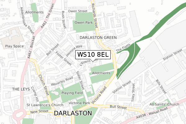
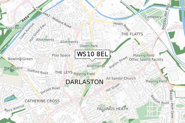
WS10 8EL maps, stats, and open data
WS10 8EL is located in the Bentley and Darlaston North electoral ward, within the metropolitan district of Walsall and the English Parliamentary constituency of Walsall South. The Sub Integrated Care Board (ICB) Location is NHS Black Country ICB - D2P2L and the police force is West Midlands. This postcode has been in use since July 2019.
WS10 8EL maps


Licence: Open Government Licence (requires attribution)
Attribution: Contains OS data © Crown copyright and database right 2025
Source: Open Postcode Geo
Licence: Open Government Licence (requires attribution)
Attribution: Contains OS data © Crown copyright and database right 2025; Contains Royal Mail data © Royal Mail copyright and database right 2025; Source: Office for National Statistics licensed under the Open Government Licence v.3.0
WS10 8EL geodata
| Easting | 397947 |
| Northing | 297058 |
| Latitude | 52.571356 |
| Longitude | -2.031718 |
Where is WS10 8EL?
| Country | England |
| Postcode District | WS10 |
Politics
| Ward | Bentley And Darlaston North |
|---|---|
| Constituency | Walsall South |
House Prices
Sales of detached houses in WS10 8EL
25, CITIZENS WAY, WEDNESBURY, WS10 8EL 2020 19 DEC £235,995 |
24, CITIZENS WAY, WEDNESBURY, WS10 8EL 2020 21 AUG £245,995 |
19, CITIZENS WAY, WEDNESBURY, WS10 8EL 2020 5 JUN £235,995 |
9, CITIZENS WAY, WEDNESBURY, WS10 8EL 2020 5 FEB £233,955 |
1, CITIZENS WAY, WEDNESBURY, WS10 8EL 2019 18 DEC £250,000 |
6, CITIZENS WAY, WEDNESBURY, WS10 8EL 2019 6 DEC £235,995 |
Licence: Contains HM Land Registry data © Crown copyright and database right 2025. This data is licensed under the Open Government Licence v3.0.
Transport
Nearest bus stops to WS10 8EL
| Why Not (The Green) | Rough Hay | 339m |
| St Josephs School (Blockall) | Rough Hay | 340m |
| Why Not (The Green) | Rough Hay | 344m |
| St Josephs School (Blockall) | Rough Hay | 351m |
| Gordon St (Walsall Rd) | Darlaston | 377m |
Nearest railway stations to WS10 8EL
| Bescot Stadium Station | 2.9km |
| Walsall Station | 3.5km |
| Tame Bridge Parkway Station | 4.3km |
Broadband
Broadband access in WS10 8EL (2020 data)
| Percentage of properties with Next Generation Access | 100.0% |
| Percentage of properties with Superfast Broadband | 100.0% |
| Percentage of properties with Ultrafast Broadband | 0.0% |
| Percentage of properties with Full Fibre Broadband | 0.0% |
Superfast Broadband is between 30Mbps and 300Mbps
Ultrafast Broadband is > 300Mbps
Broadband limitations in WS10 8EL (2020 data)
| Percentage of properties unable to receive 2Mbps | 0.0% |
| Percentage of properties unable to receive 5Mbps | 0.0% |
| Percentage of properties unable to receive 10Mbps | 0.0% |
| Percentage of properties unable to receive 30Mbps | 0.0% |
Deprivation
88.8% of English postcodes are less deprived than WS10 8EL:Food Standards Agency
Three nearest food hygiene ratings to WS10 8EL (metres)


➜ Get more ratings from the Food Standards Agency
Nearest post box to WS10 8EL
| Last Collection | |||
|---|---|---|---|
| Location | Mon-Fri | Sat | Distance |
| Wednesbury Post Office | 17:30 | 12:00 | 274m |
| Park Lane Post Office | 17:15 | 12:00 | 1,197m |
| Hough Road | 16:00 | 12:00 | 1,455m |
WS10 8EL ITL and WS10 8EL LAU
The below table lists the International Territorial Level (ITL) codes (formerly Nomenclature of Territorial Units for Statistics (NUTS) codes) and Local Administrative Units (LAU) codes for WS10 8EL:
| ITL 1 Code | Name |
|---|---|
| TLG | West Midlands (England) |
| ITL 2 Code | Name |
| TLG3 | West Midlands |
| ITL 3 Code | Name |
| TLG38 | Walsall |
| LAU 1 Code | Name |
| E08000030 | Walsall |
WS10 8EL census areas
The below table lists the Census Output Area (OA), Lower Layer Super Output Area (LSOA), and Middle Layer Super Output Area (MSOA) for WS10 8EL:
| Code | Name | |
|---|---|---|
| OA | E00051884 | |
| LSOA | E01010264 | Walsall 033C |
| MSOA | E02002142 | Walsall 033 |
Nearest postcodes to WS10 8EL
| WS10 8XY | Taryn Drive | 73m |
| WS10 8EE | Slater Street | 107m |
| WS10 8XU | Jasmine Way | 111m |
| WS10 8AJ | Richards Street | 135m |
| WS10 8AH | Victoria Road | 136m |
| WS10 8DW | Florian Grove | 139m |
| WS10 8AQ | Pensarn Villas | 154m |
| WS10 8AG | Bronwen Villas | 160m |
| WS10 8XX | Bryony Gardens | 179m |
| WS10 8AF | Victoria Road | 186m |