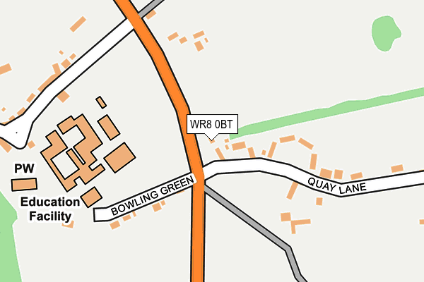
WR8 0BT is located in the Powick & the Hanleys electoral ward, within the local authority district of Malvern Hills and the English Parliamentary constituency of West Worcestershire. The Sub Integrated Care Board (ICB) Location is NHS Herefordshire and Worcestershire ICB - 18C and the police force is West Mercia. This postcode has been in use since March 2017.


GetTheData
Source: OS OpenMap – Local (Ordnance Survey)
Source: OS VectorMap District (Ordnance Survey)
Licence: Open Government Licence (requires attribution)
| Easting | 384149 |
| Northing | 242005 |
| Latitude | 52.076187 |
| Longitude | -2.232687 |
GetTheData
Source: Open Postcode Geo
Licence: Open Government Licence
| Country | England |
| Postcode District | WR8 |
➜ See where WR8 is on a map ➜ Where is Hanley Castle? | |
GetTheData
Source: Land Registry Price Paid Data
Licence: Open Government Licence
| Ward | Powick & The Hanleys |
| Constituency | West Worcestershire |
GetTheData
Source: ONS Postcode Database
Licence: Open Government Licence
| Hanley Castle High School (Hanley Castle High School Bus Bays) | Hanley Castle | 192m |
| Hanley Castle (B4211) | Hanley Castle | 468m |
| Hanley Castle (B4211) | Hanley Castle | 527m |
| Panes Garage (Church Street) | Upton Upon Severn | 1,571m |
| Panes Garage (Church Street) | Upton Upon Severn | 1,576m |
GetTheData
Source: NaPTAN
Licence: Open Government Licence
| Percentage of properties with Next Generation Access | 100.0% |
| Percentage of properties with Superfast Broadband | 0.0% |
| Percentage of properties with Ultrafast Broadband | 0.0% |
| Percentage of properties with Full Fibre Broadband | 0.0% |
Superfast Broadband is between 30Mbps and 300Mbps
Ultrafast Broadband is > 300Mbps
| Percentage of properties unable to receive 2Mbps | 0.0% |
| Percentage of properties unable to receive 5Mbps | 0.0% |
| Percentage of properties unable to receive 10Mbps | 0.0% |
| Percentage of properties unable to receive 30Mbps | 100.0% |
GetTheData
Source: Ofcom
Licence: Ofcom Terms of Use (requires attribution)
GetTheData
Source: ONS Postcode Database
Licence: Open Government Licence

➜ Get more ratings from the Food Standards Agency
GetTheData
Source: Food Standards Agency
Licence: FSA terms & conditions
| Last Collection | |||
|---|---|---|---|
| Location | Mon-Fri | Sat | Distance |
| Church End | 17:15 | 07:15 | 246m |
| Hanley Castle P.o. | 17:15 | 10:15 | 547m |
| Hanley Road | 1,489m | ||
GetTheData
Source: Dracos
Licence: Creative Commons Attribution-ShareAlike
The below table lists the International Territorial Level (ITL) codes (formerly Nomenclature of Territorial Units for Statistics (NUTS) codes) and Local Administrative Units (LAU) codes for WR8 0BT:
| ITL 1 Code | Name |
|---|---|
| TLG | West Midlands (England) |
| ITL 2 Code | Name |
| TLG1 | Herefordshire, Worcestershire and Warwickshire |
| ITL 3 Code | Name |
| TLG12 | Worcestershire CC |
| LAU 1 Code | Name |
| E07000235 | Malvern Hills |
GetTheData
Source: ONS Postcode Directory
Licence: Open Government Licence
The below table lists the Census Output Area (OA), Lower Layer Super Output Area (LSOA), and Middle Layer Super Output Area (MSOA) for WR8 0BT:
| Code | Name | |
|---|---|---|
| OA | E00164331 | |
| LSOA | E01032217 | Malvern Hills 005D |
| MSOA | E02006714 | Malvern Hills 005 |
GetTheData
Source: ONS Postcode Directory
Licence: Open Government Licence
| WR8 0BS | Quay Lane | 148m |
| WR8 0BP | Bowling Green | 164m |
| WR8 0BL | Church End | 266m |
| WR8 0BJ | 574m | |
| WR8 0BX | Gilberts End Lane | 617m |
| WR8 0BD | Brotheridge Green | 756m |
| WR8 0BW | 760m | |
| WR8 0BU | 863m | |
| WR8 0BG | Mill Lane | 1076m |
| WR8 0PA | Hanley Road | 1078m |
GetTheData
Source: Open Postcode Geo; Land Registry Price Paid Data
Licence: Open Government Licence