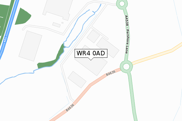
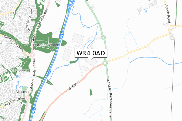
WR4 0AD is located in the Bowbrook electoral ward, within the local authority district of Wychavon and the English Parliamentary constituency of Mid Worcestershire. The Sub Integrated Care Board (ICB) Location is NHS Herefordshire and Worcestershire ICB - 18C and the police force is West Mercia. This postcode has been in use since January 2018.


GetTheData
Source: OS Open Zoomstack (Ordnance Survey)
Licence: Open Government Licence (requires attribution)
Attribution: Contains OS data © Crown copyright and database right 2025
Source: Open Postcode Geo
Licence: Open Government Licence (requires attribution)
Attribution: Contains OS data © Crown copyright and database right 2025; Contains Royal Mail data © Royal Mail copyright and database right 2025; Source: Office for National Statistics licensed under the Open Government Licence v.3.0
| Easting | 389471 |
| Northing | 256049 |
| Latitude | 52.202579 |
| Longitude | -2.155476 |
GetTheData
Source: Open Postcode Geo
Licence: Open Government Licence
| Country | England |
| Postcode District | WR4 |
➜ See where WR4 is on a map | |
GetTheData
Source: Land Registry Price Paid Data
Licence: Open Government Licence
| Ward | Bowbrook |
| Constituency | Mid Worcestershire |
GetTheData
Source: ONS Postcode Database
Licence: Open Government Licence
| Barass Avenue (Plantation Drive) | Trotshill | 977m |
| Barass Avenue (Plantation Drive) | Trotshill | 987m |
| Old Turnpike Road (Plough Road) | Tibberton | 1,171m |
| Old Turnpike Road (Plough Road) | Tibberton | 1,182m |
| Three Pears (Wainwright Road) | Warndon Villages | 1,187m |
| Worcester Shrub Hill Station | 3.8km |
| Worcester Foregate Street Station | 4.6km |
GetTheData
Source: NaPTAN
Licence: Open Government Licence
GetTheData
Source: ONS Postcode Database
Licence: Open Government Licence


➜ Get more ratings from the Food Standards Agency
GetTheData
Source: Food Standards Agency
Licence: FSA terms & conditions
| Last Collection | |||
|---|---|---|---|
| Location | Mon-Fri | Sat | Distance |
| Tibberton Vicarage | 16:30 | 09:30 | 1,387m |
| Millwood Drive | 17:15 | 11:30 | 1,444m |
| Dugdale Drive | 17:00 | 11:30 | 1,446m |
GetTheData
Source: Dracos
Licence: Creative Commons Attribution-ShareAlike
The below table lists the International Territorial Level (ITL) codes (formerly Nomenclature of Territorial Units for Statistics (NUTS) codes) and Local Administrative Units (LAU) codes for WR4 0AD:
| ITL 1 Code | Name |
|---|---|
| TLG | West Midlands (England) |
| ITL 2 Code | Name |
| TLG1 | Herefordshire, Worcestershire and Warwickshire |
| ITL 3 Code | Name |
| TLG12 | Worcestershire CC |
| LAU 1 Code | Name |
| E07000238 | Wychavon |
GetTheData
Source: ONS Postcode Directory
Licence: Open Government Licence
The below table lists the Census Output Area (OA), Lower Layer Super Output Area (LSOA), and Middle Layer Super Output Area (MSOA) for WR4 0AD:
| Code | Name | |
|---|---|---|
| OA | E00164980 | |
| LSOA | E01032346 | Wychavon 007B |
| MSOA | E02006754 | Wychavon 007 |
GetTheData
Source: ONS Postcode Directory
Licence: Open Government Licence
| WR4 0QB | Woolmead Row | 943m |
| WR4 0RE | Fotheringhay | 948m |
| WR4 0SU | Auckland Close | 949m |
| WR4 0AT | Trotshill Lane East | 953m |
| WR4 0ST | Bolton Avenue | 972m |
| WR4 0RD | Grosmont Avenue | 1001m |
| WR4 0SP | Pembroke Place | 1003m |
| WR4 0RY | Haggs Meadow | 1013m |
| WR4 0QD | Barass Avenue | 1014m |
| WR4 0SN | Rockingham Lane | 1014m |
GetTheData
Source: Open Postcode Geo; Land Registry Price Paid Data
Licence: Open Government Licence