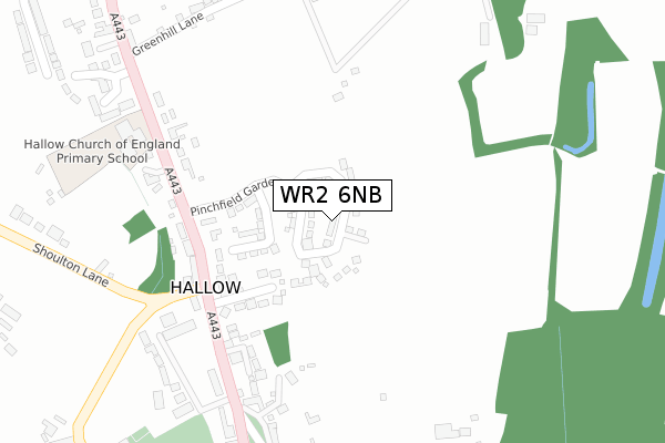
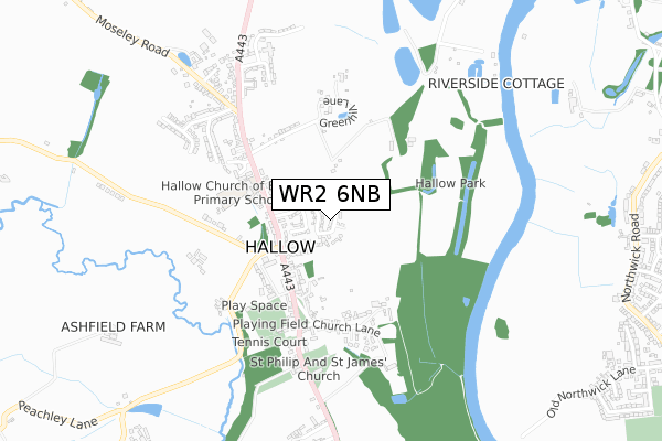
WR2 6NB is located in the Hallow & Holt electoral ward, within the local authority district of Malvern Hills and the English Parliamentary constituency of West Worcestershire. The Sub Integrated Care Board (ICB) Location is NHS Herefordshire and Worcestershire ICB - 18C and the police force is West Mercia. This postcode has been in use since November 2018.


GetTheData
Source: OS Open Zoomstack (Ordnance Survey)
Licence: Open Government Licence (requires attribution)
Attribution: Contains OS data © Crown copyright and database right 2025
Source: Open Postcode Geo
Licence: Open Government Licence (requires attribution)
Attribution: Contains OS data © Crown copyright and database right 2025; Contains Royal Mail data © Royal Mail copyright and database right 2025; Source: Office for National Statistics licensed under the Open Government Licence v.3.0
| Easting | 382900 |
| Northing | 258497 |
| Latitude | 52.224422 |
| Longitude | -2.251749 |
GetTheData
Source: Open Postcode Geo
Licence: Open Government Licence
| Country | England |
| Postcode District | WR2 |
➜ See where WR2 is on a map | |
GetTheData
Source: Land Registry Price Paid Data
Licence: Open Government Licence
| Ward | Hallow & Holt |
| Constituency | West Worcestershire |
GetTheData
Source: ONS Postcode Database
Licence: Open Government Licence
| Archbell Cottages (Worcester Road) | Hallow | 216m |
| Crown Inn | Hallow | 279m |
| Crown Inn (Hallow Road) | Hallow | 289m |
| Hallow C Of E Primary School (A443) | Hallow | 294m |
| Hallow C Of E Primary School (A443) | Hallow | 315m |
| Worcester Foregate Street Station | 3.9km |
| Worcester Shrub Hill Station | 4.4km |
GetTheData
Source: NaPTAN
Licence: Open Government Licence
| Percentage of properties with Next Generation Access | 100.0% |
| Percentage of properties with Superfast Broadband | 100.0% |
| Percentage of properties with Ultrafast Broadband | 100.0% |
| Percentage of properties with Full Fibre Broadband | 100.0% |
Superfast Broadband is between 30Mbps and 300Mbps
Ultrafast Broadband is > 300Mbps
| Percentage of properties unable to receive 2Mbps | 0.0% |
| Percentage of properties unable to receive 5Mbps | 0.0% |
| Percentage of properties unable to receive 10Mbps | 0.0% |
| Percentage of properties unable to receive 30Mbps | 0.0% |
GetTheData
Source: Ofcom
Licence: Ofcom Terms of Use (requires attribution)
GetTheData
Source: ONS Postcode Database
Licence: Open Government Licence


➜ Get more ratings from the Food Standards Agency
GetTheData
Source: Food Standards Agency
Licence: FSA terms & conditions
| Last Collection | |||
|---|---|---|---|
| Location | Mon-Fri | Sat | Distance |
| Hallow Green | 17:00 | 10:00 | 232m |
| Hallow P.o. | 17:15 | 10:00 | 561m |
| Common Hill | 16:45 | 11:30 | 1,149m |
GetTheData
Source: Dracos
Licence: Creative Commons Attribution-ShareAlike
The below table lists the International Territorial Level (ITL) codes (formerly Nomenclature of Territorial Units for Statistics (NUTS) codes) and Local Administrative Units (LAU) codes for WR2 6NB:
| ITL 1 Code | Name |
|---|---|
| TLG | West Midlands (England) |
| ITL 2 Code | Name |
| TLG1 | Herefordshire, Worcestershire and Warwickshire |
| ITL 3 Code | Name |
| TLG12 | Worcestershire CC |
| LAU 1 Code | Name |
| E07000235 | Malvern Hills |
GetTheData
Source: ONS Postcode Directory
Licence: Open Government Licence
The below table lists the Census Output Area (OA), Lower Layer Super Output Area (LSOA), and Middle Layer Super Output Area (MSOA) for WR2 6NB:
| Code | Name | |
|---|---|---|
| OA | E00164190 | |
| LSOA | E01032190 | Malvern Hills 002B |
| MSOA | E02006711 | Malvern Hills 002 |
GetTheData
Source: ONS Postcode Directory
Licence: Open Government Licence
| WR2 6LA | Orchard Close | 162m |
| WR2 6LB | Main Road | 240m |
| WR2 6LD | Main Road | 241m |
| WR2 6PE | The Green | 338m |
| WR2 6PP | Main Road | 347m |
| WR2 6LE | Brownes Way | 370m |
| WR2 6PF | Church Lane | 377m |
| WR2 6LG | Greenhill Lane | 386m |
| WR2 6LH | Greenhill Cottages | 405m |
| WR2 6LF | Ladygo Lane | 425m |
GetTheData
Source: Open Postcode Geo; Land Registry Price Paid Data
Licence: Open Government Licence