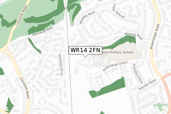
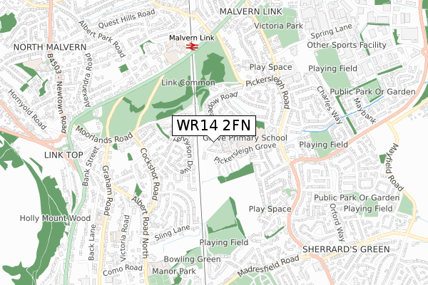
WR14 2FN is located in the Great Malvern electoral ward, within the local authority district of Malvern Hills and the English Parliamentary constituency of West Worcestershire. The Sub Integrated Care Board (ICB) Location is NHS Herefordshire and Worcestershire ICB - 18C and the police force is West Mercia. This postcode has been in use since December 2019.


GetTheData
Source: OS Open Zoomstack (Ordnance Survey)
Licence: Open Government Licence (requires attribution)
Attribution: Contains OS data © Crown copyright and database right 2025
Source: Open Postcode Geo
Licence: Open Government Licence (requires attribution)
Attribution: Contains OS data © Crown copyright and database right 2025; Contains Royal Mail data © Royal Mail copyright and database right 2025; Source: Office for National Statistics licensed under the Open Government Licence v.3.0
| Easting | 378355 |
| Northing | 246913 |
| Latitude | 52.120115 |
| Longitude | -2.317541 |
GetTheData
Source: Open Postcode Geo
Licence: Open Government Licence
| Country | England |
| Postcode District | WR14 |
➜ See where WR14 is on a map ➜ Where is Great Malvern? | |
GetTheData
Source: Land Registry Price Paid Data
Licence: Open Government Licence
| Ward | Great Malvern |
| Constituency | West Worcestershire |
GetTheData
Source: ONS Postcode Database
Licence: Open Government Licence
| North End Lane (Pickersleigh Road) | Malvern Link | 474m |
| North End Lane (Pickersleigh Road) | Malvern Link | 492m |
| Community Hospital (Worcester Road) | Malvern Link | 500m |
| Malvern Community Hospital (Worcester Road) | Malvern Link | 511m |
| Morgan Works (Pickersleigh Road) | Malvern Link | 513m |
| Malvern Link Station | 0.6km |
| Great Malvern Station | 1.2km |
| Colwall Station | 5.2km |
GetTheData
Source: NaPTAN
Licence: Open Government Licence
GetTheData
Source: ONS Postcode Database
Licence: Open Government Licence


➜ Get more ratings from the Food Standards Agency
GetTheData
Source: Food Standards Agency
Licence: FSA terms & conditions
| Last Collection | |||
|---|---|---|---|
| Location | Mon-Fri | Sat | Distance |
| Meadow Road | 17:15 | 11:30 | 104m |
| Tennyson Drive | 17:30 | 11:30 | 170m |
| Link Common | 17:45 | 11:30 | 512m |
GetTheData
Source: Dracos
Licence: Creative Commons Attribution-ShareAlike
The below table lists the International Territorial Level (ITL) codes (formerly Nomenclature of Territorial Units for Statistics (NUTS) codes) and Local Administrative Units (LAU) codes for WR14 2FN:
| ITL 1 Code | Name |
|---|---|
| TLG | West Midlands (England) |
| ITL 2 Code | Name |
| TLG1 | Herefordshire, Worcestershire and Warwickshire |
| ITL 3 Code | Name |
| TLG12 | Worcestershire CC |
| LAU 1 Code | Name |
| E07000235 | Malvern Hills |
GetTheData
Source: ONS Postcode Directory
Licence: Open Government Licence
The below table lists the Census Output Area (OA), Lower Layer Super Output Area (LSOA), and Middle Layer Super Output Area (MSOA) for WR14 2FN:
| Code | Name | |
|---|---|---|
| OA | E00164265 | |
| LSOA | E01032201 | Malvern Hills 007A |
| MSOA | E02006716 | Malvern Hills 007 |
GetTheData
Source: ONS Postcode Directory
Licence: Open Government Licence
| WR14 2RZ | Meadow Road | 96m |
| WR14 2LU | Pickersleigh Grove | 116m |
| WR14 2UB | Moorlands Road | 127m |
| WR14 2UL | Tennyson Drive | 134m |
| WR14 2SD | Meadow Road | 138m |
| WR14 2LX | Pickersleigh Grove | 155m |
| WR14 2UN | Macaulay Rise | 183m |
| WR14 2SE | Willow Grove | 201m |
| WR14 2UJ | Barrett Rise | 202m |
| WR14 2TQ | Tennyson Drive | 204m |
GetTheData
Source: Open Postcode Geo; Land Registry Price Paid Data
Licence: Open Government Licence