Property/Postcode Data Search:
WR14 1YL maps, stats, and open data
WR14 1YL is located in the Link electoral ward, within the local authority district of Malvern Hills and the English Parliamentary constituency of West Worcestershire. The Sub Integrated Care Board (ICB) Location is NHS Herefordshire and Worcestershire ICB - 18C and the police force is West Mercia. This postcode has been in use since April 2020.
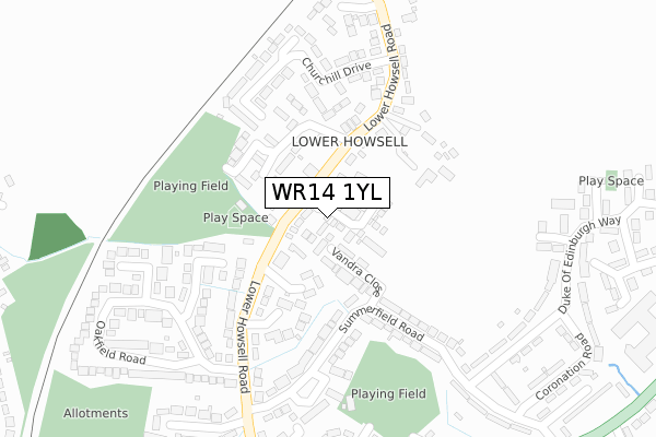
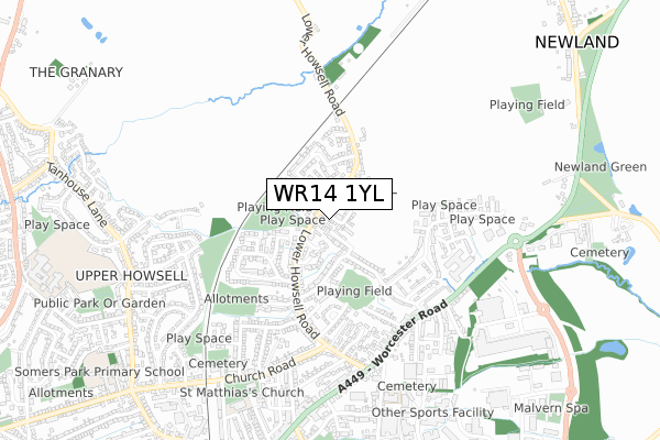
WR14 1YL maps


Source: OS Open Zoomstack (Ordnance Survey)
Licence: Open Government Licence (requires attribution)
Attribution: Contains OS data © Crown copyright and database right 2025
Source: Open Postcode Geo
Licence: Open Government Licence (requires attribution)
Attribution: Contains OS data © Crown copyright and database right 2025; Contains Royal Mail data © Royal Mail copyright and database right 2025; Source: Office for National Statistics licensed under the Open Government Licence v.3.0
Licence: Open Government Licence (requires attribution)
Attribution: Contains OS data © Crown copyright and database right 2025
Source: Open Postcode Geo
Licence: Open Government Licence (requires attribution)
Attribution: Contains OS data © Crown copyright and database right 2025; Contains Royal Mail data © Royal Mail copyright and database right 2025; Source: Office for National Statistics licensed under the Open Government Licence v.3.0
WR14 1YL geodata
| Easting | 378749 |
| Northing | 248479 |
| Latitude | 52.134210 |
| Longitude | -2.311886 |
Where is WR14 1YL?
| Country | England |
| Postcode District | WR14 |
Politics
| Ward | Link |
|---|---|
| Constituency | West Worcestershire |
House Prices
Sales of detached houses in WR14 1YL
2023 11 APR £410,000 |
2022 27 JUN £332,500 |
54, WHEELBARROW WAY, MALVERN, WR14 1YL 2022 20 APR £330,000 |
52, WHEELBARROW WAY, MALVERN, WR14 1YL 2022 31 MAR £455,000 |
60, WHEELBARROW WAY, MALVERN, WR14 1YL 2022 10 MAR £460,000 |
2022 3 MAR £403,000 |
48, WHEELBARROW WAY, MALVERN, WR14 1YL 2022 28 FEB £340,000 |
50, WHEELBARROW WAY, MALVERN, WR14 1YL 2022 25 FEB £455,000 |
46, WHEELBARROW WAY, MALVERN, WR14 1YL 2022 25 FEB £340,000 |
2, WHEELBARROW WAY, MALVERN, WR14 1YL 2022 21 JAN £465,000 |
Source: HM Land Registry Price Paid Data
Licence: Contains HM Land Registry data © Crown copyright and database right 2025. This data is licensed under the Open Government Licence v3.0.
Licence: Contains HM Land Registry data © Crown copyright and database right 2025. This data is licensed under the Open Government Licence v3.0.
Transport
Nearest bus stops to WR14 1YL
| Churchill Drive (Lower Howsell Road) | Lower Howsell | 317m |
| Handbury Road (Lower Howsell Road) | Malvern Link | 391m |
| Handbury Road (Lower Howsell Rd) | Malvern Link | 391m |
| The Oak Inn (Worcester Road) | Malvern Link | 394m |
| Lower Howsell Road (Worcester Road) | Malvern Link | 455m |
Nearest railway stations to WR14 1YL
| Malvern Link Station | 1.1km |
| Great Malvern Station | 2.8km |
Deprivation
78% of English postcodes are less deprived than WR14 1YL:Food Standards Agency
Three nearest food hygiene ratings to WR14 1YL (metres)
The New Inn
105 Lower Howsell Road
154m
Dalvington And The Oaks

146 Lower Howsell Road
183m
Malvern Cricket Club
Regency Road
338m
➜ Get more ratings from the Food Standards Agency
Nearest post box to WR14 1YL
| Last Collection | |||
|---|---|---|---|
| Location | Mon-Fri | Sat | Distance |
| Lower Howsell | 17:15 | 11:00 | 152m |
| Hanbury Road | 17:15 | 11:00 | 387m |
| Newland Road | 17:15 | 11:00 | 395m |
WR14 1YL ITL and WR14 1YL LAU
The below table lists the International Territorial Level (ITL) codes (formerly Nomenclature of Territorial Units for Statistics (NUTS) codes) and Local Administrative Units (LAU) codes for WR14 1YL:
| ITL 1 Code | Name |
|---|---|
| TLG | West Midlands (England) |
| ITL 2 Code | Name |
| TLG1 | Herefordshire, Worcestershire and Warwickshire |
| ITL 3 Code | Name |
| TLG12 | Worcestershire CC |
| LAU 1 Code | Name |
| E07000235 | Malvern Hills |
WR14 1YL census areas
The below table lists the Census Output Area (OA), Lower Layer Super Output Area (LSOA), and Middle Layer Super Output Area (MSOA) for WR14 1YL:
| Code | Name | |
|---|---|---|
| OA | E00164216 | |
| LSOA | E01032194 | Malvern Hills 004A |
| MSOA | E02006713 | Malvern Hills 004 |
Nearest postcodes to WR14 1YL
| WR14 1EJ | Vandra Close | 76m |
| WR14 1BZ | Beech Close | 104m |
| WR14 1DZ | Summerfield Road | 141m |
| WR14 1DN | Lower Howsell Road | 153m |
| WR14 1DW | Brookfield | 170m |
| WR14 1DL | Lower Howsell Road | 171m |
| WR14 1DY | Summerfield Road | 179m |
| WR14 1FB | Crispin Drive | 189m |
| WR14 1EA | Summerfield Road | 194m |
| WR14 1EW | Seymour Court | 235m |