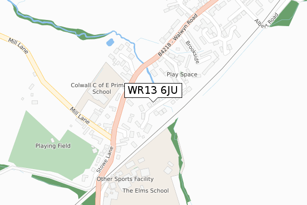
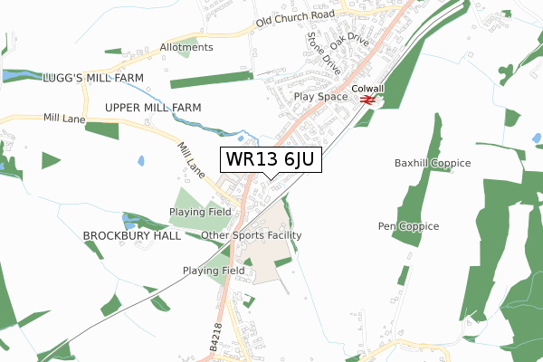
WR13 6JU is located in the Hope End electoral ward, within the unitary authority of Herefordshire, County of and the English Parliamentary constituency of North Herefordshire. The Sub Integrated Care Board (ICB) Location is NHS Herefordshire and Worcestershire ICB - 18C and the police force is West Mercia. This postcode has been in use since June 2018.


GetTheData
Source: OS Open Zoomstack (Ordnance Survey)
Licence: Open Government Licence (requires attribution)
Attribution: Contains OS data © Crown copyright and database right 2025
Source: Open Postcode Geo
Licence: Open Government Licence (requires attribution)
Attribution: Contains OS data © Crown copyright and database right 2025; Contains Royal Mail data © Royal Mail copyright and database right 2025; Source: Office for National Statistics licensed under the Open Government Licence v.3.0
| Easting | 375206 |
| Northing | 242076 |
| Latitude | 52.076495 |
| Longitude | -2.363179 |
GetTheData
Source: Open Postcode Geo
Licence: Open Government Licence
| Country | England |
| Postcode District | WR13 |
➜ See where WR13 is on a map ➜ Where is Colwall Stone? | |
GetTheData
Source: Land Registry Price Paid Data
Licence: Open Government Licence
| Ward | Hope End |
| Constituency | North Herefordshire |
GetTheData
Source: ONS Postcode Database
Licence: Open Government Licence
3, EVENDINE MEWS, COLWALL, MALVERN, WR13 6JU 2022 26 SEP £750,000 |
3, EVENDINE MEWS, COLWALL, MALVERN, WR13 6JU 2018 23 NOV £589,995 |
1, EVENDINE MEWS, COLWALL, MALVERN, WR13 6JU 2018 8 NOV £609,995 |
5, EVENDINE MEWS, COLWALL, MALVERN, WR13 6JU 2018 24 OCT £603,495 |
6, EVENDINE MEWS, COLWALL, MALVERN, WR13 6JU 2018 28 SEP £589,500 |
2, EVENDINE MEWS, COLWALL, MALVERN, WR13 6JU 2018 15 JUN £592,495 |
4, EVENDINE MEWS, COLWALL, MALVERN, WR13 6JU 2018 30 MAY £535,000 |
GetTheData
Source: HM Land Registry Price Paid Data
Licence: Contains HM Land Registry data © Crown copyright and database right 2025. This data is licensed under the Open Government Licence v3.0.
| Brookmill Close (Walwyn Road (B4218)) | Colwall Stone | 130m |
| Brookmill Close (Walwyn Road (B4218)) | Colwall Stone | 145m |
| Mill Lane (Walwyn Road) | Colwall Stone | 164m |
| Mill Lane (Walwyn Road) | Colwall Stone | 166m |
| Chevenham Close (Walwyn Road) | Colwall Stone | 297m |
| Colwall Station | 0.6km |
| Great Malvern Station | 4.8km |
| Ledbury Station | 5.5km |
GetTheData
Source: NaPTAN
Licence: Open Government Licence
| Percentage of properties with Next Generation Access | 100.0% |
| Percentage of properties with Superfast Broadband | 100.0% |
| Percentage of properties with Ultrafast Broadband | 0.0% |
| Percentage of properties with Full Fibre Broadband | 0.0% |
Superfast Broadband is between 30Mbps and 300Mbps
Ultrafast Broadband is > 300Mbps
| Median download speed | 80.0Mbps |
| Average download speed | 79.4Mbps |
| Maximum download speed | 80.00Mbps |
| Median upload speed | 15.6Mbps |
| Average upload speed | 15.5Mbps |
| Maximum upload speed | 20.00Mbps |
| Percentage of properties unable to receive 2Mbps | 0.0% |
| Percentage of properties unable to receive 5Mbps | 0.0% |
| Percentage of properties unable to receive 10Mbps | 0.0% |
| Percentage of properties unable to receive 30Mbps | 0.0% |
GetTheData
Source: Ofcom
Licence: Ofcom Terms of Use (requires attribution)
GetTheData
Source: ONS Postcode Database
Licence: Open Government Licence


➜ Get more ratings from the Food Standards Agency
GetTheData
Source: Food Standards Agency
Licence: FSA terms & conditions
| Last Collection | |||
|---|---|---|---|
| Location | Mon-Fri | Sat | Distance |
| Railway Bridge | 16:15 | 10:00 | 202m |
| Colwall P.o. | 16:45 | 11:00 | 563m |
| Gas Works | 16:45 | 07:45 | 786m |
GetTheData
Source: Dracos
Licence: Creative Commons Attribution-ShareAlike
The below table lists the International Territorial Level (ITL) codes (formerly Nomenclature of Territorial Units for Statistics (NUTS) codes) and Local Administrative Units (LAU) codes for WR13 6JU:
| ITL 1 Code | Name |
|---|---|
| TLG | West Midlands (England) |
| ITL 2 Code | Name |
| TLG1 | Herefordshire, Worcestershire and Warwickshire |
| ITL 3 Code | Name |
| TLG11 | Herefordshire, County of |
| LAU 1 Code | Name |
| E06000019 | Herefordshire, County of |
GetTheData
Source: ONS Postcode Directory
Licence: Open Government Licence
The below table lists the Census Output Area (OA), Lower Layer Super Output Area (LSOA), and Middle Layer Super Output Area (MSOA) for WR13 6JU:
| Code | Name | |
|---|---|---|
| OA | E00070824 | |
| LSOA | E01014029 | Herefordshire 009C |
| MSOA | E02002913 | Herefordshire 009 |
GetTheData
Source: ONS Postcode Directory
Licence: Open Government Licence
| WR13 6HY | Brookmill Close | 100m |
| WR13 6EG | Walwyn Road | 122m |
| WR13 6QX | Walwyn Road | 129m |
| WR13 6QU | Brookside | 218m |
| WR13 6EQ | Mill Lane | 238m |
| WR13 6RJ | Taylour Close | 267m |
| WR13 6RG | Chevenham Close | 302m |
| WR13 6EH | Stowe Lane | 327m |
| WR13 6QT | Walwyn Road | 363m |
| WR13 6QW | Crescent Road | 393m |
GetTheData
Source: Open Postcode Geo; Land Registry Price Paid Data
Licence: Open Government Licence