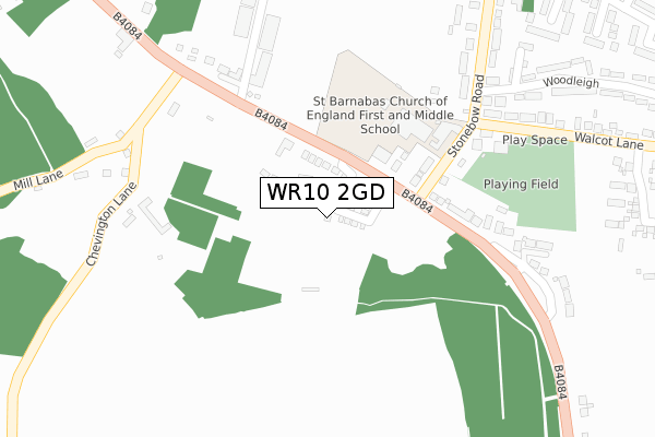
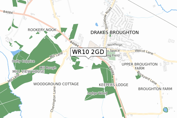
WR10 2GD is located in the Drakes Broughton, Norton & Whittington electoral ward, within the local authority district of Wychavon and the English Parliamentary constituency of Mid Worcestershire. The Sub Integrated Care Board (ICB) Location is NHS Herefordshire and Worcestershire ICB - 18C and the police force is West Mercia. This postcode has been in use since December 2019.


GetTheData
Source: OS Open Zoomstack (Ordnance Survey)
Licence: Open Government Licence (requires attribution)
Attribution: Contains OS data © Crown copyright and database right 2025
Source: Open Postcode Geo
Licence: Open Government Licence (requires attribution)
Attribution: Contains OS data © Crown copyright and database right 2025; Contains Royal Mail data © Royal Mail copyright and database right 2025; Source: Office for National Statistics licensed under the Open Government Licence v.3.0
| Easting | 392447 |
| Northing | 248317 |
| Latitude | 52.133114 |
| Longitude | -2.111754 |
GetTheData
Source: Open Postcode Geo
Licence: Open Government Licence
| Country | England |
| Postcode District | WR10 |
➜ See where WR10 is on a map ➜ Where is Drakes Broughton? | |
GetTheData
Source: Land Registry Price Paid Data
Licence: Open Government Licence
| Ward | Drakes Broughton, Norton & Whittington |
| Constituency | Mid Worcestershire |
GetTheData
Source: ONS Postcode Database
Licence: Open Government Licence
2023 6 APR £408,500 |
10, THORN DRIVE, DRAKES BROUGHTON, PERSHORE, WR10 2GD 2022 30 JUN £649,995 |
5, THORN DRIVE, DRAKES BROUGHTON, PERSHORE, WR10 2GD 2021 30 JUN £529,995 |
14, THORN DRIVE, DRAKES BROUGHTON, PERSHORE, WR10 2GD 2021 25 JUN £599,995 |
12, THORN DRIVE, DRAKES BROUGHTON, PERSHORE, WR10 2GD 2021 24 JUN £529,995 |
7, THORN DRIVE, DRAKES BROUGHTON, PERSHORE, WR10 2GD 2021 18 JUN £599,995 |
3, THORN DRIVE, DRAKES BROUGHTON, PERSHORE, WR10 2GD 2021 24 MAR £289,995 |
2020 30 NOV £329,995 |
6, THORN DRIVE, DRAKES BROUGHTON, PERSHORE, WR10 2GD 2020 2 OCT £329,995 |
4, THORN DRIVE, DRAKES BROUGHTON, PERSHORE, WR10 2GD 2020 31 JAN £329,995 |
➜ Drakes Broughton house prices
GetTheData
Source: HM Land Registry Price Paid Data
Licence: Contains HM Land Registry data © Crown copyright and database right 2025. This data is licensed under the Open Government Licence v3.0.
| Motorcycle Shop (Worcester Road) | Drakes Broughton | 139m |
| St. Barnabas First & Middle School (Stonebow Road) | Drakes Broughton | 243m |
| Main Road (B4084) | Drakes Broughton | 254m |
| Church (Walcot Lane) | Drakes Broughton | 311m |
| Walcot Lane | Drakes Broughton | 314m |
| Pershore Station | 2.8km |
GetTheData
Source: NaPTAN
Licence: Open Government Licence
GetTheData
Source: ONS Postcode Database
Licence: Open Government Licence


➜ Get more ratings from the Food Standards Agency
GetTheData
Source: Food Standards Agency
Licence: FSA terms & conditions
| Last Collection | |||
|---|---|---|---|
| Location | Mon-Fri | Sat | Distance |
| Plough & Harrow | 17:00 | 09:00 | 348m |
| Stonebow Road | 17:00 | 09:15 | 360m |
| Drakes Broughton P.o. | 17:00 | 09:15 | 568m |
GetTheData
Source: Dracos
Licence: Creative Commons Attribution-ShareAlike
The below table lists the International Territorial Level (ITL) codes (formerly Nomenclature of Territorial Units for Statistics (NUTS) codes) and Local Administrative Units (LAU) codes for WR10 2GD:
| ITL 1 Code | Name |
|---|---|
| TLG | West Midlands (England) |
| ITL 2 Code | Name |
| TLG1 | Herefordshire, Worcestershire and Warwickshire |
| ITL 3 Code | Name |
| TLG12 | Worcestershire CC |
| LAU 1 Code | Name |
| E07000238 | Wychavon |
GetTheData
Source: ONS Postcode Directory
Licence: Open Government Licence
The below table lists the Census Output Area (OA), Lower Layer Super Output Area (LSOA), and Middle Layer Super Output Area (MSOA) for WR10 2GD:
| Code | Name | |
|---|---|---|
| OA | E00165024 | |
| LSOA | E01032355 | Wychavon 009A |
| MSOA | E02006756 | Wychavon 009 |
GetTheData
Source: ONS Postcode Directory
Licence: Open Government Licence
| WR10 2AW | Stonebow Road | 197m |
| WR10 2AQ | Worcester Road | 320m |
| WR10 2AG | Worcester Road | 368m |
| WR10 2AN | Woodleigh | 482m |
| WR10 2BB | Keepers Close | 485m |
| WR10 2AP | Stonebow Road | 513m |
| WR10 2AJ | Walcot Lane | 535m |
| WR10 2BG | Woodland Close | 541m |
| WR10 2AE | Chevington Lane | 554m |
| WR10 2BA | Shrubbery Road | 565m |
GetTheData
Source: Open Postcode Geo; Land Registry Price Paid Data
Licence: Open Government Licence