Property/Postcode Data Search:
WN7 5DB maps, stats, and open data
WN7 5DB is located in the Leigh West electoral ward, within the metropolitan district of Wigan and the English Parliamentary constituency of Leigh. The Sub Integrated Care Board (ICB) Location is NHS Greater Manchester ICB - 02H and the police force is Greater Manchester. This postcode has been in use since October 2019.
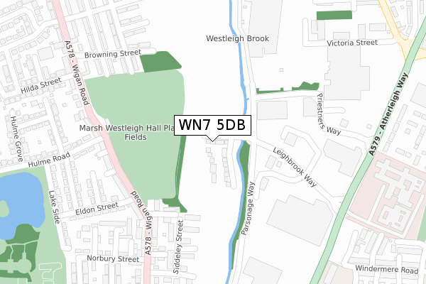
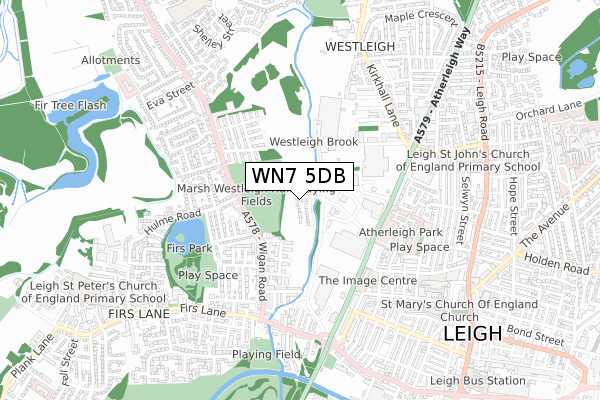
WN7 5DB maps


Source: OS Open Zoomstack (Ordnance Survey)
Licence: Open Government Licence (requires attribution)
Attribution: Contains OS data © Crown copyright and database right 2025
Source: Open Postcode Geo
Licence: Open Government Licence (requires attribution)
Attribution: Contains OS data © Crown copyright and database right 2025; Contains Royal Mail data © Royal Mail copyright and database right 2025; Source: Office for National Statistics licensed under the Open Government Licence v.3.0
Licence: Open Government Licence (requires attribution)
Attribution: Contains OS data © Crown copyright and database right 2025
Source: Open Postcode Geo
Licence: Open Government Licence (requires attribution)
Attribution: Contains OS data © Crown copyright and database right 2025; Contains Royal Mail data © Royal Mail copyright and database right 2025; Source: Office for National Statistics licensed under the Open Government Licence v.3.0
WN7 5DB geodata
| Easting | 364970 |
| Northing | 400753 |
| Latitude | 53.502312 |
| Longitude | -2.529580 |
Where is WN7 5DB?
| Country | England |
| Postcode District | WN7 |
Politics
| Ward | Leigh West |
|---|---|
| Constituency | Leigh |
House Prices
Sales of detached houses in WN7 5DB
6, BRIDGEDALE ROAD, LEIGH, WN7 5DB 2024 5 AUG £299,950 |
5, BRIDGEDALE ROAD, LEIGH, WN7 5DB 2020 3 NOV £220,000 |
9, BRIDGEDALE ROAD, LEIGH, WN7 5DB 2020 29 OCT £235,000 |
1, BRIDGEDALE ROAD, LEIGH, WN7 5DB 2020 23 SEP £235,000 |
8, BRIDGEDALE ROAD, LEIGH, WN7 5DB 2020 4 SEP £220,000 |
10, BRIDGEDALE ROAD, LEIGH, WN7 5DB 2020 15 MAY £267,000 |
3, BRIDGEDALE ROAD, LEIGH, WN7 5DB 2020 3 APR £220,000 |
7, BRIDGEDALE ROAD, LEIGH, WN7 5DB 2019 16 DEC £265,000 |
12, BRIDGEDALE ROAD, LEIGH, WN7 5DB 2019 11 OCT £235,000 |
Source: HM Land Registry Price Paid Data
Licence: Contains HM Land Registry data © Crown copyright and database right 2025. This data is licensed under the Open Government Licence v3.0.
Licence: Contains HM Land Registry data © Crown copyright and database right 2025. This data is licensed under the Open Government Licence v3.0.
Transport
Nearest bus stops to WN7 5DB
| Wigan Rd/Eldon St (Wigan Rd) | Firs Lane | 242m |
| Wigan Rd/Hulme Rd (Wigan Rd) | Firs Lane | 244m |
| Parsonage Way/Sainsbury's (Parsonage Way) | Firs Lane | 278m |
| Wigan Rd/Hulme Rd (Wigan Rd) | Firs Lane | 280m |
| Parsonage Way/Sainsbury's (Parsonage Way) | Firs Lane | 282m |
Nearest railway stations to WN7 5DB
| Hag Fold Station | 4.2km |
| Daisy Hill Station | 4.2km |
| Atherton Station | 4.5km |
Deprivation
93.1% of English postcodes are less deprived than WN7 5DB:Food Standards Agency
Three nearest food hygiene ratings to WN7 5DB (metres)
Spice Cafe and Staff Shop within AB World Foods

Kiribati Way
251m
Waggon & Horses

68 Wigan Road
258m
Aldi Stores Ltd

Leighbrook Way
305m
➜ Get more ratings from the Food Standards Agency
Nearest post box to WN7 5DB
| Last Collection | |||
|---|---|---|---|
| Location | Mon-Fri | Sat | Distance |
| Romford Avenue | 18:15 | 11:30 | 753m |
| Charles Street | 18:10 | 11:35 | 863m |
| Leigh Branch Office | 19:15 | 12:30 | 1,026m |
WN7 5DB ITL and WN7 5DB LAU
The below table lists the International Territorial Level (ITL) codes (formerly Nomenclature of Territorial Units for Statistics (NUTS) codes) and Local Administrative Units (LAU) codes for WN7 5DB:
| ITL 1 Code | Name |
|---|---|
| TLD | North West (England) |
| ITL 2 Code | Name |
| TLD3 | Greater Manchester |
| ITL 3 Code | Name |
| TLD36 | Greater Manchester North West |
| LAU 1 Code | Name |
| E08000010 | Wigan |
WN7 5DB census areas
The below table lists the Census Output Area (OA), Lower Layer Super Output Area (LSOA), and Middle Layer Super Output Area (MSOA) for WN7 5DB:
| Code | Name | |
|---|---|---|
| OA | E00031838 | |
| LSOA | E01006283 | Wigan 027B |
| MSOA | E02001313 | Wigan 027 |
Nearest postcodes to WN7 5DB
| WN7 5BB | Lostock Walk | 187m |
| WN7 5BG | Peacock Fold | 199m |
| WN7 5AY | Wigan Road | 257m |
| WN7 5DE | Wigan Road | 262m |
| WN7 5AQ | Wigan Road | 269m |
| WN7 5BD | Alt Close | 279m |
| WN7 5AZ | Siddeley Street | 280m |
| WN7 5BA | Cowburn Street | 281m |
| WN7 5EE | Wordsworth Avenue | 287m |
| WN7 5EF | Browning Street | 294m |