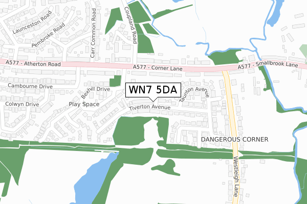
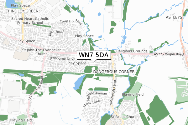
WN7 5DA is located in the Hindley Green electoral ward, within the metropolitan district of Wigan and the English Parliamentary constituency of Makerfield. The Sub Integrated Care Board (ICB) Location is NHS Greater Manchester ICB - 02H and the police force is Greater Manchester. This postcode has been in use since April 2019.


GetTheData
Source: OS Open Zoomstack (Ordnance Survey)
Licence: Open Government Licence (requires attribution)
Attribution: Contains OS data © Crown copyright and database right 2025
Source: Open Postcode Geo
Licence: Open Government Licence (requires attribution)
Attribution: Contains OS data © Crown copyright and database right 2025; Contains Royal Mail data © Royal Mail copyright and database right 2025; Source: Office for National Statistics licensed under the Open Government Licence v.3.0
| Easting | 364690 |
| Northing | 402947 |
| Latitude | 53.522013 |
| Longitude | -2.534050 |
GetTheData
Source: Open Postcode Geo
Licence: Open Government Licence
| Country | England |
| Postcode District | WN7 |
➜ See where WN7 is on a map ➜ Where is Hindley? | |
GetTheData
Source: Land Registry Price Paid Data
Licence: Open Government Licence
| Ward | Hindley Green |
| Constituency | Makerfield |
GetTheData
Source: ONS Postcode Database
Licence: Open Government Licence
15, YEW TREE CLOSE, LEIGH, WN7 5DA 2023 14 APR £280,000 |
24, YEW TREE CLOSE, LEIGH, WN7 5DA 2021 9 JUL £186,995 |
15, YEW TREE CLOSE, LEIGH, WN7 5DA 2021 4 JUN £237,995 |
7, YEW TREE CLOSE, LEIGH, WN7 5DA 2021 28 MAY £232,995 |
4, YEW TREE CLOSE, LEIGH, WN7 5DA 2021 7 MAY £184,995 |
18, YEW TREE CLOSE, LEIGH, WN7 5DA 2021 23 APR £264,995 |
5, YEW TREE CLOSE, LEIGH, WN7 5DA 2021 6 APR £232,995 |
3, YEW TREE CLOSE, LEIGH, WN7 5DA 2021 25 MAR £224,995 |
12, YEW TREE CLOSE, LEIGH, WN7 5DA 2021 28 JAN £225,995 |
6, YEW TREE CLOSE, LEIGH, WN7 5DA 2021 21 JAN £222,995 |
GetTheData
Source: HM Land Registry Price Paid Data
Licence: Contains HM Land Registry data © Crown copyright and database right 2025. This data is licensed under the Open Government Licence v3.0.
| Corner Ln/Bexhill Dr (Corner Ln) | Dangerous Corner | 110m |
| Corner Ln/Dangerous Corner (Corner Ln) | Dangerous Corner | 135m |
| Corner Ln/Bexhill Dr (Corner Ln) | Dangerous Corner | 140m |
| Westleigh Ln/Dangerous Corner (Westleigh Ln) | Dangerous Corner | 257m |
| Smallbrook Ln/Dangerous Corner (Smallbrook Ln) | Dangerous Corner | 268m |
| Daisy Hill Station | 2.3km |
| Hag Fold Station | 2.9km |
| Hindley Station | 3.6km |
GetTheData
Source: NaPTAN
Licence: Open Government Licence
GetTheData
Source: ONS Postcode Database
Licence: Open Government Licence


➜ Get more ratings from the Food Standards Agency
GetTheData
Source: Food Standards Agency
Licence: FSA terms & conditions
| Last Collection | |||
|---|---|---|---|
| Location | Mon-Fri | Sat | Distance |
| Howe Bridge | 17:30 | 11:30 | 1,000m |
| Platt Bridge P O | 18:45 | 12:05 | 1,145m |
| Sanderlings | 17:10 | 11:45 | 1,763m |
GetTheData
Source: Dracos
Licence: Creative Commons Attribution-ShareAlike
The below table lists the International Territorial Level (ITL) codes (formerly Nomenclature of Territorial Units for Statistics (NUTS) codes) and Local Administrative Units (LAU) codes for WN7 5DA:
| ITL 1 Code | Name |
|---|---|
| TLD | North West (England) |
| ITL 2 Code | Name |
| TLD3 | Greater Manchester |
| ITL 3 Code | Name |
| TLD36 | Greater Manchester North West |
| LAU 1 Code | Name |
| E08000010 | Wigan |
GetTheData
Source: ONS Postcode Directory
Licence: Open Government Licence
The below table lists the Census Output Area (OA), Lower Layer Super Output Area (LSOA), and Middle Layer Super Output Area (MSOA) for WN7 5DA:
| Code | Name | |
|---|---|---|
| OA | E00031860 | |
| LSOA | E01006281 | Wigan 019D |
| MSOA | E02001305 | Wigan 019 |
GetTheData
Source: ONS Postcode Directory
Licence: Open Government Licence
| WN7 5PX | Corner Lane | 57m |
| WN7 5PY | Corner Lane | 91m |
| WN7 5QG | Tiverton Avenue | 98m |
| WN7 5TF | Bexhill Drive | 110m |
| WN7 5TB | Polegate Drive | 173m |
| WN7 5PT | Taunton Avenue | 173m |
| WN2 4NF | Croyde Close | 186m |
| WN7 5QF | Minehead Avenue | 196m |
| WN7 5QE | Honiton Close | 226m |
| WN2 4TD | Carr Common Road | 252m |
GetTheData
Source: Open Postcode Geo; Land Registry Price Paid Data
Licence: Open Government Licence