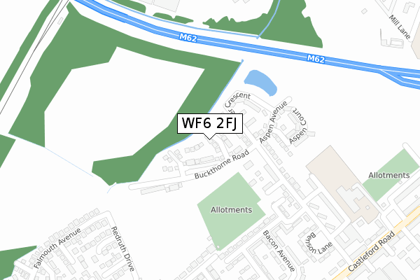
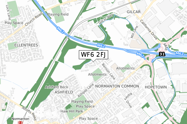
WF6 2FJ is located in the Normanton electoral ward, within the metropolitan district of Wakefield and the English Parliamentary constituency of Normanton, Pontefract and Castleford. The Sub Integrated Care Board (ICB) Location is NHS West Yorkshire ICB - 03R and the police force is West Yorkshire. This postcode has been in use since August 2019.


GetTheData
Source: OS Open Zoomstack (Ordnance Survey)
Licence: Open Government Licence (requires attribution)
Attribution: Contains OS data © Crown copyright and database right 2025
Source: Open Postcode Geo
Licence: Open Government Licence (requires attribution)
Attribution: Contains OS data © Crown copyright and database right 2025; Contains Royal Mail data © Royal Mail copyright and database right 2025; Source: Office for National Statistics licensed under the Open Government Licence v.3.0
| Easting | 439126 |
| Northing | 423636 |
| Latitude | 53.707708 |
| Longitude | -1.408748 |
GetTheData
Source: Open Postcode Geo
Licence: Open Government Licence
| Country | England |
| Postcode District | WF6 |
➜ See where WF6 is on a map ➜ Where is Normanton? | |
GetTheData
Source: Land Registry Price Paid Data
Licence: Open Government Licence
| Ward | Normanton |
| Constituency | Normanton, Pontefract And Castleford |
GetTheData
Source: ONS Postcode Database
Licence: Open Government Licence
2022 7 DEC £300,000 |
2021 28 JUN £263,000 |
2019 25 OCT £239,995 |
2019 25 OCT £229,995 |
17, BUCKTHORNE COURT, NORMANTON, WF6 2FJ 2019 16 OCT £258,995 |
15, BUCKTHORNE COURT, NORMANTON, WF6 2FJ 2019 11 OCT £257,995 |
16, BUCKTHORNE COURT, NORMANTON, WF6 2FJ 2019 26 SEP £204,950 |
11, BUCKTHORNE COURT, NORMANTON, WF6 2FJ 2019 6 SEP £239,995 |
1, BUCKTHORNE COURT, NORMANTON, WF6 2FJ 2019 21 AUG £254,995 |
6, BUCKTHORNE COURT, NORMANTON, WF6 2FJ 2019 6 AUG £254,995 |
GetTheData
Source: HM Land Registry Price Paid Data
Licence: Contains HM Land Registry data © Crown copyright and database right 2025. This data is licensed under the Open Government Licence v3.0.
| Castleford Road Benson Ln (Castleford Road) | Normanton | 454m |
| Castleford Road Benson Ln (Castleford Road) | Normanton | 459m |
| Castleford Road Gladstone St (Castleford Road) | Normanton | 476m |
| Castleford Road Gladstone St (Castleford Road) | Normanton | 513m |
| Castleford Rd Mill Lane (Castleford Road) | Whitwood | 555m |
| Normanton Station | 1.3km |
| Streethouse Station | 3.6km |
| Castleford Station | 4km |
GetTheData
Source: NaPTAN
Licence: Open Government Licence
GetTheData
Source: ONS Postcode Database
Licence: Open Government Licence

➜ Get more ratings from the Food Standards Agency
GetTheData
Source: Food Standards Agency
Licence: FSA terms & conditions
| Last Collection | |||
|---|---|---|---|
| Location | Mon-Fri | Sat | Distance |
| Hopetown P.o. | 17:30 | 11:15 | 440m |
| The Village | 17:30 | 11:00 | 543m |
| Opp 45 Ashgap Lane | 17:30 | 11:00 | 551m |
GetTheData
Source: Dracos
Licence: Creative Commons Attribution-ShareAlike
The below table lists the International Territorial Level (ITL) codes (formerly Nomenclature of Territorial Units for Statistics (NUTS) codes) and Local Administrative Units (LAU) codes for WF6 2FJ:
| ITL 1 Code | Name |
|---|---|
| TLE | Yorkshire and The Humber |
| ITL 2 Code | Name |
| TLE4 | West Yorkshire |
| ITL 3 Code | Name |
| TLE45 | Wakefield |
| LAU 1 Code | Name |
| E08000036 | Wakefield |
GetTheData
Source: ONS Postcode Directory
Licence: Open Government Licence
The below table lists the Census Output Area (OA), Lower Layer Super Output Area (LSOA), and Middle Layer Super Output Area (MSOA) for WF6 2FJ:
| Code | Name | |
|---|---|---|
| OA | E00059318 | |
| LSOA | E01011758 | Wakefield 013A |
| MSOA | E02002450 | Wakefield 013 |
GetTheData
Source: ONS Postcode Directory
Licence: Open Government Licence
| WF6 2HT | Regent Street | 177m |
| WF6 2HS | Benson Lane | 200m |
| WF6 2HP | Mackinnon Avenue | 278m |
| WF6 2HU | Albert Street | 321m |
| WF6 2HX | Benson Lane | 323m |
| WF6 2HE | Ash Gap Lane | 328m |
| WF6 2HW | Crossman Drive | 342m |
| WF6 2HR | Bacon Avenue | 348m |
| WF6 2ER | Tintagel Court | 370m |
| WF6 2HH | Croft Avenue | 387m |
GetTheData
Source: Open Postcode Geo; Land Registry Price Paid Data
Licence: Open Government Licence