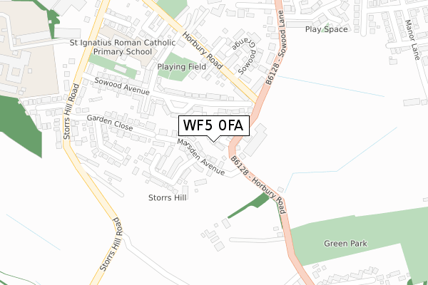
WF5 0FA maps, stats, and open data
WF5 0FA is located in the Horbury and South Ossett electoral ward, within the metropolitan district of Wakefield and the English Parliamentary constituency of Wakefield. The Sub Integrated Care Board (ICB) Location is NHS West Yorkshire ICB - 03R and the police force is West Yorkshire. This postcode has been in use since April 2019.
WF5 0FA maps


Licence: Open Government Licence (requires attribution)
Attribution: Contains OS data © Crown copyright and database right 2025
Source: Open Postcode Geo
Licence: Open Government Licence (requires attribution)
Attribution: Contains OS data © Crown copyright and database right 2025; Contains Royal Mail data © Royal Mail copyright and database right 2025; Source: Office for National Statistics licensed under the Open Government Licence v.3.0
WF5 0FA geodata
| Easting | 428437 |
| Northing | 419076 |
| Latitude | 53.667411 |
| Longitude | -1.571090 |
Where is WF5 0FA?
| Country | England |
| Postcode District | WF5 |
Politics
| Ward | Horbury And South Ossett |
|---|---|
| Constituency | Wakefield |
House Prices
Sales of detached houses in WF5 0FA
2024 12 APR £460,000 |
6, HORBURY VIEW, OSSETT, WF5 0FA 2022 23 SEP £595,000 |
2022 14 SEP £385,000 |
2021 25 MAR £420,000 |
8, HORBURY VIEW, OSSETT, WF5 0FA 2021 24 MAR £260,000 |
5, HORBURY VIEW, OSSETT, WF5 0FA 2019 21 OCT £100,000 |
2019 1 JUL £320,000 |
6, HORBURY VIEW, OSSETT, WF5 0FA 2018 25 JUL £265,000 |
Licence: Contains HM Land Registry data © Crown copyright and database right 2025. This data is licensed under the Open Government Licence v3.0.
Transport
Nearest bus stops to WF5 0FA
| Sowood Lane Horbury Rd (Sowood Lane) | Ossett Spa | 130m |
| Horbury Road Sowood Grange (Horbury Road) | Ossett | 146m |
| Sowood Lane Horbury Rd (Sowood Lane) | Ossett Spa | 171m |
| Horbury Rd South Terrace (Horbury Road) | Ossett | 225m |
| Storrs Hill Rd Matty Marsden Lane (Storrs Hill Road) | Horbury Bridge | 322m |
Nearest railway stations to WF5 0FA
| Wakefield Westgate Station | 4.6km |
| Dewsbury Station | 4.9km |
| Batley Station | 5.8km |
Broadband
Broadband access in WF5 0FA (2020 data)
| Percentage of properties with Next Generation Access | 100.0% |
| Percentage of properties with Superfast Broadband | 100.0% |
| Percentage of properties with Ultrafast Broadband | 0.0% |
| Percentage of properties with Full Fibre Broadband | 0.0% |
Superfast Broadband is between 30Mbps and 300Mbps
Ultrafast Broadband is > 300Mbps
Broadband limitations in WF5 0FA (2020 data)
| Percentage of properties unable to receive 2Mbps | 0.0% |
| Percentage of properties unable to receive 5Mbps | 0.0% |
| Percentage of properties unable to receive 10Mbps | 0.0% |
| Percentage of properties unable to receive 30Mbps | 0.0% |
Deprivation
26.4% of English postcodes are less deprived than WF5 0FA:Food Standards Agency
Three nearest food hygiene ratings to WF5 0FA (metres)


➜ Get more ratings from the Food Standards Agency
Nearest post box to WF5 0FA
| Last Collection | |||
|---|---|---|---|
| Location | Mon-Fri | Sat | Distance |
| Horbury Road | 17:30 | 11:45 | 168m |
| South Ossett | 17:45 | 11:45 | 418m |
| Manor Road | 17:30 | 11:45 | 491m |
WF5 0FA ITL and WF5 0FA LAU
The below table lists the International Territorial Level (ITL) codes (formerly Nomenclature of Territorial Units for Statistics (NUTS) codes) and Local Administrative Units (LAU) codes for WF5 0FA:
| ITL 1 Code | Name |
|---|---|
| TLE | Yorkshire and The Humber |
| ITL 2 Code | Name |
| TLE4 | West Yorkshire |
| ITL 3 Code | Name |
| TLE45 | Wakefield |
| LAU 1 Code | Name |
| E08000036 | Wakefield |
WF5 0FA census areas
The below table lists the Census Output Area (OA), Lower Layer Super Output Area (LSOA), and Middle Layer Super Output Area (MSOA) for WF5 0FA:
| Code | Name | |
|---|---|---|
| OA | E00059474 | |
| LSOA | E01011796 | Wakefield 029D |
| MSOA | E02002466 | Wakefield 029 |
Nearest postcodes to WF5 0FA
| WF5 0DB | Sowood Avenue | 76m |
| WF5 0AW | Marsden Avenue | 93m |
| WF5 0BS | Horbury Road | 131m |
| WF5 0BG | Rock House Way | 150m |
| WF5 0TJ | Sowood Court | 159m |
| WF5 0TL | Sowood Grange | 192m |
| WF4 6EX | Westfield Road | 197m |
| WF5 0BT | Horbury Road | 214m |
| WF5 0DE | South Terrace | 224m |
| WF5 0DD | Sowood Avenue | 235m |