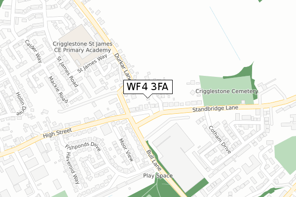
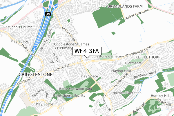
WF4 3FA is located in the Wakefield South electoral ward, within the metropolitan district of Wakefield and the English Parliamentary constituency of Hemsworth. The Sub Integrated Care Board (ICB) Location is NHS West Yorkshire ICB - 03R and the police force is West Yorkshire. This postcode has been in use since September 2018.


GetTheData
Source: OS Open Zoomstack (Ordnance Survey)
Licence: Open Government Licence (requires attribution)
Attribution: Contains OS data © Crown copyright and database right 2025
Source: Open Postcode Geo
Licence: Open Government Licence (requires attribution)
Attribution: Contains OS data © Crown copyright and database right 2025; Contains Royal Mail data © Royal Mail copyright and database right 2025; Source: Office for National Statistics licensed under the Open Government Licence v.3.0
| Easting | 431761 |
| Northing | 416443 |
| Latitude | 53.643556 |
| Longitude | -1.521051 |
GetTheData
Source: Open Postcode Geo
Licence: Open Government Licence
| Country | England |
| Postcode District | WF4 |
➜ See where WF4 is on a map ➜ Where is Crigglestone? | |
GetTheData
Source: Land Registry Price Paid Data
Licence: Open Government Licence
| Ward | Wakefield South |
| Constituency | Hemsworth |
GetTheData
Source: ONS Postcode Database
Licence: Open Government Licence
| Standbridge Lane Standbridge Garth (Standbridge Lane) | Crigglestone | 106m |
| Standbridge Lane Standbridge Garth (Standbridge Lane) | Crigglestone | 148m |
| High Street Nursery School (High Street) | Crigglestone | 166m |
| High Street Nursery School (High Street) | Crigglestone | 167m |
| Bull Lane Fishpond Ln (Bull Lane) | Crigglestone | 215m |
| Sandal & Agbrigg Station | 3.4km |
| Wakefield Kirkgate Station | 4.5km |
| Wakefield Westgate Station | 4.5km |
GetTheData
Source: NaPTAN
Licence: Open Government Licence
| Percentage of properties with Next Generation Access | 100.0% |
| Percentage of properties with Superfast Broadband | 100.0% |
| Percentage of properties with Ultrafast Broadband | 0.0% |
| Percentage of properties with Full Fibre Broadband | 0.0% |
Superfast Broadband is between 30Mbps and 300Mbps
Ultrafast Broadband is > 300Mbps
| Percentage of properties unable to receive 2Mbps | 0.0% |
| Percentage of properties unable to receive 5Mbps | 0.0% |
| Percentage of properties unable to receive 10Mbps | 0.0% |
| Percentage of properties unable to receive 30Mbps | 0.0% |
GetTheData
Source: Ofcom
Licence: Ofcom Terms of Use (requires attribution)
GetTheData
Source: ONS Postcode Database
Licence: Open Government Licence


➜ Get more ratings from the Food Standards Agency
GetTheData
Source: Food Standards Agency
Licence: FSA terms & conditions
| Last Collection | |||
|---|---|---|---|
| Location | Mon-Fri | Sat | Distance |
| Crigglestone P.o. | 16:30 | 11:45 | 535m |
| Hendal Lane/Woodmoor Road | 17:15 | 12:15 | 622m |
| Howard Crescent/ Holling Lane | 16:00 | 11:00 | 684m |
GetTheData
Source: Dracos
Licence: Creative Commons Attribution-ShareAlike
The below table lists the International Territorial Level (ITL) codes (formerly Nomenclature of Territorial Units for Statistics (NUTS) codes) and Local Administrative Units (LAU) codes for WF4 3FA:
| ITL 1 Code | Name |
|---|---|
| TLE | Yorkshire and The Humber |
| ITL 2 Code | Name |
| TLE4 | West Yorkshire |
| ITL 3 Code | Name |
| TLE45 | Wakefield |
| LAU 1 Code | Name |
| E08000036 | Wakefield |
GetTheData
Source: ONS Postcode Directory
Licence: Open Government Licence
The below table lists the Census Output Area (OA), Lower Layer Super Output Area (LSOA), and Middle Layer Super Output Area (MSOA) for WF4 3FA:
| Code | Name | |
|---|---|---|
| OA | E00060211 | |
| LSOA | E01011940 | Wakefield 037C |
| MSOA | E02002474 | Wakefield 037 |
GetTheData
Source: ONS Postcode Directory
Licence: Open Government Licence
| WF4 3NY | Standbridge Garth | 53m |
| WF4 3LN | The Willows | 83m |
| WF4 3JA | Standbridge Lane | 108m |
| WF4 3HZ | Durkar Lane | 136m |
| WF4 3EU | Bull Lane | 162m |
| WF4 3QB | Durkar Rise | 174m |
| WF4 3PE | Moor View | 184m |
| WF4 3EB | High Street | 219m |
| WF4 3HY | Durkar Lane | 239m |
| WF2 7YY | Standbridge Lane | 251m |
GetTheData
Source: Open Postcode Geo; Land Registry Price Paid Data
Licence: Open Government Licence