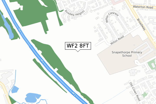
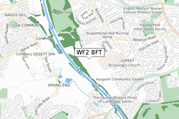
WF2 8FT is located in the Wakefield West electoral ward, within the metropolitan district of Wakefield and the English Parliamentary constituency of Wakefield. The Sub Integrated Care Board (ICB) Location is NHS West Yorkshire ICB - 03R and the police force is West Yorkshire. This postcode has been in use since April 2020.


GetTheData
Source: OS Open Zoomstack (Ordnance Survey)
Licence: Open Government Licence (requires attribution)
Attribution: Contains OS data © Crown copyright and database right 2025
Source: Open Postcode Geo
Licence: Open Government Licence (requires attribution)
Attribution: Contains OS data © Crown copyright and database right 2025; Contains Royal Mail data © Royal Mail copyright and database right 2025; Source: Office for National Statistics licensed under the Open Government Licence v.3.0
| Easting | 430211 |
| Northing | 419532 |
| Latitude | 53.671411 |
| Longitude | -1.544197 |
GetTheData
Source: Open Postcode Geo
Licence: Open Government Licence
| Country | England |
| Postcode District | WF2 |
➜ See where WF2 is on a map ➜ Where is Wakefield? | |
GetTheData
Source: Land Registry Price Paid Data
Licence: Open Government Licence
| Ward | Wakefield West |
| Constituency | Wakefield |
GetTheData
Source: ONS Postcode Database
Licence: Open Government Licence
2, YARN COURT, WAKEFIELD, WF2 8FT 2023 28 APR £206,496 |
1, YARN COURT, WAKEFIELD, WF2 8FT 2023 31 MAR £227,996 |
3, YARN COURT, WAKEFIELD, WF2 8FT 2023 31 MAR £227,496 |
GetTheData
Source: HM Land Registry Price Paid Data
Licence: Contains HM Land Registry data © Crown copyright and database right 2025. This data is licensed under the Open Government Licence v3.0.
| Broadway Waterton Road (Broadway) | Lupset | 434m |
| Broadway Waterton Road (Broadway) | Lupset | 445m |
| Dacre Avenue Lindsey Ave (Dacre Avenue) | Lupset | 455m |
| Dacre Avenue Lindsey Ave (Dacre Avenue) | Lupset | 475m |
| Broadway Snapethorpe Gate (Broadway) | Lupset | 488m |
| Wakefield Westgate Station | 2.8km |
| Wakefield Kirkgate Station | 3.8km |
| Sandal & Agbrigg Station | 4.2km |
GetTheData
Source: NaPTAN
Licence: Open Government Licence
GetTheData
Source: ONS Postcode Database
Licence: Open Government Licence


➜ Get more ratings from the Food Standards Agency
GetTheData
Source: Food Standards Agency
Licence: FSA terms & conditions
| Last Collection | |||
|---|---|---|---|
| Location | Mon-Fri | Sat | Distance |
| 126 Broadway/Hall Road | 17:30 | 11:00 | 480m |
| 7 Victoria Grove | 17:45 | 12:30 | 525m |
| 20 Spring End Road | 17:45 | 12:00 | 669m |
GetTheData
Source: Dracos
Licence: Creative Commons Attribution-ShareAlike
The below table lists the International Territorial Level (ITL) codes (formerly Nomenclature of Territorial Units for Statistics (NUTS) codes) and Local Administrative Units (LAU) codes for WF2 8FT:
| ITL 1 Code | Name |
|---|---|
| TLE | Yorkshire and The Humber |
| ITL 2 Code | Name |
| TLE4 | West Yorkshire |
| ITL 3 Code | Name |
| TLE45 | Wakefield |
| LAU 1 Code | Name |
| E08000036 | Wakefield |
GetTheData
Source: ONS Postcode Directory
Licence: Open Government Licence
The below table lists the Census Output Area (OA), Lower Layer Super Output Area (LSOA), and Middle Layer Super Output Area (MSOA) for WF2 8FT:
| Code | Name | |
|---|---|---|
| OA | E00060026 | |
| LSOA | E01011899 | Wakefield 026A |
| MSOA | E02002463 | Wakefield 026 |
GetTheData
Source: ONS Postcode Directory
Licence: Open Government Licence
| WF2 8AD | Milton Road | 208m |
| WF2 8YL | St James Rise | 231m |
| WF2 8AE | Milton Crescent | 278m |
| WF2 8YG | Airedale Heights | 294m |
| WF2 8YQ | Holby Square | 306m |
| WF2 8YF | Airedale Heights | 315m |
| WF2 8AB | Milton Road | 329m |
| WF2 8YH | Castle Hill | 338m |
| WF2 8YA | Snapethorpe Gate | 394m |
| WF2 8YB | Hallamshire Mews | 397m |
GetTheData
Source: Open Postcode Geo; Land Registry Price Paid Data
Licence: Open Government Licence