Property/Postcode Data Search:
WF15 7FA maps, stats, and open data
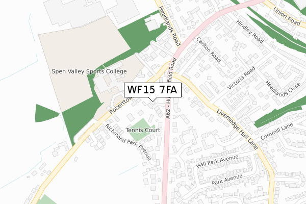
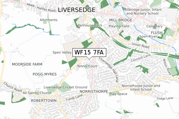
WF15 7FA is located in the Liversedge and Gomersal electoral ward, within the metropolitan district of Kirklees and the English Parliamentary constituency of Batley and Spen. The Sub Integrated Care Board (ICB) Location is NHS West Yorkshire ICB - X2C4Y and the police force is West Yorkshire. This postcode has been in use since December 2019.
WF15 7FA maps


Source: OS Open Zoomstack (Ordnance Survey)
Licence: Open Government Licence (requires attribution)
Attribution: Contains OS data © Crown copyright and database right 2025
Source: Open Postcode Geo
Licence: Open Government Licence (requires attribution)
Attribution: Contains OS data © Crown copyright and database right 2025; Contains Royal Mail data © Royal Mail copyright and database right 2025; Source: Office for National Statistics licensed under the Open Government Licence v.3.0
Licence: Open Government Licence (requires attribution)
Attribution: Contains OS data © Crown copyright and database right 2025
Source: Open Postcode Geo
Licence: Open Government Licence (requires attribution)
Attribution: Contains OS data © Crown copyright and database right 2025; Contains Royal Mail data © Royal Mail copyright and database right 2025; Source: Office for National Statistics licensed under the Open Government Licence v.3.0
WF15 7FA geodata
| Easting | 420185 |
| Northing | 423136 |
| Latitude | 53.704284 |
| Longitude | -1.695717 |
Where is WF15 7FA?
| Country | England |
| Postcode District | WF15 |
Politics
| Ward | Liversedge And Gomersal |
|---|---|
| Constituency | Batley And Spen |
House Prices
Sales of detached houses in WF15 7FA
3, DUXBURY GARDENS, LIVERSEDGE, WF15 7FA 2022 25 FEB £435,000 |
2020 4 DEC £435,000 |
1, DUXBURY GARDENS, LIVERSEDGE, WF15 7FA 2020 6 NOV £435,000 |
5, DUXBURY GARDENS, LIVERSEDGE, WF15 7FA 2020 29 OCT £430,000 |
2, DUXBURY GARDENS, LIVERSEDGE, WF15 7FA 2020 4 SEP £495,000 |
2016 19 AUG £480,000 |
Source: HM Land Registry Price Paid Data
Licence: Contains HM Land Registry data © Crown copyright and database right 2025. This data is licensed under the Open Government Licence v3.0.
Licence: Contains HM Land Registry data © Crown copyright and database right 2025. This data is licensed under the Open Government Licence v3.0.
Transport
Nearest bus stops to WF15 7FA
| Huddersfield Rd Liversedge Hall Lane (Huddersfield Road) | Liversedge | 44m |
| Huddersfield Rd Liversedge Hall Lane (Huddersfield Road) | Liversedge | 49m |
| Roberttown Lane Headlands (Roberttown Lane) | Liversedge | 105m |
| Roberttown Lane Headlands (Roberttown Lane) | Liversedge | 120m |
| Huddersfield Road Lineham Court (Huddersfield Road) | Norristhorpe | 169m |
Nearest railway stations to WF15 7FA
| Mirfield Station | 3.7km |
| Ravensthorpe Station | 4.2km |
| Dewsbury Station | 4.3km |
Deprivation
47.3% of English postcodes are less deprived than WF15 7FA:Food Standards Agency
Three nearest food hygiene ratings to WF15 7FA (metres)
Spen Valley High School

Roberttown Lane
98m
Northfields Nursery

Northfield Nursery
209m
Liversedge Tennis Club

Richmond Park Avenue
224m
➜ Get more ratings from the Food Standards Agency
Nearest post box to WF15 7FA
| Last Collection | |||
|---|---|---|---|
| Location | Mon-Fri | Sat | Distance |
| Headlandsroad | 16:00 | 12:00 | 142m |
| 43 Liversedge Hall Lane | 16:30 | 11:00 | 364m |
| Yew Tree | 16:30 | 11:15 | 412m |
WF15 7FA ITL and WF15 7FA LAU
The below table lists the International Territorial Level (ITL) codes (formerly Nomenclature of Territorial Units for Statistics (NUTS) codes) and Local Administrative Units (LAU) codes for WF15 7FA:
| ITL 1 Code | Name |
|---|---|
| TLE | Yorkshire and The Humber |
| ITL 2 Code | Name |
| TLE4 | West Yorkshire |
| ITL 3 Code | Name |
| TLE44 | Calderdale and Kirklees |
| LAU 1 Code | Name |
| E08000034 | Kirklees |
WF15 7FA census areas
The below table lists the Census Output Area (OA), Lower Layer Super Output Area (LSOA), and Middle Layer Super Output Area (MSOA) for WF15 7FA:
| Code | Name | |
|---|---|---|
| OA | E00056209 | |
| LSOA | E01011156 | Kirklees 015A |
| MSOA | E02002285 | Kirklees 015 |
Nearest postcodes to WF15 7FA
| WF15 7DA | Huddersfield Road | 68m |
| WF15 7NR | Roberttown Lane | 93m |
| WF15 7LX | Roberttown Lane | 99m |
| WF15 7BY | Huddersfield Road | 112m |
| WF15 7EJ | Lineham Court | 134m |
| WF15 7DD | Liversedge Hall Lane | 142m |
| WF15 7NZ | Richmond Park Avenue | 146m |
| WF15 7NS | Headlands | 190m |
| WF15 7DE | Headlands Street | 190m |
| WF15 7QX | Hartley Court | 202m |