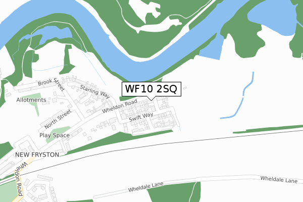
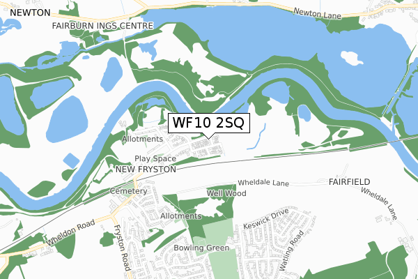
WF10 2SQ is located in the Airedale and Ferry Fryston electoral ward, within the metropolitan district of Wakefield and the English Parliamentary constituency of Normanton, Pontefract and Castleford. The Sub Integrated Care Board (ICB) Location is NHS West Yorkshire ICB - 03R and the police force is West Yorkshire. This postcode has been in use since November 2018.


GetTheData
Source: OS Open Zoomstack (Ordnance Survey)
Licence: Open Government Licence (requires attribution)
Attribution: Contains OS data © Crown copyright and database right 2025
Source: Open Postcode Geo
Licence: Open Government Licence (requires attribution)
Attribution: Contains OS data © Crown copyright and database right 2025; Contains Royal Mail data © Royal Mail copyright and database right 2025; Source: Office for National Statistics licensed under the Open Government Licence v.3.0
| Easting | 445760 |
| Northing | 427092 |
| Latitude | 53.738231 |
| Longitude | -1.307745 |
GetTheData
Source: Open Postcode Geo
Licence: Open Government Licence
| Country | England |
| Postcode District | WF10 |
➜ See where WF10 is on a map ➜ Where is Castleford? | |
GetTheData
Source: Land Registry Price Paid Data
Licence: Open Government Licence
| Ward | Airedale And Ferry Fryston |
| Constituency | Normanton, Pontefract And Castleford |
GetTheData
Source: ONS Postcode Database
Licence: Open Government Licence
2024 28 AUG £333,000 |
2022 24 NOV £245,000 |
2018 16 NOV £185,000 |
2018 28 SEP £239,995 |
2, DUNNOCK WAY, CASTLEFORD, WF10 2SQ 2018 28 SEP £241,995 |
GetTheData
Source: HM Land Registry Price Paid Data
Licence: Contains HM Land Registry data © Crown copyright and database right 2025. This data is licensed under the Open Government Licence v3.0.
| Colliery Village South View (Wheldon Road) | Fryston Village | 422m |
| Keswick Drive Borrowdale Dr (Keswick Drive) | Ferry Fryston | 558m |
| Wheldon Road Silkstone (Wheldon Road) | Fryston Village | 594m |
| Keswick Drive Cumberland Rd (Keswick Drive) | Ferry Fryston | 601m |
| Wheldon Rd Fryston Road (Wheldon Road) | Fryston Village | 684m |
| Castleford Station | 3.5km |
| Glasshoughton Station | 4km |
| Pontefract Monkhill Station | 4.4km |
GetTheData
Source: NaPTAN
Licence: Open Government Licence
| Percentage of properties with Next Generation Access | 100.0% |
| Percentage of properties with Superfast Broadband | 100.0% |
| Percentage of properties with Ultrafast Broadband | 100.0% |
| Percentage of properties with Full Fibre Broadband | 100.0% |
Superfast Broadband is between 30Mbps and 300Mbps
Ultrafast Broadband is > 300Mbps
| Percentage of properties unable to receive 2Mbps | 0.0% |
| Percentage of properties unable to receive 5Mbps | 0.0% |
| Percentage of properties unable to receive 10Mbps | 0.0% |
| Percentage of properties unable to receive 30Mbps | 0.0% |
GetTheData
Source: Ofcom
Licence: Ofcom Terms of Use (requires attribution)
GetTheData
Source: ONS Postcode Database
Licence: Open Government Licence


➜ Get more ratings from the Food Standards Agency
GetTheData
Source: Food Standards Agency
Licence: FSA terms & conditions
| Last Collection | |||
|---|---|---|---|
| Location | Mon-Fri | Sat | Distance |
| Fryston | 17:30 | 12:15 | 497m |
| Fairfield Close P.o. | 17:30 | 12:15 | 778m |
| Lancaster St/Dunderdale Cres | 17:30 | 12:15 | 846m |
GetTheData
Source: Dracos
Licence: Creative Commons Attribution-ShareAlike
The below table lists the International Territorial Level (ITL) codes (formerly Nomenclature of Territorial Units for Statistics (NUTS) codes) and Local Administrative Units (LAU) codes for WF10 2SQ:
| ITL 1 Code | Name |
|---|---|
| TLE | Yorkshire and The Humber |
| ITL 2 Code | Name |
| TLE4 | West Yorkshire |
| ITL 3 Code | Name |
| TLE45 | Wakefield |
| LAU 1 Code | Name |
| E08000036 | Wakefield |
GetTheData
Source: ONS Postcode Directory
Licence: Open Government Licence
The below table lists the Census Output Area (OA), Lower Layer Super Output Area (LSOA), and Middle Layer Super Output Area (MSOA) for WF10 2SQ:
| Code | Name | |
|---|---|---|
| OA | E00059193 | |
| LSOA | E01011746 | Wakefield 001E |
| MSOA | E02002438 | Wakefield 001 |
GetTheData
Source: ONS Postcode Directory
Licence: Open Government Licence
| WF10 2QL | North Street | 312m |
| WF10 2PL | Brook Street | 365m |
| WF10 2QH | Smith Street | 431m |
| WF10 2QQ | William Street | 451m |
| WF10 2QU | Beamshaw Close | 462m |
| WF10 2QG | Smith Cottages | 486m |
| WF10 2PH | Wheatley Drive | 504m |
| WF10 2QW | Netherwood Avenue | 508m |
| WF10 2QF | South View | 537m |
| WF10 2RF | Keswick Drive | 553m |
GetTheData
Source: Open Postcode Geo; Land Registry Price Paid Data
Licence: Open Government Licence