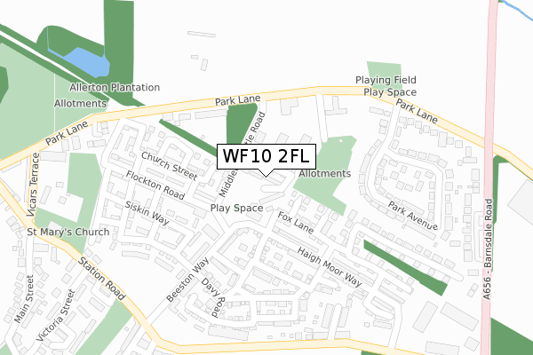
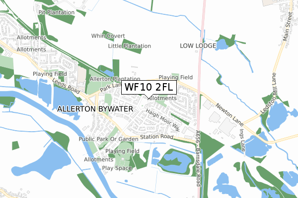
WF10 2FL lies on Fletchers Way in Castleford. WF10 2FL is located in the Kippax & Methley electoral ward, within the metropolitan district of Leeds and the English Parliamentary constituency of Elmet and Rothwell. The Sub Integrated Care Board (ICB) Location is NHS West Yorkshire ICB - 15F and the police force is West Yorkshire. This postcode has been in use since June 2018.


GetTheData
Source: OS Open Zoomstack (Ordnance Survey)
Licence: Open Government Licence (requires attribution)
Attribution: Contains OS data © Crown copyright and database right 2025
Source: Open Postcode Geo
Licence: Open Government Licence (requires attribution)
Attribution: Contains OS data © Crown copyright and database right 2025; Contains Royal Mail data © Royal Mail copyright and database right 2025; Source: Office for National Statistics licensed under the Open Government Licence v.3.0
| Easting | 442208 |
| Northing | 427934 |
| Latitude | 53.746097 |
| Longitude | -1.361476 |
GetTheData
Source: Open Postcode Geo
Licence: Open Government Licence
| Street | Fletchers Way |
| Town/City | Castleford |
| Country | England |
| Postcode District | WF10 |
➜ See where WF10 is on a map ➜ Where is Allerton Bywater? | |
GetTheData
Source: Land Registry Price Paid Data
Licence: Open Government Licence
| Ward | Kippax & Methley |
| Constituency | Elmet And Rothwell |
GetTheData
Source: ONS Postcode Database
Licence: Open Government Licence
2023 16 MAY £202,000 |
4, FLETCHERS WAY, ALLERTON BYWATER, CASTLEFORD, WF10 2FL 2019 28 SEP £158,000 |
1, FLETCHERS WAY, ALLERTON BYWATER, CASTLEFORD, WF10 2FL 2019 21 JUN £194,995 |
19, FLETCHERS WAY, CASTLEFORD, WF10 2FL 2018 30 OCT £189,995 |
2018 28 SEP £158,000 |
➜ Allerton Bywater house prices
GetTheData
Source: HM Land Registry Price Paid Data
Licence: Contains HM Land Registry data © Crown copyright and database right 2025. This data is licensed under the Open Government Licence v3.0.
| Park Lane Millennium Village (Park Lane) | Allerton Bywater | 151m |
| Park Lane Millennium Village (Park Lane) | Allerton Bywater | 175m |
| Park Lane Park Ave (Park Lane) | Allerton Bywater | 285m |
| Park Lane Park Ave (Park Lane) | Allerton Bywater | 291m |
| Station Rd Shaws Terrace (Station Road) | Allerton Bywater | 313m |
| Castleford Station | 2.5km |
| Glasshoughton Station | 4.3km |
| Micklefield Station | 5.3km |
GetTheData
Source: NaPTAN
Licence: Open Government Licence
| Percentage of properties with Next Generation Access | 8.0% |
| Percentage of properties with Superfast Broadband | 8.0% |
| Percentage of properties with Ultrafast Broadband | 0.0% |
| Percentage of properties with Full Fibre Broadband | 0.0% |
Superfast Broadband is between 30Mbps and 300Mbps
Ultrafast Broadband is > 300Mbps
| Median download speed | 6.0Mbps |
| Average download speed | 10.7Mbps |
| Maximum download speed | 76.42Mbps |
| Median upload speed | 0.8Mbps |
| Average upload speed | 2.1Mbps |
| Maximum upload speed | 19.53Mbps |
| Percentage of properties unable to receive 2Mbps | 0.0% |
| Percentage of properties unable to receive 5Mbps | 92.0% |
| Percentage of properties unable to receive 10Mbps | 92.0% |
| Percentage of properties unable to receive 30Mbps | 92.0% |
GetTheData
Source: Ofcom
Licence: Ofcom Terms of Use (requires attribution)
GetTheData
Source: ONS Postcode Database
Licence: Open Government Licence


➜ Get more ratings from the Food Standards Agency
GetTheData
Source: Food Standards Agency
Licence: FSA terms & conditions
| Last Collection | |||
|---|---|---|---|
| Location | Mon-Fri | Sat | Distance |
| Barnsdale Road / Park Lane | 16:15 | 11:15 | 286m |
| In Wall Of 22 Main Street | 16:15 | 11:15 | 469m |
| Allerton Bywater P.o. | 16:45 | 11:15 | 1,323m |
GetTheData
Source: Dracos
Licence: Creative Commons Attribution-ShareAlike
The below table lists the International Territorial Level (ITL) codes (formerly Nomenclature of Territorial Units for Statistics (NUTS) codes) and Local Administrative Units (LAU) codes for WF10 2FL:
| ITL 1 Code | Name |
|---|---|
| TLE | Yorkshire and The Humber |
| ITL 2 Code | Name |
| TLE4 | West Yorkshire |
| ITL 3 Code | Name |
| TLE42 | Leeds |
| LAU 1 Code | Name |
| E08000035 | Leeds |
GetTheData
Source: ONS Postcode Directory
Licence: Open Government Licence
The below table lists the Census Output Area (OA), Lower Layer Super Output Area (LSOA), and Middle Layer Super Output Area (MSOA) for WF10 2FL:
| Code | Name | |
|---|---|---|
| OA | E00056985 | |
| LSOA | E01011307 | Leeds 103A |
| MSOA | E02002432 | Leeds 103 |
GetTheData
Source: ONS Postcode Directory
Licence: Open Government Licence
| WF10 2FJ | Middleton Little Road | 84m |
| WF10 2FB | Warren House Road | 139m |
| WF10 2GD | Fieldfare Drive | 160m |
| WF10 2EZ | Sirocco Avenue | 167m |
| WF10 2AT | Park Lane | 184m |
| WF10 2EX | Haigh Moor Way | 186m |
| WF10 2AG | Beeston Way | 198m |
| WF10 2FG | Trevithick Road | 217m |
| WF10 2GB | Flockton Road | 226m |
| WF10 2AS | Park Avenue | 228m |
GetTheData
Source: Open Postcode Geo; Land Registry Price Paid Data
Licence: Open Government Licence