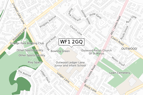
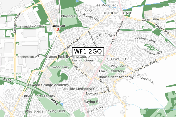
WF1 2GQ is located in the Wrenthorpe and Outwood West electoral ward, within the metropolitan district of Wakefield and the English Parliamentary constituency of Morley and Outwood. The Sub Integrated Care Board (ICB) Location is NHS West Yorkshire ICB - 03R and the police force is West Yorkshire. This postcode has been in use since February 2018.


GetTheData
Source: OS Open Zoomstack (Ordnance Survey)
Licence: Open Government Licence (requires attribution)
Attribution: Contains OS data © Crown copyright and database right 2025
Source: Open Postcode Geo
Licence: Open Government Licence (requires attribution)
Attribution: Contains OS data © Crown copyright and database right 2025; Contains Royal Mail data © Royal Mail copyright and database right 2025; Source: Office for National Statistics licensed under the Open Government Licence v.3.0
| Easting | 432827 |
| Northing | 424001 |
| Latitude | 53.711420 |
| Longitude | -1.504130 |
GetTheData
Source: Open Postcode Geo
Licence: Open Government Licence
| Country | England |
| Postcode District | WF1 |
➜ See where WF1 is on a map ➜ Where is Wakefield? | |
GetTheData
Source: Land Registry Price Paid Data
Licence: Open Government Licence
| Ward | Wrenthorpe And Outwood West |
| Constituency | Morley And Outwood |
GetTheData
Source: ONS Postcode Database
Licence: Open Government Licence
6, ST GEORGES PLACE, WAKEFIELD, WF1 2GQ 2019 7 OCT £190,000 |
4, ST GEORGES PLACE, WAKEFIELD, WF1 2GQ 2017 27 OCT £150,000 |
GetTheData
Source: HM Land Registry Price Paid Data
Licence: Contains HM Land Registry data © Crown copyright and database right 2025. This data is licensed under the Open Government Licence v3.0.
| Ledger Ln The Avenue (Ledger Lane) | Outwood | 199m |
| Outwood Church Moxon Street (Leeds Road) | Outwood | 216m |
| Ledger Ln The Avenue (Ledger Lane) | Outwood | 227m |
| Leeds Rd Church Lane (Leeds Road) | Outwood | 232m |
| Leeds Rd Bolus Lane (Leeds Road) | Outwood | 243m |
| Outwood Station | 0.6km |
| Wakefield Westgate Station | 3.2km |
| Wakefield Kirkgate Station | 3.8km |
GetTheData
Source: NaPTAN
Licence: Open Government Licence
| Percentage of properties with Next Generation Access | 100.0% |
| Percentage of properties with Superfast Broadband | 100.0% |
| Percentage of properties with Ultrafast Broadband | 0.0% |
| Percentage of properties with Full Fibre Broadband | 0.0% |
Superfast Broadband is between 30Mbps and 300Mbps
Ultrafast Broadband is > 300Mbps
| Percentage of properties unable to receive 2Mbps | 0.0% |
| Percentage of properties unable to receive 5Mbps | 0.0% |
| Percentage of properties unable to receive 10Mbps | 0.0% |
| Percentage of properties unable to receive 30Mbps | 0.0% |
GetTheData
Source: Ofcom
Licence: Ofcom Terms of Use (requires attribution)
GetTheData
Source: ONS Postcode Database
Licence: Open Government Licence


➜ Get more ratings from the Food Standards Agency
GetTheData
Source: Food Standards Agency
Licence: FSA terms & conditions
| Last Collection | |||
|---|---|---|---|
| Location | Mon-Fri | Sat | Distance |
| Coach Road / Leeds Road | 17:30 | 11:00 | 284m |
| Lawns Lane P.o. | 17:45 | 12:00 | 333m |
| Outwood P.o. | 17:30 | 12:00 | 450m |
GetTheData
Source: Dracos
Licence: Creative Commons Attribution-ShareAlike
The below table lists the International Territorial Level (ITL) codes (formerly Nomenclature of Territorial Units for Statistics (NUTS) codes) and Local Administrative Units (LAU) codes for WF1 2GQ:
| ITL 1 Code | Name |
|---|---|
| TLE | Yorkshire and The Humber |
| ITL 2 Code | Name |
| TLE4 | West Yorkshire |
| ITL 3 Code | Name |
| TLE45 | Wakefield |
| LAU 1 Code | Name |
| E08000036 | Wakefield |
GetTheData
Source: ONS Postcode Directory
Licence: Open Government Licence
The below table lists the Census Output Area (OA), Lower Layer Super Output Area (LSOA), and Middle Layer Super Output Area (MSOA) for WF1 2GQ:
| Code | Name | |
|---|---|---|
| OA | E00059960 | |
| LSOA | E01011896 | Wakefield 008D |
| MSOA | E02002445 | Wakefield 008 |
GetTheData
Source: ONS Postcode Directory
Licence: Open Government Licence
| WF1 2JU | Church Lane Avenue | 65m |
| WF1 2JY | Monkwood Road | 90m |
| WF1 2JS | Church Lane | 94m |
| WF1 2JX | Monkwood Road | 140m |
| WF1 2PR | Kelburn Road | 150m |
| WF1 2JT | Church Lane | 165m |
| WF1 2LB | Kingsley Close | 179m |
| WF1 2PH | Ledger Lane | 181m |
| WF1 2LR | George Street | 186m |
| WF1 2JL | Leeds Road | 198m |
GetTheData
Source: Open Postcode Geo; Land Registry Price Paid Data
Licence: Open Government Licence