Property/Postcode Data Search:
WD25 9DA maps, stats, and open data
WD25 9DA is located in the Leavesden electoral ward, within the local authority district of Three Rivers and the English Parliamentary constituency of Watford. The Sub Integrated Care Board (ICB) Location is NHS Hertfordshire and West Essex ICB - 06N and the police force is Hertfordshire. This postcode has been in use since April 2020.
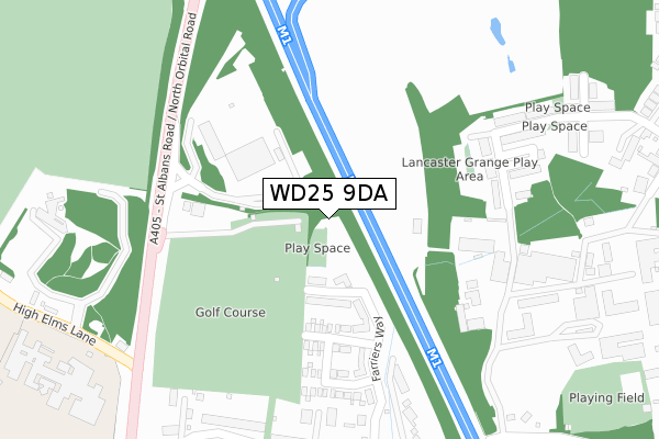
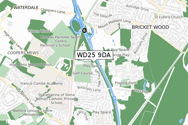
WD25 9DA maps


Source: OS Open Zoomstack (Ordnance Survey)
Licence: Open Government Licence (requires attribution)
Attribution: Contains OS data © Crown copyright and database right 2025
Source: Open Postcode Geo
Licence: Open Government Licence (requires attribution)
Attribution: Contains OS data © Crown copyright and database right 2025; Contains Royal Mail data © Royal Mail copyright and database right 2025; Source: Office for National Statistics licensed under the Open Government Licence v.3.0
Licence: Open Government Licence (requires attribution)
Attribution: Contains OS data © Crown copyright and database right 2025
Source: Open Postcode Geo
Licence: Open Government Licence (requires attribution)
Attribution: Contains OS data © Crown copyright and database right 2025; Contains Royal Mail data © Royal Mail copyright and database right 2025; Source: Office for National Statistics licensed under the Open Government Licence v.3.0
WD25 9DA geodata
| Easting | 512082 |
| Northing | 201475 |
| Latitude | 51.700841 |
| Longitude | -0.379517 |
Where is WD25 9DA?
| Country | England |
| Postcode District | WD25 |
Politics
| Ward | Leavesden |
|---|---|
| Constituency | Watford |
Transport
Nearest bus stops to WD25 9DA
| Building Research Establishment (Bucknalls Lane) | Garston | 353m |
| Bucknalls Lane (North Orbital Road) | Garston | 360m |
| Bucknalls Lane (North Orbital Road) | Garston | 399m |
| St Michael's Rc School (High Elms Lane) | Garston | 424m |
| Mount Pleasant Lane School (Mount Pleasant Lane) | Bricket Wood | 585m |
Nearest railway stations to WD25 9DA
| Bricket Wood Station | 1.5km |
| Garston (Herts) Station | 1.6km |
| Watford North Station | 2.9km |
Deprivation
21.4% of English postcodes are less deprived than WD25 9DA:Food Standards Agency
Three nearest food hygiene ratings to WD25 9DA (metres)
Primal Instinct

19 Fullers Avenue
180m
One Vision @ Penfold Park

Penfold Park
242m
Bluebells Tea Rooms

West Hertfordshire Crematorium
444m
➜ Get more ratings from the Food Standards Agency
Nearest post box to WD25 9DA
| Last Collection | |||
|---|---|---|---|
| Location | Mon-Fri | Sat | Distance |
| Ferndene | 17:30 | 12:00 | 750m |
| Oakwood Road Post Office | 18:30 | 12:00 | 1,192m |
| Katherine Place | 17:00 | 12:00 | 1,715m |
WD25 9DA ITL and WD25 9DA LAU
The below table lists the International Territorial Level (ITL) codes (formerly Nomenclature of Territorial Units for Statistics (NUTS) codes) and Local Administrative Units (LAU) codes for WD25 9DA:
| ITL 1 Code | Name |
|---|---|
| TLH | East |
| ITL 2 Code | Name |
| TLH2 | Bedfordshire and Hertfordshire |
| ITL 3 Code | Name |
| TLH23 | Hertfordshire CC |
| LAU 1 Code | Name |
| E07000102 | Three Rivers |
WD25 9DA census areas
The below table lists the Census Output Area (OA), Lower Layer Super Output Area (LSOA), and Middle Layer Super Output Area (MSOA) for WD25 9DA:
| Code | Name | |
|---|---|---|
| OA | E00121024 | |
| LSOA | E01023834 | Three Rivers 002E |
| MSOA | E02004957 | Three Rivers 002 |
Nearest postcodes to WD25 9DA
| WD25 9NF | Bucknalls Close | 180m |
| WD25 9BD | Lodge Close | 223m |
| WD25 9NB | Bucknalls Close | 237m |
| WD25 0GB | St Albans Road | 243m |
| WD25 9NE | Bucknalls Lane | 264m |
| WD25 9JQ | Bucknalls Lane | 299m |
| WD25 9TQ | Tudor Manor Gardens | 363m |
| WD25 9TW | Avalon Close | 364m |
| WD25 9ND | St Albans Road | 427m |
| WD25 9PE | Coates Way | 428m |