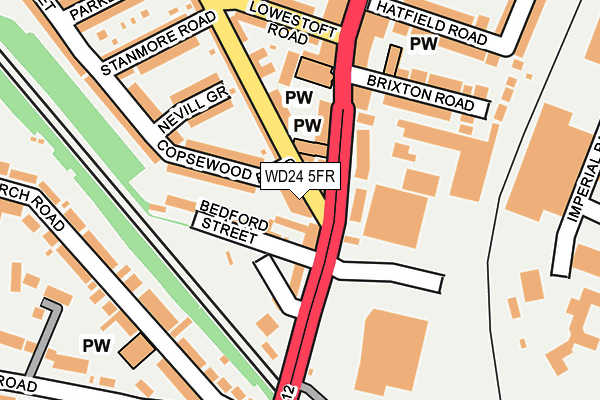
WD24 5FR is located in the Callowland electoral ward, within the local authority district of Watford and the English Parliamentary constituency of Watford. The Sub Integrated Care Board (ICB) Location is NHS Hertfordshire and West Essex ICB - 06N and the police force is Hertfordshire. This postcode has been in use since April 2017.


GetTheData
Source: OS OpenMap – Local (Ordnance Survey)
Source: OS VectorMap District (Ordnance Survey)
Licence: Open Government Licence (requires attribution)
| Easting | 510851 |
| Northing | 197760 |
| Latitude | 51.667696 |
| Longitude | -0.398501 |
GetTheData
Source: Open Postcode Geo
Licence: Open Government Licence
| Country | England |
| Postcode District | WD24 |
➜ See where WD24 is on a map ➜ Where is Watford? | |
GetTheData
Source: Land Registry Price Paid Data
Licence: Open Government Licence
| Ward | Callowland |
| Constituency | Watford |
GetTheData
Source: ONS Postcode Database
Licence: Open Government Licence
| Brixton Road (St Albans Road) | North Watford | 65m |
| Railway Bridge (St Albans Road) | Watford | 188m |
| Railway Bridge (St Albans Road) | Watford | 213m |
| Regent Street (St Albans Road) | North Watford | 286m |
| Church Road (Stratford Road) | Watford | 316m |
| Watford Underground Station | Watford | 1,732m |
| Watford Junction Station | 0.5km |
| Watford North Station | 1.1km |
| Watford High Street Station | 1.7km |
GetTheData
Source: NaPTAN
Licence: Open Government Licence
| Percentage of properties with Next Generation Access | 100.0% |
| Percentage of properties with Superfast Broadband | 100.0% |
| Percentage of properties with Ultrafast Broadband | 100.0% |
| Percentage of properties with Full Fibre Broadband | 0.0% |
Superfast Broadband is between 30Mbps and 300Mbps
Ultrafast Broadband is > 300Mbps
| Median download speed | 12.0Mbps |
| Average download speed | 30.3Mbps |
| Maximum download speed | 80.00Mbps |
| Median upload speed | 1.1Mbps |
| Average upload speed | 6.6Mbps |
| Maximum upload speed | 20.00Mbps |
| Percentage of properties unable to receive 2Mbps | 0.0% |
| Percentage of properties unable to receive 5Mbps | 0.0% |
| Percentage of properties unable to receive 10Mbps | 0.0% |
| Percentage of properties unable to receive 30Mbps | 0.0% |
GetTheData
Source: Ofcom
Licence: Ofcom Terms of Use (requires attribution)
GetTheData
Source: ONS Postcode Database
Licence: Open Government Licence


➜ Get more ratings from the Food Standards Agency
GetTheData
Source: Food Standards Agency
Licence: FSA terms & conditions
| Last Collection | |||
|---|---|---|---|
| Location | Mon-Fri | Sat | Distance |
| Leavesden Road | 18:30 | 12:00 | 133m |
| Leavesden Road North | 18:30 | 12:00 | 453m |
| Watford Junction Station | 18:30 | 11:30 | 492m |
GetTheData
Source: Dracos
Licence: Creative Commons Attribution-ShareAlike
The below table lists the International Territorial Level (ITL) codes (formerly Nomenclature of Territorial Units for Statistics (NUTS) codes) and Local Administrative Units (LAU) codes for WD24 5FR:
| ITL 1 Code | Name |
|---|---|
| TLH | East |
| ITL 2 Code | Name |
| TLH2 | Bedfordshire and Hertfordshire |
| ITL 3 Code | Name |
| TLH23 | Hertfordshire CC |
| LAU 1 Code | Name |
| E07000103 | Watford |
GetTheData
Source: ONS Postcode Directory
Licence: Open Government Licence
The below table lists the Census Output Area (OA), Lower Layer Super Output Area (LSOA), and Middle Layer Super Output Area (MSOA) for WD24 5FR:
| Code | Name | |
|---|---|---|
| OA | E00121141 | |
| LSOA | E01023855 | Watford 006A |
| MSOA | E02004973 | Watford 006 |
GetTheData
Source: ONS Postcode Directory
Licence: Open Government Licence
| WD24 5DU | Bedford Street | 24m |
| WD24 5DT | Bedford Street | 63m |
| WD24 5QR | Copsewood Road | 65m |
| WD24 5BD | St Albans Road | 71m |
| WD24 5BS | St Albans Road | 99m |
| WD24 5ED | Leavesden Road | 110m |
| WD24 5DZ | Copsewood Road | 111m |
| WD24 5FH | Railway Terrace | 122m |
| WD24 5DW | Nevill Grove | 122m |
| WD24 5EB | Leavesden Road | 124m |
GetTheData
Source: Open Postcode Geo; Land Registry Price Paid Data
Licence: Open Government Licence