WD23 2NW maps, stats, and open data
WD23 2NW is located in the Bushey St James electoral ward, within the local authority district of Hertsmere and the English Parliamentary constituency of Hertsmere. The Sub Integrated Care Board (ICB) Location is NHS Hertfordshire and West Essex ICB - 06N and the police force is Hertfordshire. This postcode has been in use since November 2017.
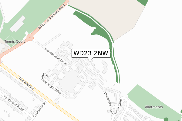
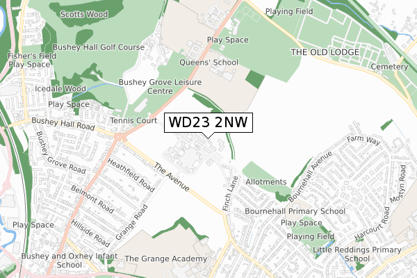
WD23 2NW maps


Licence: Open Government Licence (requires attribution)
Attribution: Contains OS data © Crown copyright and database right 2025
Source: Open Postcode Geo
Licence: Open Government Licence (requires attribution)
Attribution: Contains OS data © Crown copyright and database right 2025; Contains Royal Mail data © Royal Mail copyright and database right 2025; Source: Office for National Statistics licensed under the Open Government Licence v.3.0
WD23 2NW geodata
| Easting | 512986 |
| Northing | 196268 |
| Latitude | 51.653862 |
| Longitude | -0.368124 |
Where is WD23 2NW?
| Country | England |
| Postcode District | WD23 |
Politics
| Ward | Bushey St James |
|---|---|
| Constituency | Hertsmere |
House Prices
Sales of detached houses in WD23 2NW
PAVILION HOUSE, MARLBOROUGH DRIVE, BUSHEY, WD23 2NW 2020 6 MAR £1,207,500 |
Licence: Contains HM Land Registry data © Crown copyright and database right 2025. This data is licensed under the Open Government Licence v3.0.
Transport
Nearest bus stops to WD23 2NW
| Leisure Centre (Aldenham Road) | Bushey | 296m |
| Leisure Centre (Aldenham Road) | Bushey | 307m |
| Royal Connaught Park (The Avenue) | Bushey | 313m |
| Royal Connaught Park (The Avenue) | Bushey | 322m |
| Aldenham Road (The Avenue) | Bushey | 430m |
Nearest railway stations to WD23 2NW
| Bushey Station | 1.5km |
| Watford High Street Station | 1.6km |
| Watford Junction Station | 2.2km |
Broadband
Broadband access in WD23 2NW (2020 data)
| Percentage of properties with Next Generation Access | 100.0% |
| Percentage of properties with Superfast Broadband | 100.0% |
| Percentage of properties with Ultrafast Broadband | 100.0% |
| Percentage of properties with Full Fibre Broadband | 100.0% |
Superfast Broadband is between 30Mbps and 300Mbps
Ultrafast Broadband is > 300Mbps
Broadband limitations in WD23 2NW (2020 data)
| Percentage of properties unable to receive 2Mbps | 0.0% |
| Percentage of properties unable to receive 5Mbps | 0.0% |
| Percentage of properties unable to receive 10Mbps | 0.0% |
| Percentage of properties unable to receive 30Mbps | 0.0% |
Deprivation
12.1% of English postcodes are less deprived than WD23 2NW:Food Standards Agency
Three nearest food hygiene ratings to WD23 2NW (metres)


➜ Get more ratings from the Food Standards Agency
Nearest post box to WD23 2NW
| Last Collection | |||
|---|---|---|---|
| Location | Mon-Fri | Sat | Distance |
| The Avenue | 18:30 | 12:00 | 284m |
| Woodlands Road | 18:30 | 12:00 | 640m |
| Bushey Hall Road P.o | 19:00 | 12:00 | 1,014m |
WD23 2NW ITL and WD23 2NW LAU
The below table lists the International Territorial Level (ITL) codes (formerly Nomenclature of Territorial Units for Statistics (NUTS) codes) and Local Administrative Units (LAU) codes for WD23 2NW:
| ITL 1 Code | Name |
|---|---|
| TLH | East |
| ITL 2 Code | Name |
| TLH2 | Bedfordshire and Hertfordshire |
| ITL 3 Code | Name |
| TLH23 | Hertfordshire CC |
| LAU 1 Code | Name |
| E07000098 | Hertsmere |
WD23 2NW census areas
The below table lists the Census Output Area (OA), Lower Layer Super Output Area (LSOA), and Middle Layer Super Output Area (MSOA) for WD23 2NW:
| Code | Name | |
|---|---|---|
| OA | E00119670 | |
| LSOA | E01023562 | Hertsmere 012E |
| MSOA | E02004907 | Hertsmere 012 |
Nearest postcodes to WD23 2NW
| WD23 2RR | Marlborough Drive | 60m |
| WD23 2RJ | King Edward Place | 77m |
| WD23 2RT | Marlborough Drive | 83m |
| WD23 2RG | King Edward Place | 89m |
| WD23 2RN | Marlborough Drive | 132m |
| WD23 2RH | King Edward Place | 133m |
| WD23 2RF | Royal Connaught Drive | 162m |
| WD23 2RP | Marlborough Drive | 171m |
| WD23 2RL | Marlborough Drive | 186m |
| WD23 2RB | Royal Connaught Drive | 209m |