WD23 2FW maps, stats, and open data
- Home
- Postcode
- WD
- WD23
- WD23 2
WD23 2FW is located in the Bushey North electoral ward, within the local authority district of Hertsmere and the English Parliamentary constituency of Hertsmere. The Sub Integrated Care Board (ICB) Location is NHS Hertfordshire and West Essex ICB - 06N and the police force is Hertfordshire. This postcode has been in use since July 2018.
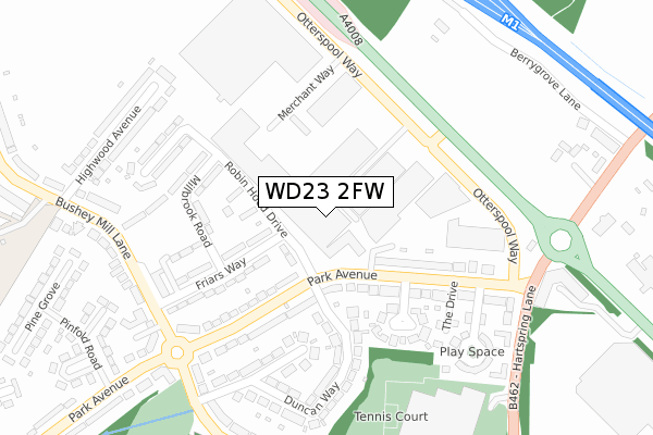
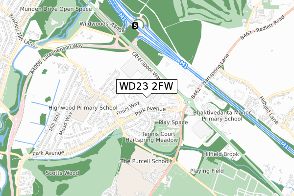
WD23 2FW maps


Source: OS Open Zoomstack (Ordnance Survey)
Licence: Open Government Licence (requires attribution)
Attribution: Contains OS data © Crown copyright and database right 2025
Source: Open Postcode GeoLicence: Open Government Licence (requires attribution)
Attribution: Contains OS data © Crown copyright and database right 2025; Contains Royal Mail data © Royal Mail copyright and database right 2025; Source: Office for National Statistics licensed under the Open Government Licence v.3.0
WD23 2FW geodata
| Easting | 513008 |
| Northing | 197604 |
| Latitude | 51.665865 |
| Longitude | -0.367375 |
Where is WD23 2FW?
| Country | England |
| Postcode District | WD23 |
Politics
| Ward | Bushey North |
|---|
| Constituency | Hertsmere |
|---|
Transport
Nearest bus stops to WD23 2FW
| Robin Hood Drive (Park Avenue) | North Bushey | 111m |
| Robin Hood Drive (Park Avenue) | North Bushey | 124m |
| Otterspool Way (Park Avenue) | North Bushey | 186m |
| Otterspool Way (Park Avenue) | North Bushey | 219m |
| Park Avenue (Hartspring Lane) | North Bushey | 294m |
Nearest railway stations to WD23 2FW
| Watford North Station | 1.9km |
| Watford Junction Station | 2km |
| Watford High Street Station | 2.2km |
Broadband
Broadband access in WD23 2FW (2020 data)
| Percentage of properties with Next Generation Access | 100.0% |
| Percentage of properties with Superfast Broadband | 100.0% |
| Percentage of properties with Ultrafast Broadband | 100.0% |
| Percentage of properties with Full Fibre Broadband | 0.0% |
Superfast Broadband is between 30Mbps and 300Mbps
Ultrafast Broadband is > 300Mbps
Broadband speed in WD23 2FW (2019 data)
Download
| Median download speed | 40.0Mbps |
| Average download speed | 36.2Mbps |
| Maximum download speed | 80.00Mbps |
Upload
| Median upload speed | 10.0Mbps |
| Average upload speed | 8.3Mbps |
| Maximum upload speed | 20.00Mbps |
Broadband limitations in WD23 2FW (2020 data)
| Percentage of properties unable to receive 2Mbps | 0.0% |
| Percentage of properties unable to receive 5Mbps | 0.0% |
| Percentage of properties unable to receive 10Mbps | 0.0% |
| Percentage of properties unable to receive 30Mbps | 0.0% |
Deprivation
71.6% of English postcodes are less deprived than
WD23 2FW:
Food Standards Agency
Three nearest food hygiene ratings to WD23 2FW (metres)
Wickes Building Supplies Ltd
The Lunch Box
Dina's
➜ Get more ratings from the Food Standards Agency
Nearest post box to WD23 2FW
| | Last Collection | |
|---|
| Location | Mon-Fri | Sat | Distance |
|---|
| North Watford P.o | 18:30 | 12:00 | 1,564m |
| The Avenue | 18:30 | 12:00 | 1,599m |
| Bushey Hall Road P.o | 19:00 | 12:00 | 1,600m |
WD23 2FW ITL and WD23 2FW LAU
The below table lists the International Territorial Level (ITL) codes (formerly Nomenclature of Territorial Units for Statistics (NUTS) codes) and Local Administrative Units (LAU) codes for WD23 2FW:
| ITL 1 Code | Name |
|---|
| TLH | East |
| ITL 2 Code | Name |
|---|
| TLH2 | Bedfordshire and Hertfordshire |
| ITL 3 Code | Name |
|---|
| TLH23 | Hertfordshire CC |
| LAU 1 Code | Name |
|---|
| E07000098 | Hertsmere |
WD23 2FW census areas
The below table lists the Census Output Area (OA), Lower Layer Super Output Area (LSOA), and Middle Layer Super Output Area (MSOA) for WD23 2FW:
| Code | Name |
|---|
| OA | E00119627 | |
|---|
| LSOA | E01023555 | Hertsmere 008D |
|---|
| MSOA | E02004903 | Hertsmere 008 |
|---|
Nearest postcodes to WD23 2FW


