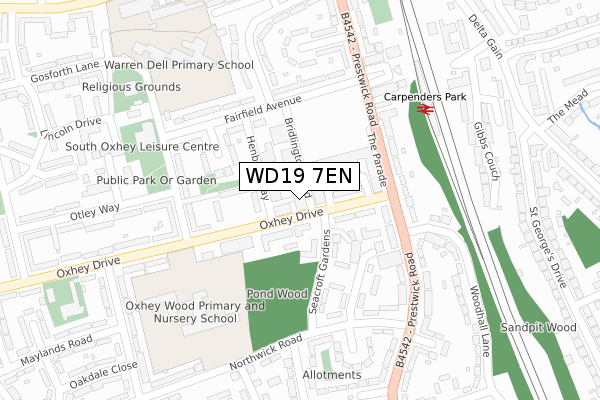
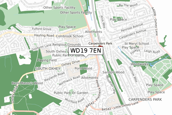
WD19 7EN is located in the South Oxhey electoral ward, within the local authority district of Three Rivers and the English Parliamentary constituency of South West Hertfordshire. The Sub Integrated Care Board (ICB) Location is NHS Hertfordshire and West Essex ICB - 06N and the police force is Hertfordshire. This postcode has been in use since September 2018.


GetTheData
Source: OS Open Zoomstack (Ordnance Survey)
Licence: Open Government Licence (requires attribution)
Attribution: Contains OS data © Crown copyright and database right 2025
Source: Open Postcode Geo
Licence: Open Government Licence (requires attribution)
Attribution: Contains OS data © Crown copyright and database right 2025; Contains Royal Mail data © Royal Mail copyright and database right 2025; Source: Office for National Statistics licensed under the Open Government Licence v.3.0
| Easting | 511634 |
| Northing | 193188 |
| Latitude | 51.626449 |
| Longitude | -0.388643 |
GetTheData
Source: Open Postcode Geo
Licence: Open Government Licence
| Country | England |
| Postcode District | WD19 |
➜ See where WD19 is on a map ➜ Where is Watford? | |
GetTheData
Source: Land Registry Price Paid Data
Licence: Open Government Licence
| Ward | South Oxhey |
| Constituency | South West Hertfordshire |
GetTheData
Source: ONS Postcode Database
Licence: Open Government Licence
| Seacroft Gardens (Oxhey Drive) | South Oxhey | 63m |
| Oxhey Wood Primary School (Oxhey Drive) | South Oxhey | 127m |
| Carpenders Park Railway Station (Fairfield Avenue) | South Oxhey | 173m |
| Carpenders Park Railway Station (Fairfield Avenue) | South Oxhey | 188m |
| Northwick Road (Prestwick Road) | South Oxhey | 222m |
| Carpenders Park Station | 0.3km |
| Bushey Station | 2.2km |
| Hatch End Station | 2.3km |
GetTheData
Source: NaPTAN
Licence: Open Government Licence
| Percentage of properties with Next Generation Access | 100.0% |
| Percentage of properties with Superfast Broadband | 100.0% |
| Percentage of properties with Ultrafast Broadband | 100.0% |
| Percentage of properties with Full Fibre Broadband | 0.0% |
Superfast Broadband is between 30Mbps and 300Mbps
Ultrafast Broadband is > 300Mbps
| Median download speed | 39.1Mbps |
| Average download speed | 46.7Mbps |
| Maximum download speed | 71.89Mbps |
| Median upload speed | 9.8Mbps |
| Average upload speed | 12.0Mbps |
| Maximum upload speed | 19.52Mbps |
| Percentage of properties unable to receive 2Mbps | 0.0% |
| Percentage of properties unable to receive 5Mbps | 0.0% |
| Percentage of properties unable to receive 10Mbps | 0.0% |
| Percentage of properties unable to receive 30Mbps | 0.0% |
GetTheData
Source: Ofcom
Licence: Ofcom Terms of Use (requires attribution)
GetTheData
Source: ONS Postcode Database
Licence: Open Government Licence


➜ Get more ratings from the Food Standards Agency
GetTheData
Source: Food Standards Agency
Licence: FSA terms & conditions
| Last Collection | |||
|---|---|---|---|
| Location | Mon-Fri | Sat | Distance |
| Prestwick Road P.o | 18:30 | 12:00 | 139m |
| Carpenders Park P.o | 18:30 | 12:00 | 431m |
| Compton Place | 17:30 | 11:45 | 532m |
GetTheData
Source: Dracos
Licence: Creative Commons Attribution-ShareAlike
The below table lists the International Territorial Level (ITL) codes (formerly Nomenclature of Territorial Units for Statistics (NUTS) codes) and Local Administrative Units (LAU) codes for WD19 7EN:
| ITL 1 Code | Name |
|---|---|
| TLH | East |
| ITL 2 Code | Name |
| TLH2 | Bedfordshire and Hertfordshire |
| ITL 3 Code | Name |
| TLH23 | Hertfordshire CC |
| LAU 1 Code | Name |
| E07000102 | Three Rivers |
GetTheData
Source: ONS Postcode Directory
Licence: Open Government Licence
The below table lists the Census Output Area (OA), Lower Layer Super Output Area (LSOA), and Middle Layer Super Output Area (MSOA) for WD19 7EN:
| Code | Name | |
|---|---|---|
| OA | E00121081 | |
| LSOA | E01023844 | Three Rivers 012D |
| MSOA | E02004967 | Three Rivers 012 |
GetTheData
Source: ONS Postcode Directory
Licence: Open Government Licence
| WD19 7SB | Oxhey Drive | 55m |
| WD19 7SG | Oxhey Drive | 76m |
| WD19 6AQ | Lawrence Court | 94m |
| WD19 7SA | Oxhey Drive | 102m |
| WD19 7SQ | Oxhey Drive | 107m |
| WD19 6RT | Seacroft Gardens | 113m |
| WD19 7SH | Oxhey Drive | 138m |
| WD19 7AT | Ferryhills Close | 140m |
| WD19 7SJ | Oxhey Drive | 167m |
| WD19 6EG | Prestwick Road | 170m |
GetTheData
Source: Open Postcode Geo; Land Registry Price Paid Data
Licence: Open Government Licence