WD18 9AF maps, stats, and open data
- Home
- Postcode
- WD
- WD18
- WD18 9
WD18 9AF is located in the Moor Park & Eastbury electoral ward, within the local authority district of Three Rivers and the English Parliamentary constituency of South West Hertfordshire. The Sub Integrated Care Board (ICB) Location is NHS Hertfordshire and West Essex ICB - 06N and the police force is Hertfordshire. This postcode has been in use since November 2018.
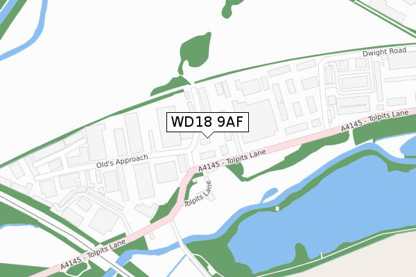
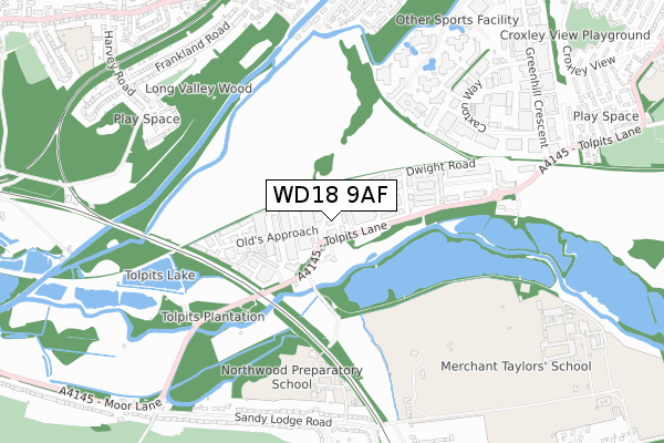
WD18 9AF maps


Source: OS Open Zoomstack (Ordnance Survey)
Licence: Open Government Licence (requires attribution)
Attribution: Contains OS data © Crown copyright and database right 2025
Source: Open Postcode GeoLicence: Open Government Licence (requires attribution)
Attribution: Contains OS data © Crown copyright and database right 2025; Contains Royal Mail data © Royal Mail copyright and database right 2025; Source: Office for National Statistics licensed under the Open Government Licence v.3.0
WD18 9AF geodata
| Easting | 508299 |
| Northing | 194527 |
| Latitude | 51.639135 |
| Longitude | -0.436389 |
Where is WD18 9AF?
| Country | England |
| Postcode District | WD18 |
Politics
| Ward | Moor Park & Eastbury |
|---|
| Constituency | South West Hertfordshire |
|---|
Transport
Nearest bus stops to WD18 9AF
| Hatters Lane | Holywell | 678m |
| Caxton Court (Caxton Way) | Holywell | 684m |
| Magnet (Caxton Way) | Holywell | 789m |
| Croxley Park Management Centre (Hatters Lane) | Holywell | 868m |
| Croxley Park Management Centre (Hatters Lane) | Holywell | 873m |
Nearest underground/metro/tram to WD18 9AF
| Croxley Underground Station | Croxley Green | 954m |
| Moor Park Underground Station | Moor Park | 1,069m |
Nearest railway stations to WD18 9AF
| Rickmansworth Station | 2.6km |
| Watford High Street Station | 3.4km |
| Bushey Station | 3.6km |
Broadband
Broadband access in WD18 9AF (2020 data)
| Percentage of properties with Next Generation Access | 100.0% |
| Percentage of properties with Superfast Broadband | 100.0% |
| Percentage of properties with Ultrafast Broadband | 0.0% |
| Percentage of properties with Full Fibre Broadband | 0.0% |
Superfast Broadband is between 30Mbps and 300Mbps
Ultrafast Broadband is > 300Mbps
Broadband limitations in WD18 9AF (2020 data)
| Percentage of properties unable to receive 2Mbps | 0.0% |
| Percentage of properties unable to receive 5Mbps | 0.0% |
| Percentage of properties unable to receive 10Mbps | 0.0% |
| Percentage of properties unable to receive 30Mbps | 0.0% |
Deprivation
0.5% of English postcodes are less deprived than
WD18 9AF:
Food Standards Agency
Three nearest food hygiene ratings to WD18 9AF (metres)
Warren Packers
My Beauty And Care
Bar Brothers Events Ltd
➜ Get more ratings from the Food Standards Agency
Nearest post box to WD18 9AF
| | Last Collection | |
|---|
| Location | Mon-Fri | Sat | Distance |
|---|
| Dwight Road | 18:30 | 12:00 | 663m |
| Dwight Road | | | 668m |
| Watford Road Croxley Green | 17:30 | 12:00 | 952m |
WD18 9AF ITL and WD18 9AF LAU
The below table lists the International Territorial Level (ITL) codes (formerly Nomenclature of Territorial Units for Statistics (NUTS) codes) and Local Administrative Units (LAU) codes for WD18 9AF:
| ITL 1 Code | Name |
|---|
| TLH | East |
| ITL 2 Code | Name |
|---|
| TLH2 | Bedfordshire and Hertfordshire |
| ITL 3 Code | Name |
|---|
| TLH23 | Hertfordshire CC |
| LAU 1 Code | Name |
|---|
| E07000102 | Three Rivers |
WD18 9AF census areas
The below table lists the Census Output Area (OA), Lower Layer Super Output Area (LSOA), and Middle Layer Super Output Area (MSOA) for WD18 9AF:
| Code | Name |
|---|
| OA | E00121054 | |
|---|
| LSOA | E01023841 | Three Rivers 011C |
|---|
| MSOA | E02004966 | Three Rivers 011 |
|---|
Nearest postcodes to WD18 9AF


