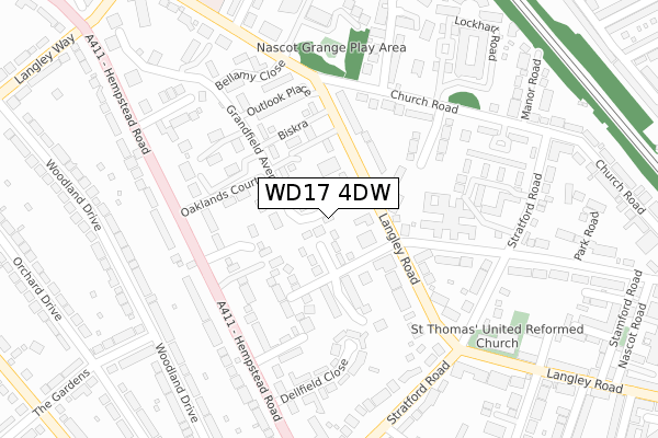
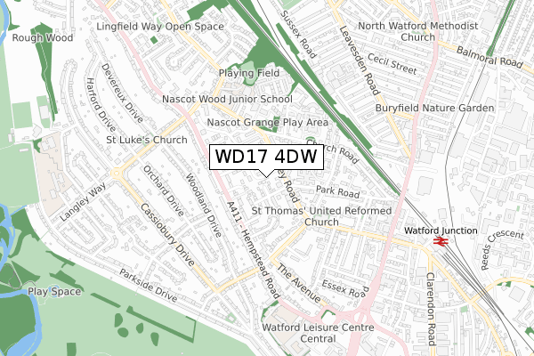
WD17 4DW is located in the Nascot electoral ward, within the local authority district of Watford and the English Parliamentary constituency of Watford. The Sub Integrated Care Board (ICB) Location is NHS Hertfordshire and West Essex ICB - 06N and the police force is Hertfordshire. This postcode has been in use since November 2017.


GetTheData
Source: OS Open Zoomstack (Ordnance Survey)
Licence: Open Government Licence (requires attribution)
Attribution: Contains OS data © Crown copyright and database right 2025
Source: Open Postcode Geo
Licence: Open Government Licence (requires attribution)
Attribution: Contains OS data © Crown copyright and database right 2025; Contains Royal Mail data © Royal Mail copyright and database right 2025; Source: Office for National Statistics licensed under the Open Government Licence v.3.0
| Easting | 510201 |
| Northing | 197645 |
| Latitude | 51.666791 |
| Longitude | -0.407933 |
GetTheData
Source: Open Postcode Geo
Licence: Open Government Licence
| Country | England |
| Postcode District | WD17 |
➜ See where WD17 is on a map ➜ Where is Watford? | |
GetTheData
Source: Land Registry Price Paid Data
Licence: Open Government Licence
| Ward | Nascot |
| Constituency | Watford |
GetTheData
Source: ONS Postcode Database
Licence: Open Government Licence
| Grandfield Avenue (Langley Road) | Watford | 76m |
| Grandfield Avenue (Langley Road) | Watford | 81m |
| Woodville Court (Hempstead Road) | Watford | 201m |
| Woodville Court (Hempstead Road) | Watford | 219m |
| The Spinney (Church Road) | Watford | 221m |
| Watford Underground Station | Watford | 1,227m |
| Watford Junction Station | 0.9km |
| Watford North Station | 1.6km |
| Watford High Street Station | 1.9km |
GetTheData
Source: NaPTAN
Licence: Open Government Licence
| Percentage of properties with Next Generation Access | 100.0% |
| Percentage of properties with Superfast Broadband | 100.0% |
| Percentage of properties with Ultrafast Broadband | 0.0% |
| Percentage of properties with Full Fibre Broadband | 0.0% |
Superfast Broadband is between 30Mbps and 300Mbps
Ultrafast Broadband is > 300Mbps
| Percentage of properties unable to receive 2Mbps | 0.0% |
| Percentage of properties unable to receive 5Mbps | 0.0% |
| Percentage of properties unable to receive 10Mbps | 0.0% |
| Percentage of properties unable to receive 30Mbps | 0.0% |
GetTheData
Source: Ofcom
Licence: Ofcom Terms of Use (requires attribution)
GetTheData
Source: ONS Postcode Database
Licence: Open Government Licence


➜ Get more ratings from the Food Standards Agency
GetTheData
Source: Food Standards Agency
Licence: FSA terms & conditions
| Last Collection | |||
|---|---|---|---|
| Location | Mon-Fri | Sat | Distance |
| Woodland Drive | 18:30 | 12:00 | 323m |
| Stratford Way | 18:30 | 12:00 | 427m |
| Hempstead Road Langley Road | 17:30 | 12:00 | 474m |
GetTheData
Source: Dracos
Licence: Creative Commons Attribution-ShareAlike
The below table lists the International Territorial Level (ITL) codes (formerly Nomenclature of Territorial Units for Statistics (NUTS) codes) and Local Administrative Units (LAU) codes for WD17 4DW:
| ITL 1 Code | Name |
|---|---|
| TLH | East |
| ITL 2 Code | Name |
| TLH2 | Bedfordshire and Hertfordshire |
| ITL 3 Code | Name |
| TLH23 | Hertfordshire CC |
| LAU 1 Code | Name |
| E07000103 | Watford |
GetTheData
Source: ONS Postcode Directory
Licence: Open Government Licence
The below table lists the Census Output Area (OA), Lower Layer Super Output Area (LSOA), and Middle Layer Super Output Area (MSOA) for WD17 4DW:
| Code | Name | |
|---|---|---|
| OA | E00121259 | |
| LSOA | E01023879 | Watford 007B |
| MSOA | E02004974 | Watford 007 |
GetTheData
Source: ONS Postcode Directory
Licence: Open Government Licence
| WD17 4YR | Grandfield Avenue | 41m |
| WD17 4PD | Langwood Gardens | 49m |
| WD17 4UE | Grandfield Avenue | 56m |
| WD17 4XA | Grandfield Avenue | 69m |
| WD17 4PW | Langley Road | 72m |
| WD17 4AN | Grandfield Avenue | 80m |
| WD17 4QL | Park Road | 107m |
| WD17 4PG | Woodgate Mews | 114m |
| WD17 4PE | Langley Road | 122m |
| WD17 4DZ | Grandfield Avenue | 132m |
GetTheData
Source: Open Postcode Geo; Land Registry Price Paid Data
Licence: Open Government Licence