Property/Postcode Data Search:
WD17 2AW maps, stats, and open data
WD17 2AW is located in the Central electoral ward, within the local authority district of Watford and the English Parliamentary constituency of Watford. The Sub Integrated Care Board (ICB) Location is NHS Hertfordshire and West Essex ICB - 06N and the police force is Hertfordshire. This postcode has been in use since August 2019.
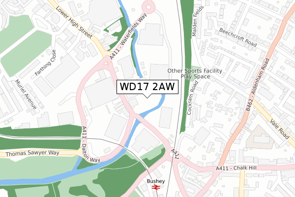
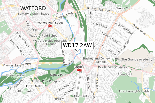
WD17 2AW maps


Source: OS Open Zoomstack (Ordnance Survey)
Licence: Open Government Licence (requires attribution)
Attribution: Contains OS data © Crown copyright and database right 2025
Source: Open Postcode Geo
Licence: Open Government Licence (requires attribution)
Attribution: Contains OS data © Crown copyright and database right 2025; Contains Royal Mail data © Royal Mail copyright and database right 2025; Source: Office for National Statistics licensed under the Open Government Licence v.3.0
Licence: Open Government Licence (requires attribution)
Attribution: Contains OS data © Crown copyright and database right 2025
Source: Open Postcode Geo
Licence: Open Government Licence (requires attribution)
Attribution: Contains OS data © Crown copyright and database right 2025; Contains Royal Mail data © Royal Mail copyright and database right 2025; Source: Office for National Statistics licensed under the Open Government Licence v.3.0
WD17 2AW geodata
| Easting | 511790 |
| Northing | 195664 |
| Latitude | 51.648672 |
| Longitude | -0.385599 |
Where is WD17 2AW?
| Country | England |
| Postcode District | WD17 |
Politics
| Ward | Central |
|---|---|
| Constituency | Watford |
Transport
Nearest bus stops to WD17 2AW
| Bushey Arches (Lower High Street) | Watford | 124m |
| Bushey Arches (Lower High Street) | Watford | 133m |
| Waterfields Way (Lower High Street) | Watford | 133m |
| Dalton Way | Watford | 234m |
| Bushey Railway Station West (Eastbury Road) | Bushey | 269m |
Nearest railway stations to WD17 2AW
| Bushey Station | 0.3km |
| Watford High Street Station | 0.6km |
| Watford Junction Station | 1.8km |
Deprivation
56.5% of English postcodes are less deprived than WD17 2AW:Food Standards Agency
Three nearest food hygiene ratings to WD17 2AW (metres)
Lidl

275 Lower High Street
148m
The Lunch Box

Carpark
158m
Costa Coffee Drive Thru

Watford Arches Retail Park
169m
➜ Get more ratings from the Food Standards Agency
Nearest post box to WD17 2AW
| Last Collection | |||
|---|---|---|---|
| Location | Mon-Fri | Sat | Distance |
| Aldenham Road P.o | 18:30 | 12:00 | 363m |
| Oxhey P.o. Villiers Road | 18:30 | 12:00 | 497m |
| Woodlands Road | 18:30 | 12:00 | 702m |
WD17 2AW ITL and WD17 2AW LAU
The below table lists the International Territorial Level (ITL) codes (formerly Nomenclature of Territorial Units for Statistics (NUTS) codes) and Local Administrative Units (LAU) codes for WD17 2AW:
| ITL 1 Code | Name |
|---|---|
| TLH | East |
| ITL 2 Code | Name |
| TLH2 | Bedfordshire and Hertfordshire |
| ITL 3 Code | Name |
| TLH23 | Hertfordshire CC |
| LAU 1 Code | Name |
| E07000103 | Watford |
WD17 2AW census areas
The below table lists the Census Output Area (OA), Lower Layer Super Output Area (LSOA), and Middle Layer Super Output Area (MSOA) for WD17 2AW:
| Code | Name | |
|---|---|---|
| OA | E00121178 | |
| LSOA | E01023862 | Watford 009D |
| MSOA | E02004976 | Watford 009 |
Nearest postcodes to WD17 2AW
| WD17 2JE | Lower High Street | 89m |
| WD17 2JH | Bridge Place | 104m |
| WD23 2PN | Plantation Close | 166m |
| WD23 2PL | Plantation Close | 201m |
| WD23 2PG | Plantation Close | 213m |
| WD19 4BN | Chalk Hill | 245m |
| WD23 2FL | Verini Close | 259m |
| WD23 2FF | Three Valleys Way | 271m |
| WD23 2NX | Wellsfield | 271m |
| WD17 2SF | Century Park | 273m |