WA8 6TY maps, stats, and open data
WA8 6TY is located in the Appleton electoral ward, within the unitary authority of Halton and the English Parliamentary constituency of Halton. The Sub Integrated Care Board (ICB) Location is NHS Cheshire and Merseyside ICB - 01F and the police force is Cheshire. This postcode has been in use since September 2017.
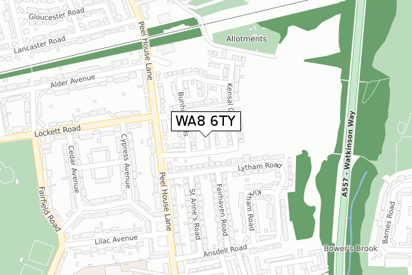
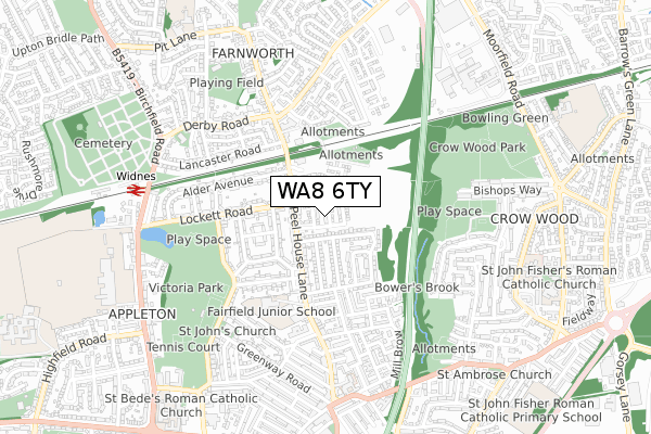
WA8 6TY maps


Licence: Open Government Licence (requires attribution)
Attribution: Contains OS data © Crown copyright and database right 2025
Source: Open Postcode Geo
Licence: Open Government Licence (requires attribution)
Attribution: Contains OS data © Crown copyright and database right 2025; Contains Royal Mail data © Royal Mail copyright and database right 2025; Source: Office for National Statistics licensed under the Open Government Licence v.3.0
WA8 6TY geodata
| Easting | 352013 |
| Northing | 387015 |
| Latitude | 53.377813 |
| Longitude | -2.722807 |
Where is WA8 6TY?
| Country | England |
| Postcode District | WA8 |
Politics
| Ward | Appleton |
|---|---|
| Constituency | Halton |
House Prices
Sales of detached houses in WA8 6TY
11, ST MARTINS CLOSE, WIDNES, WA8 6TY 2017 8 DEC £269,995 |
3, ST MARTINS CLOSE, WIDNES, WA8 6TY 2017 29 SEP £296,995 |
2, ST MARTINS CLOSE, WIDNES, WA8 6TY 2017 29 SEP £272,995 |
1, ST MARTINS CLOSE, WIDNES, WA8 6TY 2017 21 SEP £243,995 |
Licence: Contains HM Land Registry data © Crown copyright and database right 2025. This data is licensed under the Open Government Licence v3.0.
Transport
Nearest bus stops to WA8 6TY
| Lytham Road (Peelhouse Lane) | Appleton | 154m |
| Fairfield High (Peelhouse Lane) | Appleton | 167m |
| Lytham Road (Peelhouse Lane) | Appleton | 171m |
| Fairfield High (Peelhouse Lane) | Appleton | 179m |
| Cypress Avenue (Lockett Road) | Appleton | 255m |
Nearest railway stations to WA8 6TY
| Widnes Station | 0.7km |
| Hough Green Station | 3.5km |
| Runcorn Station | 4.5km |
Broadband
Broadband access in WA8 6TY (2020 data)
| Percentage of properties with Next Generation Access | 100.0% |
| Percentage of properties with Superfast Broadband | 100.0% |
| Percentage of properties with Ultrafast Broadband | 100.0% |
| Percentage of properties with Full Fibre Broadband | 100.0% |
Superfast Broadband is between 30Mbps and 300Mbps
Ultrafast Broadband is > 300Mbps
Broadband limitations in WA8 6TY (2020 data)
| Percentage of properties unable to receive 2Mbps | 0.0% |
| Percentage of properties unable to receive 5Mbps | 0.0% |
| Percentage of properties unable to receive 10Mbps | 0.0% |
| Percentage of properties unable to receive 30Mbps | 0.0% |
Deprivation
77.3% of English postcodes are less deprived than WA8 6TY:Food Standards Agency
Three nearest food hygiene ratings to WA8 6TY (metres)


➜ Get more ratings from the Food Standards Agency
Nearest post box to WA8 6TY
| Last Collection | |||
|---|---|---|---|
| Location | Mon-Fri | Sat | Distance |
| Lytham Road | 17:30 | 11:00 | 140m |
| Farnworth S.o. | 17:15 | 12:00 | 432m |
| Beaconsfield | 17:15 | 11:00 | 573m |
WA8 6TY ITL and WA8 6TY LAU
The below table lists the International Territorial Level (ITL) codes (formerly Nomenclature of Territorial Units for Statistics (NUTS) codes) and Local Administrative Units (LAU) codes for WA8 6TY:
| ITL 1 Code | Name |
|---|---|
| TLD | North West (England) |
| ITL 2 Code | Name |
| TLD7 | Merseyside |
| ITL 3 Code | Name |
| TLD71 | East Merseyside |
| LAU 1 Code | Name |
| E06000006 | Halton |
WA8 6TY census areas
The below table lists the Census Output Area (OA), Lower Layer Super Output Area (LSOA), and Middle Layer Super Output Area (MSOA) for WA8 6TY:
| Code | Name | |
|---|---|---|
| OA | E00062407 | |
| LSOA | E01012368 | Halton 003A |
| MSOA | E02002576 | Halton 003 |
Nearest postcodes to WA8 6TY
| WA8 6RD | Lytham Road | 99m |
| WA8 6TG | Peel House Lane | 120m |
| WA8 6SZ | Peel House Lane | 145m |
| WA8 6RA | Fairhaven Road | 185m |
| WA8 6SP | Cypress Avenue | 190m |
| WA8 6RB | St Annes Road | 195m |
| WA8 6TB | Peel House Lane | 198m |
| WA8 6RG | Kirkham Road | 208m |
| WA8 6ST | Hawthorn Avenue | 219m |
| WA8 6SS | Larch Avenue | 224m |