Property/Postcode Data Search:
WA7 1DY maps, stats, and open data
WA7 1DY is located in the Daresbury, Moore & Sandymoor electoral ward, within the unitary authority of Halton and the English Parliamentary constituency of Weaver Vale. The Sub Integrated Care Board (ICB) Location is NHS Cheshire and Merseyside ICB - 01F and the police force is Cheshire. This postcode has been in use since September 2019.
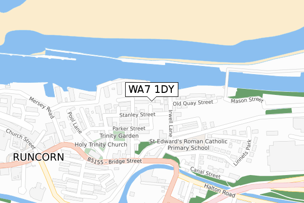
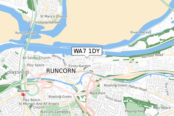
WA7 1DY maps


Source: OS Open Zoomstack (Ordnance Survey)
Licence: Open Government Licence (requires attribution)
Attribution: Contains OS data © Crown copyright and database right 2025
Source: Open Postcode Geo
Licence: Open Government Licence (requires attribution)
Attribution: Contains OS data © Crown copyright and database right 2025; Contains Royal Mail data © Royal Mail copyright and database right 2025; Source: Office for National Statistics licensed under the Open Government Licence v.3.0
Licence: Open Government Licence (requires attribution)
Attribution: Contains OS data © Crown copyright and database right 2025
Source: Open Postcode Geo
Licence: Open Government Licence (requires attribution)
Attribution: Contains OS data © Crown copyright and database right 2025; Contains Royal Mail data © Royal Mail copyright and database right 2025; Source: Office for National Statistics licensed under the Open Government Licence v.3.0
WA7 1DY geodata
| Easting | 356677 |
| Northing | 382971 |
| Latitude | 53.341868 |
| Longitude | -2.652147 |
Where is WA7 1DY?
| Country | England |
| Postcode District | WA7 |
Politics
| Ward | Daresbury, Moore & Sandymoor |
|---|---|
| Constituency | Weaver Vale |
House Prices
Sales of detached houses in WA7 1DY
2023 23 FEB £400,000 |
25, WHARFORD LANE, RUNCORN, WA7 1DY 2022 24 OCT £345,500 |
23, WHARFORD LANE, RUNCORN, WA7 1DY 2022 17 OCT £352,500 |
21, WHARFORD LANE, RUNCORN, WA7 1DY 2022 30 SEP £379,995 |
19, WHARFORD LANE, RUNCORN, WA7 1DY 2022 6 JUN £359,995 |
17, WHARFORD LANE, RUNCORN, WA7 1DY 2022 24 MAY £332,995 |
15, WHARFORD LANE, RUNCORN, WA7 1DY 2022 23 MAY £349,995 |
13, WHARFORD LANE, RUNCORN, WA7 1DY 2022 13 MAY £374,995 |
59, WHARFORD LANE, RUNCORN, WA7 1DY 2022 8 FEB £309,950 |
61, WHARFORD LANE, RUNCORN, WA7 1DY 2021 21 DEC £309,950 |
Source: HM Land Registry Price Paid Data
Licence: Contains HM Land Registry data © Crown copyright and database right 2025. This data is licensed under the Open Government Licence v3.0.
Licence: Contains HM Land Registry data © Crown copyright and database right 2025. This data is licensed under the Open Government Licence v3.0.
Transport
Nearest bus stops to WA7 1DY
| Selby Close (Newmoor Lane) | Norton | 577m |
| Selby Close (Newmoor Lane) | Norton | 585m |
| Wharford Lane | Norton | 587m |
| Wharford Lane | Norton | 591m |
| Pitts Heath (Pitts Heath Lane) | Norton | 611m |
Nearest railway stations to WA7 1DY
| Runcorn East Station | 1.8km |
| Warrington Bank Quay Station | 5.9km |
Deprivation
26.1% of English postcodes are less deprived than WA7 1DY:Food Standards Agency
Three nearest food hygiene ratings to WA7 1DY (metres)
Sandymoor Ormiston Academy

Wharford Lane
255m
1816 Bistro

Actons Wood Lane
419m
Sandymoor Community Centre

Otterburn Street
480m
➜ Get more ratings from the Food Standards Agency
Nearest post box to WA7 1DY
| Last Collection | |||
|---|---|---|---|
| Location | Mon-Fri | Sat | Distance |
| Keckwick Lane | 17:30 | 08:30 | 748m |
| Ledston Close | 17:30 | 11:00 | 1,172m |
| Old Chester Road | 17:30 | 09:00 | 1,294m |
WA7 1DY ITL and WA7 1DY LAU
The below table lists the International Territorial Level (ITL) codes (formerly Nomenclature of Territorial Units for Statistics (NUTS) codes) and Local Administrative Units (LAU) codes for WA7 1DY:
| ITL 1 Code | Name |
|---|---|
| TLD | North West (England) |
| ITL 2 Code | Name |
| TLD7 | Merseyside |
| ITL 3 Code | Name |
| TLD71 | East Merseyside |
| LAU 1 Code | Name |
| E06000006 | Halton |
WA7 1DY census areas
The below table lists the Census Output Area (OA), Lower Layer Super Output Area (LSOA), and Middle Layer Super Output Area (MSOA) for WA7 1DY:
| Code | Name | |
|---|---|---|
| OA | E00062484 | |
| LSOA | E01012386 | Halton 009B |
| MSOA | E02002582 | Halton 009 |
Nearest postcodes to WA7 1DY
| WA4 6SS | Delph Lane | 202m |
| WA7 1EB | Wharford Lane | 229m |
| WA7 1FZ | Tempsford Close | 350m |
| WA7 1FY | Biggleswade Drive | 384m |
| WA7 1EA | Potton Close | 426m |
| WA7 1QR | Sherborne Close | 441m |
| WA7 1QD | Newmoore Lane | 515m |
| WA7 1QW | Glastonbury Close | 523m |
| WA7 1QJ | Buckfast Court | 543m |
| WA7 1QX | Newmoore Lane | 604m |