Property/Postcode Data Search:
WA3 3YS maps, stats, and open data
WA3 3YS is located in the Golborne & Lowton West electoral ward, within the metropolitan district of Wigan and the English Parliamentary constituency of Leigh. The Sub Integrated Care Board (ICB) Location is NHS Greater Manchester ICB - 02H and the police force is Greater Manchester. This postcode has been in use since June 2019.
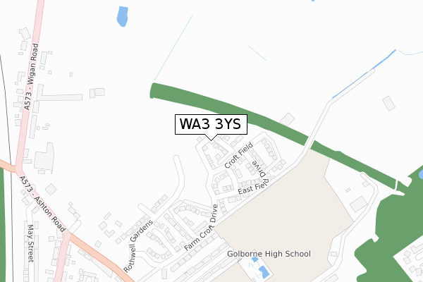
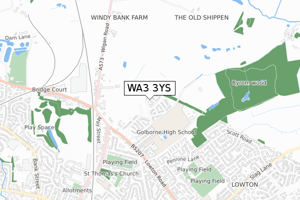
WA3 3YS maps


Source: OS Open Zoomstack (Ordnance Survey)
Licence: Open Government Licence (requires attribution)
Attribution: Contains OS data © Crown copyright and database right 2025
Source: Open Postcode Geo
Licence: Open Government Licence (requires attribution)
Attribution: Contains OS data © Crown copyright and database right 2025; Contains Royal Mail data © Royal Mail copyright and database right 2025; Source: Office for National Statistics licensed under the Open Government Licence v.3.0
Licence: Open Government Licence (requires attribution)
Attribution: Contains OS data © Crown copyright and database right 2025
Source: Open Postcode Geo
Licence: Open Government Licence (requires attribution)
Attribution: Contains OS data © Crown copyright and database right 2025; Contains Royal Mail data © Royal Mail copyright and database right 2025; Source: Office for National Statistics licensed under the Open Government Licence v.3.0
WA3 3YS geodata
| Easting | 361099 |
| Northing | 398808 |
| Latitude | 53.484557 |
| Longitude | -2.587695 |
Where is WA3 3YS?
| Country | England |
| Postcode District | WA3 |
Politics
| Ward | Golborne & Lowton West |
|---|---|
| Constituency | Leigh |
House Prices
Sales of detached houses in WA3 3YS
14, NORTH MEADOW CLOSE, GOLBORNE, WARRINGTON, WA3 3YS 2021 5 MAR £220,756 |
11, NORTH MEADOW CLOSE, GOLBORNE, WARRINGTON, WA3 3YS 2020 11 DEC £294,995 |
15, NORTH MEADOW CLOSE, GOLBORNE, WARRINGTON, WA3 3YS 2020 4 DEC £295,995 |
10, NORTH MEADOW CLOSE, GOLBORNE, WARRINGTON, WA3 3YS 2020 20 NOV £226,995 |
12, NORTH MEADOW CLOSE, GOLBORNE, WARRINGTON, WA3 3YS 2020 19 NOV £259,995 |
8, NORTH MEADOW CLOSE, GOLBORNE, WARRINGTON, WA3 3YS 2020 6 NOV £284,995 |
Source: HM Land Registry Price Paid Data
Licence: Contains HM Land Registry data © Crown copyright and database right 2025. This data is licensed under the Open Government Licence v3.0.
Licence: Contains HM Land Registry data © Crown copyright and database right 2025. This data is licensed under the Open Government Licence v3.0.
Transport
Nearest bus stops to WA3 3YS
| Lowton Rd/Church St (Lowton Rd) | Golborne | 395m |
| Lowton Rd/Church Street (Lowton Rd) | Golborne | 413m |
| Wigan Rd/Red Lion (Ashton Rd) | Golborne | 433m |
| Ashton Rd/May St (Ashton Rd) | Golborne | 448m |
| Wigan Rd/Ashton Rd (Wigan Rd) | Golborne | 458m |
Nearest railway stations to WA3 3YS
| Newton-le-Willows Station | 3.9km |
| Bryn Station | 4.3km |
| Earlestown Station | 5km |
Deprivation
72.7% of English postcodes are less deprived than WA3 3YS:Food Standards Agency
Three nearest food hygiene ratings to WA3 3YS (metres)
Governing Body of Golborne High School

Lowton Road
416m
Hooton Newsagents

54 Church Street
494m
Jumping Jacks Private Day Nursery

34 Ullswater Road
634m
➜ Get more ratings from the Food Standards Agency
Nearest post box to WA3 3YS
| Last Collection | |||
|---|---|---|---|
| Location | Mon-Fri | Sat | Distance |
| Church Street | 16:00 | 11:00 | 432m |
| Heywood Avenue | 16:45 | 11:00 | 522m |
| Derby Road | 16:30 | 11:00 | 930m |
WA3 3YS ITL and WA3 3YS LAU
The below table lists the International Territorial Level (ITL) codes (formerly Nomenclature of Territorial Units for Statistics (NUTS) codes) and Local Administrative Units (LAU) codes for WA3 3YS:
| ITL 1 Code | Name |
|---|---|
| TLD | North West (England) |
| ITL 2 Code | Name |
| TLD3 | Greater Manchester |
| ITL 3 Code | Name |
| TLD36 | Greater Manchester North West |
| LAU 1 Code | Name |
| E08000010 | Wigan |
WA3 3YS census areas
The below table lists the Census Output Area (OA), Lower Layer Super Output Area (LSOA), and Middle Layer Super Output Area (MSOA) for WA3 3YS:
| Code | Name | |
|---|---|---|
| OA | E00032147 | |
| LSOA | E01006340 | Wigan 039B |
| MSOA | E02001325 | Wigan 039 |
Nearest postcodes to WA3 3YS
| WA3 3EJ | Rothwell Road | 319m |
| WA3 3TY | Ashton Road | 383m |
| WA3 3EG | Lowton Road | 415m |
| WA3 3TS | Ashton Road | 420m |
| WA3 3TZ | Wigan Road | 435m |
| WA3 3EF | Lowton Road | 436m |
| WA3 3HB | Pendle Road | 440m |
| WA3 3TW | Church Street | 441m |
| WA3 3UD | Wigan Road | 446m |
| WA3 3DU | Elliott Avenue | 479m |