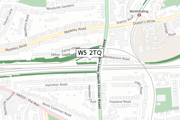
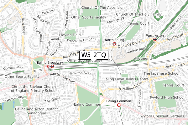
W5 2TQ is located in the Hanger Hill electoral ward, within the London borough of Ealing and the English Parliamentary constituency of Ealing Central and Acton. The Sub Integrated Care Board (ICB) Location is NHS North West London ICB - W2U3Z and the police force is Metropolitan Police. This postcode has been in use since November 2018.


GetTheData
Source: OS Open Zoomstack (Ordnance Survey)
Licence: Open Government Licence (requires attribution)
Attribution: Contains OS data © Crown copyright and database right 2025
Source: Open Postcode Geo
Licence: Open Government Licence (requires attribution)
Attribution: Contains OS data © Crown copyright and database right 2025; Contains Royal Mail data © Royal Mail copyright and database right 2025; Source: Office for National Statistics licensed under the Open Government Licence v.3.0
| Easting | 518558 |
| Northing | 180985 |
| Latitude | 51.515358 |
| Longitude | -0.292774 |
GetTheData
Source: Open Postcode Geo
Licence: Open Government Licence
| Country | England |
| Postcode District | W5 |
➜ See where W5 is on a map ➜ Where is Ealing? | |
GetTheData
Source: Land Registry Price Paid Data
Licence: Open Government Licence
| Ward | Hanger Hill |
| Constituency | Ealing Central And Acton |
GetTheData
Source: ONS Postcode Database
Licence: Open Government Licence
| North Ealing | North Ealing | 136m |
| North Ealing | North Ealing | 276m |
| Gunnersbury Avenue (W5) | Ealing | 354m |
| Hanger Lane (Uxbridge Road) | Ealing | 381m |
| North Common Road (W5) (The Mall) | Ealing | 388m |
| North Ealing Underground Station | North Ealing | 362m |
| Ealing Broadway Underground Station | Ealing Broadway | 602m |
| Ealing Common Underground Station | Ealing Common | 660m |
| West Acton Underground Station | West Acton | 871m |
| Park Royal Underground Station | Park Royal | 1,434m |
| Ealing Broadway Station | 0.6km |
| Acton Main Line Station | 1.8km |
| West Ealing Station | 1.9km |
GetTheData
Source: NaPTAN
Licence: Open Government Licence
| Percentage of properties with Next Generation Access | 100.0% |
| Percentage of properties with Superfast Broadband | 100.0% |
| Percentage of properties with Ultrafast Broadband | 100.0% |
| Percentage of properties with Full Fibre Broadband | 100.0% |
Superfast Broadband is between 30Mbps and 300Mbps
Ultrafast Broadband is > 300Mbps
Ofcom does not currently provide download speed data for W5 2TQ. This is because there are less than four broadband connections in this postcode.
Ofcom does not currently provide upload speed data for W5 2TQ. This is because there are less than four broadband connections in this postcode.
| Percentage of properties unable to receive 2Mbps | 0.0% |
| Percentage of properties unable to receive 5Mbps | 0.0% |
| Percentage of properties unable to receive 10Mbps | 0.0% |
| Percentage of properties unable to receive 30Mbps | 0.0% |
GetTheData
Source: Ofcom
Licence: Ofcom Terms of Use (requires attribution)
GetTheData
Source: ONS Postcode Database
Licence: Open Government Licence


➜ Get more ratings from the Food Standards Agency
GetTheData
Source: Food Standards Agency
Licence: FSA terms & conditions
| Last Collection | |||
|---|---|---|---|
| Location | Mon-Fri | Sat | Distance |
| Ealing Village | 17:30 | 12:00 | 153m |
| Madeley Road | 17:30 | 12:00 | 195m |
| Hamilton Road | 17:30 | 12:00 | 236m |
GetTheData
Source: Dracos
Licence: Creative Commons Attribution-ShareAlike
The below table lists the International Territorial Level (ITL) codes (formerly Nomenclature of Territorial Units for Statistics (NUTS) codes) and Local Administrative Units (LAU) codes for W5 2TQ:
| ITL 1 Code | Name |
|---|---|
| TLI | London |
| ITL 2 Code | Name |
| TLI7 | Outer London - West and North West |
| ITL 3 Code | Name |
| TLI73 | Ealing |
| LAU 1 Code | Name |
| E09000009 | Ealing |
GetTheData
Source: ONS Postcode Directory
Licence: Open Government Licence
The below table lists the Census Output Area (OA), Lower Layer Super Output Area (LSOA), and Middle Layer Super Output Area (MSOA) for W5 2TQ:
| Code | Name | |
|---|---|---|
| OA | E00006163 | |
| LSOA | E01001235 | Ealing 020D |
| MSOA | E02000257 | Ealing 020 |
GetTheData
Source: ONS Postcode Directory
Licence: Open Government Licence
| W5 2EB | Ealing Village | 92m |
| W5 2EA | Ealing Village | 130m |
| W5 2LX | Madeley Road | 149m |
| W5 2EE | Hamilton Road | 156m |
| W5 3HJ | Hanger Lane | 156m |
| W5 2EH | Hamilton Road | 164m |
| W5 3HT | Waldegrave Road | 177m |
| W5 2NB | Ealing Village | 178m |
| W5 3RH | Inglis Road | 188m |
| W5 2EJ | Hamilton Road | 204m |
GetTheData
Source: Open Postcode Geo; Land Registry Price Paid Data
Licence: Open Government Licence