Property/Postcode Data Search:
W2 1EZ maps, stats, and open data
W2 1EZ is located in the Hyde Park electoral ward, within the London borough of Westminster and the English Parliamentary constituency of Cities of London and Westminster. The Sub Integrated Care Board (ICB) Location is NHS North West London ICB - W2U3Z and the police force is Metropolitan Police. This postcode has been in use since October 2018.
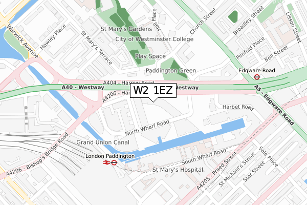
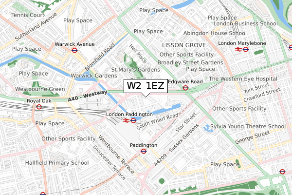
W2 1EZ maps


Source: OS Open Zoomstack (Ordnance Survey)
Licence: Open Government Licence (requires attribution)
Attribution: Contains OS data © Crown copyright and database right 2025
Source: Open Postcode Geo
Licence: Open Government Licence (requires attribution)
Attribution: Contains OS data © Crown copyright and database right 2025; Contains Royal Mail data © Royal Mail copyright and database right 2025; Source: Office for National Statistics licensed under the Open Government Licence v.3.0
Licence: Open Government Licence (requires attribution)
Attribution: Contains OS data © Crown copyright and database right 2025
Source: Open Postcode Geo
Licence: Open Government Licence (requires attribution)
Attribution: Contains OS data © Crown copyright and database right 2025; Contains Royal Mail data © Royal Mail copyright and database right 2025; Source: Office for National Statistics licensed under the Open Government Licence v.3.0
W2 1EZ geodata
| Easting | 526718 |
| Northing | 181651 |
| Latitude | 51.519575 |
| Longitude | -0.174997 |
Where is W2 1EZ?
| Country | England |
| Postcode District | W2 |
Politics
| Ward | Hyde Park |
|---|---|
| Constituency | Cities Of London And Westminster |
Transport
Nearest bus stops to W2 1EZ
| Hermitage Street (Harrow Road) | Paddington | 46m |
| Paddington Basin | Paddington | 77m |
| Paddington Green Police Stn (Harrow Road) | Lisson Grove | 230m |
| Bishops Bridge | Paddington | 231m |
| Bishops Bridge Little Venice (Harrow Road) | Paddington | 238m |
Nearest underground/metro/tram to W2 1EZ
| Paddington (H&c Line)-underground | Paddington | 275m |
| Paddington Underground Station | Paddington | 336m |
| Edgware Road (Bakerloo) Underground Station | Edgware Road | 348m |
| Edgware Road (Circle Line) Underground Station | Edgware Road | 500m |
| Warwick Avenue Underground Station | Warwick Avenue | 733m |
Nearest railway stations to W2 1EZ
| London Paddington Station | 0.4km |
| London Marylebone Station | 0.9km |
| Kilburn High Road Station | 2.3km |
Deprivation
71.5% of English postcodes are less deprived than W2 1EZ:Food Standards Agency
Three nearest food hygiene ratings to W2 1EZ (metres)
Simply Falafel

WATERSIDE HOUSE 35 NORTH WHARF ROAD
96m
Mai Sushi

WATERSIDE HOUSE 35 NORTH WHARF ROAD
96m
Marks & Spencer

WATERSIDE HOUSE 35 NORTH WHARF ROAD
96m
➜ Get more ratings from the Food Standards Agency
Nearest post box to W2 1EZ
| Last Collection | |||
|---|---|---|---|
| Location | Mon-Fri | Sat | Distance |
| South Wharf Road | 18:30 | 12:00 | 227m |
| Post Office | 18:30 | 12:00 | 305m |
| Saint Mary's Terrace | 18:30 | 12:00 | 316m |
W2 1EZ ITL and W2 1EZ LAU
The below table lists the International Territorial Level (ITL) codes (formerly Nomenclature of Territorial Units for Statistics (NUTS) codes) and Local Administrative Units (LAU) codes for W2 1EZ:
| ITL 1 Code | Name |
|---|---|
| TLI | London |
| ITL 2 Code | Name |
| TLI3 | Inner London - West |
| ITL 3 Code | Name |
| TLI32 | Westminster |
| LAU 1 Code | Name |
| E09000033 | Westminster |
W2 1EZ census areas
The below table lists the Census Output Area (OA), Lower Layer Super Output Area (LSOA), and Middle Layer Super Output Area (MSOA) for W2 1EZ:
| Code | Name | |
|---|---|---|
| OA | E00023619 | |
| LSOA | E01033593 | Westminster 015F |
| MSOA | E02000974 | Westminster 015 |
Nearest postcodes to W2 1EZ
| W2 1PB | Hermitage Street | 91m |
| W2 1HG | Harrow Road | 102m |
| W2 1JP | Harrow Road | 102m |
| W2 1PW | Hermitage Street | 104m |
| W2 1SE | St Marys Square | 175m |
| W2 1LG | Paddington Green | 175m |
| W2 1SU | St Marys Terrace | 202m |
| W2 1UP | Hogan Mews | 213m |
| W2 1SF | St Marys Terrace | 216m |
| W2 1LN | Hall Place | 225m |