Property/Postcode Data Search:
W1F 0DT maps, stats, and open data
W1F 0DT is located in the West End electoral ward, within the London borough of Westminster and the English Parliamentary constituency of Cities of London and Westminster. The Sub Integrated Care Board (ICB) Location is NHS North West London ICB - W2U3Z and the police force is Metropolitan Police. This postcode has been in use since February 2018.
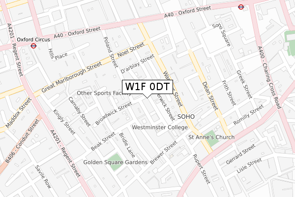
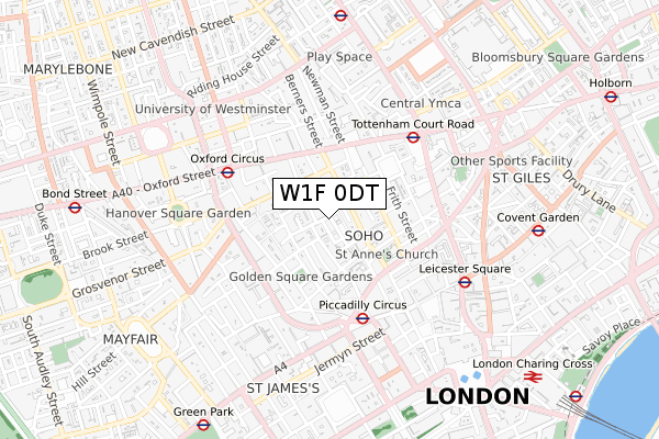
W1F 0DT maps


Source: OS Open Zoomstack (Ordnance Survey)
Licence: Open Government Licence (requires attribution)
Attribution: Contains OS data © Crown copyright and database right 2025
Source: Open Postcode Geo
Licence: Open Government Licence (requires attribution)
Attribution: Contains OS data © Crown copyright and database right 2025; Contains Royal Mail data © Royal Mail copyright and database right 2025; Source: Office for National Statistics licensed under the Open Government Licence v.3.0
Licence: Open Government Licence (requires attribution)
Attribution: Contains OS data © Crown copyright and database right 2025
Source: Open Postcode Geo
Licence: Open Government Licence (requires attribution)
Attribution: Contains OS data © Crown copyright and database right 2025; Contains Royal Mail data © Royal Mail copyright and database right 2025; Source: Office for National Statistics licensed under the Open Government Licence v.3.0
W1F 0DT geodata
| Easting | 529472 |
| Northing | 181051 |
| Latitude | 51.513558 |
| Longitude | -0.135546 |
Where is W1F 0DT?
| Country | England |
| Postcode District | W1F |
Politics
| Ward | West End |
|---|---|
| Constituency | Cities Of London And Westminster |
Transport
Nearest bus stops to W1F 0DT
| Wardour Street (Oxford Street) | Soho | 263m |
| Wardour Street (Oxford Street) | Soho | 273m |
| Wardour Street (Oxford Street) | Soho | 285m |
| Trocadero Haymarket (Shaftesbury Avenue) | Soho | 314m |
| Conduit Street Hamleys Toy Store | Soho | 327m |
Nearest underground/metro/tram to W1F 0DT
| Piccadilly Circus Underground Station | Piccadilly Circus | 409m |
| Oxford Circus Underground Station | Oxford Circus | 477m |
| Tottenham Court Road Underground Station | Tottenham Court Road | 480m |
| Leicester Square Underground Station | Leicester Square | 552m |
| Covent Garden Underground Station | Covent Garden | 775m |
Nearest railway stations to W1F 0DT
| London Charing Cross Station | 1km |
| London Euston Station | 1.6km |
| London Waterloo Station | 1.9km |
Deprivation
69.2% of English postcodes are less deprived than W1F 0DT:Food Standards Agency
Three nearest food hygiene ratings to W1F 0DT (metres)
Temper Soho

FORMER TRENCHARD HOUSE 19-25 BROADWICK STREET
21m
Yauatcha

BASEMENT 15-17 BROADWICK STREET
21m
The Ivy Soho Brasserie

AMALCO HOUSE 26-28 BROADWICK STREET
27m
➜ Get more ratings from the Food Standards Agency
Nearest post box to W1F 0DT
| Last Collection | |||
|---|---|---|---|
| Location | Mon-Fri | Sat | Distance |
| Broadwick Street | 18:30 | 12:00 | 28m |
| Beak Street | 18:30 | 12:00 | 111m |
| Noel Street | 18:30 | 12:00 | 184m |
W1F 0DT ITL and W1F 0DT LAU
The below table lists the International Territorial Level (ITL) codes (formerly Nomenclature of Territorial Units for Statistics (NUTS) codes) and Local Administrative Units (LAU) codes for W1F 0DT:
| ITL 1 Code | Name |
|---|---|
| TLI | London |
| ITL 2 Code | Name |
| TLI3 | Inner London - West |
| ITL 3 Code | Name |
| TLI32 | Westminster |
| LAU 1 Code | Name |
| E09000033 | Westminster |
W1F 0DT census areas
The below table lists the Census Output Area (OA), Lower Layer Super Output Area (LSOA), and Middle Layer Super Output Area (MSOA) for W1F 0DT:
| Code | Name | |
|---|---|---|
| OA | E00024136 | |
| LSOA | E01033596 | Westminster 013F |
| MSOA | E02000972 | Westminster 013 |
Nearest postcodes to W1F 0DT
| W1F 0DS | Ingestre Place | 9m |
| W1F 0DL | Broadwick Street | 21m |
| W1F 8HS | Broadwick Street | 39m |
| W1F 0JJ | Ingestre Place | 42m |
| W1F 0PZ | Berwick Street | 49m |
| W1F 0PY | Berwick Street | 53m |
| W1F 0PU | Berwick Street | 56m |
| W1F 0LR | Lexington Street | 58m |
| W1F 0HT | Duck Lane | 59m |
| W1F 0HU | Duck Lane | 59m |