Property/Postcode Data Search:
W10 5YB maps, stats, and open data
W10 5YB is located in the Golborne electoral ward, within the London borough of Kensington and Chelsea and the English Parliamentary constituency of Kensington. The Sub Integrated Care Board (ICB) Location is NHS North West London ICB - W2U3Z and the police force is Metropolitan Police. This postcode has been in use since January 2019.
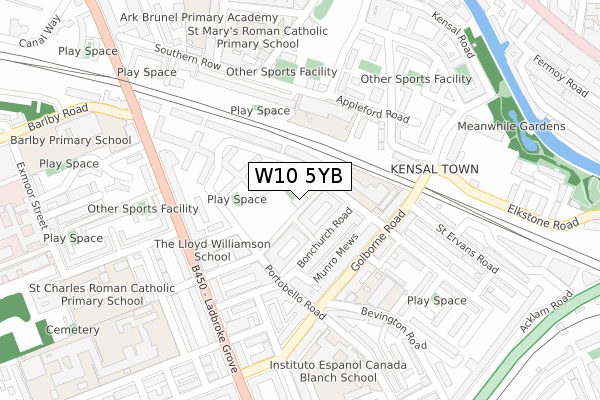
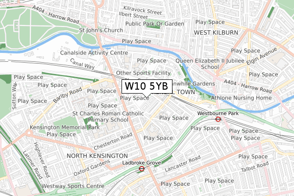
W10 5YB maps


Source: OS Open Zoomstack (Ordnance Survey)
Licence: Open Government Licence (requires attribution)
Attribution: Contains OS data © Crown copyright and database right 2025
Source: Open Postcode Geo
Licence: Open Government Licence (requires attribution)
Attribution: Contains OS data © Crown copyright and database right 2025; Contains Royal Mail data © Royal Mail copyright and database right 2025; Source: Office for National Statistics licensed under the Open Government Licence v.3.0
Licence: Open Government Licence (requires attribution)
Attribution: Contains OS data © Crown copyright and database right 2025
Source: Open Postcode Geo
Licence: Open Government Licence (requires attribution)
Attribution: Contains OS data © Crown copyright and database right 2025; Contains Royal Mail data © Royal Mail copyright and database right 2025; Source: Office for National Statistics licensed under the Open Government Licence v.3.0
W10 5YB geodata
| Easting | 524281 |
| Northing | 181942 |
| Latitude | 51.522731 |
| Longitude | -0.210001 |
Where is W10 5YB?
| Country | England |
| Postcode District | W10 |
Politics
| Ward | Golborne |
|---|---|
| Constituency | Kensington |
Transport
Nearest bus stops to W10 5YB
| St Charles Squareladbroke Grv (Ladbroke Grove) | Kensal Town | 216m |
| St Charles Squareladbroke Grv (Ladbroke Grove) | Kensal Town | 227m |
| Golborne Road | Kensal Town | 247m |
| Barlby Road (Ladbroke Grove) | Kensal Town | 254m |
| Barlby Road (Ladbroke Grove) | Kensal Town | 263m |
Nearest underground/metro/tram to W10 5YB
| Ladbroke Grove Underground Station | Ladbroke Grove | 588m |
| Westbourne Park Underground Station | Westbourne Park | 647m |
| Latimer Road Underground Station | Latimer Road | 1,171m |
| Queen's Park Underground Station | Queen's Park | 1,326m |
| Kensal Green Underground Station | Kensal Green | 1,355m |
Nearest railway stations to W10 5YB
| Queens Park (London) Station | 1.3km |
| Kensal Green Station | 1.4km |
| Kensal Rise Station | 1.5km |
Deprivation
95.6% of English postcodes are less deprived than W10 5YB:Food Standards Agency
Three nearest food hygiene ratings to W10 5YB (metres)
Food Pantry

Venture Centre
0m
The Venture Community Association

Venture Centre
0m
Golborne Deli

100 Golborne Road
124m
➜ Get more ratings from the Food Standards Agency
Nearest post box to W10 5YB
| Last Collection | |||
|---|---|---|---|
| Location | Mon-Fri | Sat | Distance |
| Goldborne Road | 17:30 | 12:00 | 162m |
| Ladbroke Grove | 17:30 | 12:00 | 191m |
| Post Office | 18:30 | 12:00 | 204m |
W10 5YB ITL and W10 5YB LAU
The below table lists the International Territorial Level (ITL) codes (formerly Nomenclature of Territorial Units for Statistics (NUTS) codes) and Local Administrative Units (LAU) codes for W10 5YB:
| ITL 1 Code | Name |
|---|---|
| TLI | London |
| ITL 2 Code | Name |
| TLI3 | Inner London - West |
| ITL 3 Code | Name |
| TLI33 | Kensington & Chelsea and Hammersmith & Fulham |
| LAU 1 Code | Name |
| E09000020 | Kensington and Chelsea |
W10 5YB census areas
The below table lists the Census Output Area (OA), Lower Layer Super Output Area (LSOA), and Middle Layer Super Output Area (MSOA) for W10 5YB:
| Code | Name | |
|---|---|---|
| OA | E00014318 | |
| LSOA | E01002853 | Kensington and Chelsea 001B |
| MSOA | E02000577 | Kensington and Chelsea 001 |
Nearest postcodes to W10 5YB
| W10 5NU | Faraday Road | 28m |
| W10 5NZ | Faraday Road | 33m |
| W10 5NN | Bonchurch Road | 86m |
| W10 5LH | Bonchurch Road | 87m |
| W10 5NS | Bonchurch Road | 105m |
| W10 5RZ | Munro Mews | 109m |
| W10 5SG | Portobello Road | 125m |
| W10 5PS | Golborne Road | 126m |
| W10 5RS | Faraday Road | 127m |
| W10 5SH | Telford Road | 139m |